
last update to page: January 22 2017 23:46:42 (UTC).
SummaryThe red marker denotes the earthquake epicenter. On Sun Jan 22nd 2017 04:30:23 (UTC) the seismic network recorded an earthquake (preliminary 7.9 mww) located in Solomon Islands. Seismic region Bismarck And Solomon Islands. The epicentral distance (i.e. distance separating the location to the epicenter) to the closest station SCI2 in the network is 10,058.8 km. If you felt the quake, the USGS would like to know. Please add your comments to the USGS page "Did you feel it?". |
Details
Proximity to Population Centers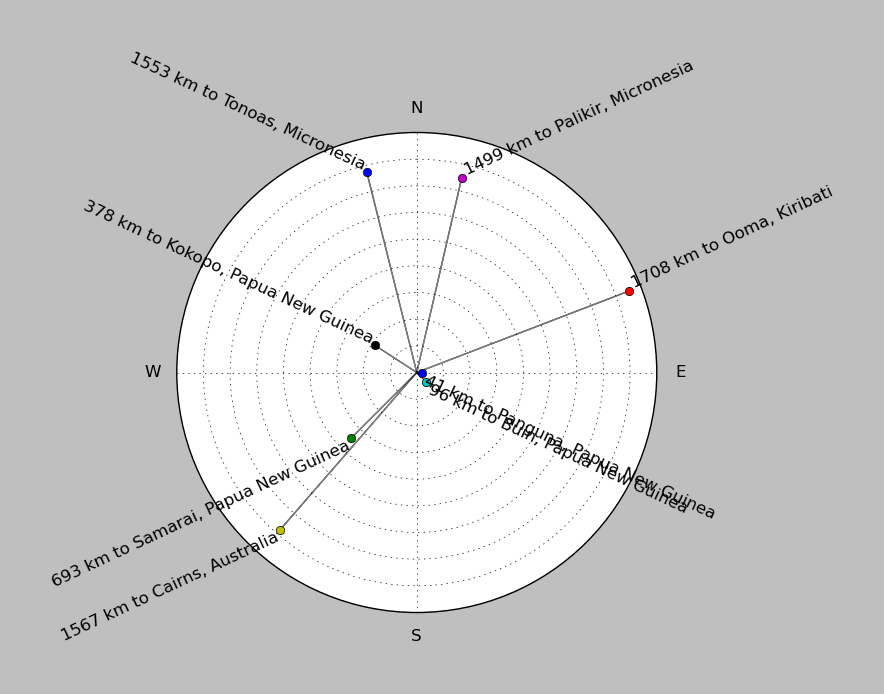
| ||||||||||||||||
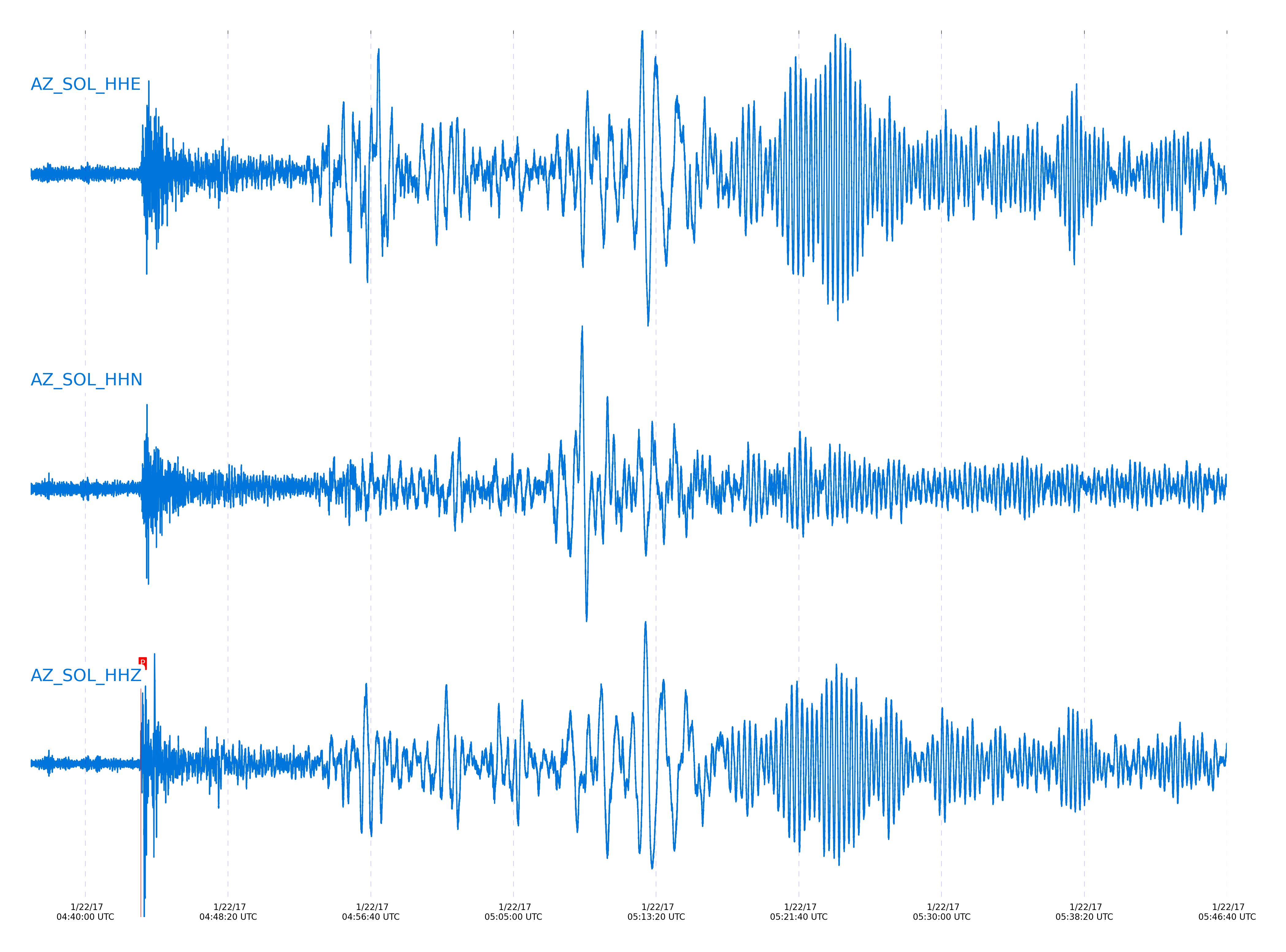
Event and active stations
|
|||||||||||||||||
Closest station with identified signal. Not filtered.
Subset of several stations close to the event. Not filtered.
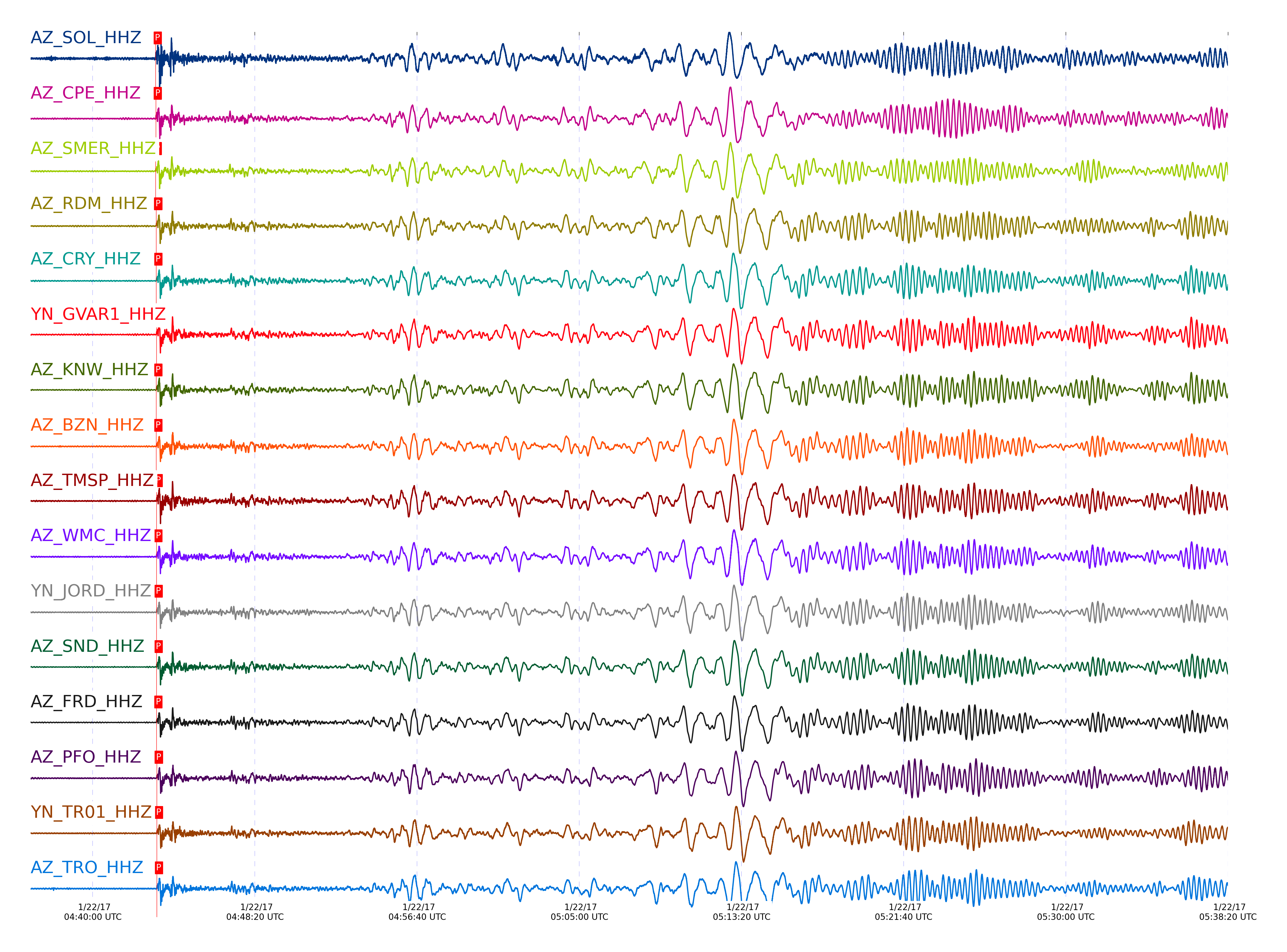
| STA_CHAN | S-E Delta | S-E Azimuth | Phase | Time | Signal/Noise | Time Residual | V. Model | Auth | arid |
|---|---|---|---|---|---|---|---|---|---|
| SOL_HHZ | 91.384° | 263.5° | PcP | 2017-01-22 04:43:14.1665 UTC | -1 | -0.067 | iasp91 | dbp:rrodd:17022 | 1328848 |
| CPE_HHZ | 91.509° | 263.57° | PcP | 2017-01-22 04:43:14.6704 UTC | -1 | -0.116 | iasp91 | dbp:rrodd:17022 | 1328852 |
| SMER_HHZ | 91.518° | 263.55° | P | 2017-01-22 04:43:14.2131 UTC | -1 | 0.051 | iasp91 | dbp:rrodd:17022 | 1328854 |
| RDM_HHZ | 91.804° | 263.74° | PcP | 2017-01-22 04:43:15.8933 UTC | -1 | -0.203 | iasp91 | dbp:rrodd:17022 | 1328864 |
| CRY_HHZ | 91.889° | 263.8° | PcP | 2017-01-22 04:43:16.2108 UTC | -1 | -0.26 | iasp91 | dbp:rrodd:17022 | 1328867 |
| GVAR1_HHZ | 91.925° | 263.82° | PcP | 2017-01-22 04:43:16.5216 UTC | -1 | -0.11 | iasp91 | dbp:rrodd:17022 | 1328868 |
| KNW_HHZ | 91.926° | 263.81° | P | 2017-01-22 04:43:16.0956 UTC | -1 | 0.051 | iasp91 | dbp:rrodd:17022 | 1328869 |
| BZN_HHZ | 91.939° | 263.83° | P | 2017-01-22 04:43:16.299 UTC | -1 | 0.193 | iasp91 | dbp:rrodd:17022 | 1328870 |
| TMSP_HHZ | 91.941° | 263.83° | PcP | 2017-01-22 04:43:16.6677 UTC | -1 | -0.036 | iasp91 | dbp:rrodd:17022 | 1328871 |
| WMC_HHZ | 91.942° | 263.83° | P | 2017-01-22 04:43:16.3822 UTC | -1 | 0.265 | iasp91 | dbp:rrodd:17022 | 1328872 |
| JORD_HHZ | 91.955° | 263.84° | PcP | 2017-01-22 04:43:16.8747 UTC | -1 | 0.109 | iasp91 | dbp:rrodd:17022 | 1328873 |
| SND_HHZ | 91.99° | 263.86° | PcP | 2017-01-22 04:43:16.8936 UTC | 8.4833 | -0.027 | iasp91 | dbp:rrodd:17022 | 1328613 |
| FRD_HHZ | 91.993° | 263.87° | P | 2017-01-22 04:43:16.6196 UTC | 7.0025 | 0.265 | iasp91 | dbp:rrodd:17022 | 1328614 |
| PFO_HHZ | 92.124° | 263.95° | PcP | 2017-01-22 04:43:17.6516 UTC | -1 | 0.139 | iasp91 | dbp:rrodd:17022 | 1328885 |
| TR01_HHZ | 92.142° | 263.97° | PcP | 2017-01-22 04:43:17.5914 UTC | -1 | -0.002 | iasp91 | dbp:rrodd:17022 | 1328889 |
| TRO_HHZ | 92.143° | 263.96° | PcP | 2017-01-22 04:43:17.8086 UTC | -1 | 0.213 | iasp91 | dbp:rrodd:17022 | 1328890 |
Click the link below to observe an interactive map of earthquakes recorded by the station deployment:
Broadband Seismic Data Collection Center (ANZA),
Institute of Geophysics & Planetary Physics
Scripps Institution of Oceanography,
University of California San Diego
Copyright © 1989 - 2014. All Rights Reserved.