
last update to page: February 26 2018 17:26:15 (UTC).
SummaryThe red marker denotes the earthquake epicenter. On Sun Feb 25th 2018 17:44:44 (UTC) the seismic network recorded an earthquake (preliminary 7.5 mww) located in New Guinea, Papua New Guinea. Seismic region New Guinea. The epicentral distance (i.e. distance separating the location to the epicenter) to the closest station SCI2 in the network is 11,206.3 km. If you felt the quake, the USGS would like to know. Please add your comments to the USGS page "Did you feel it?". |
Details
Proximity to Population Centers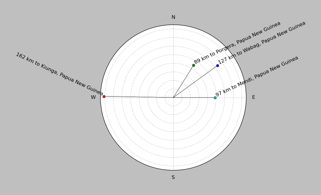
| ||||||||||||||||
Event and active stations
|
|||||||||||||||||
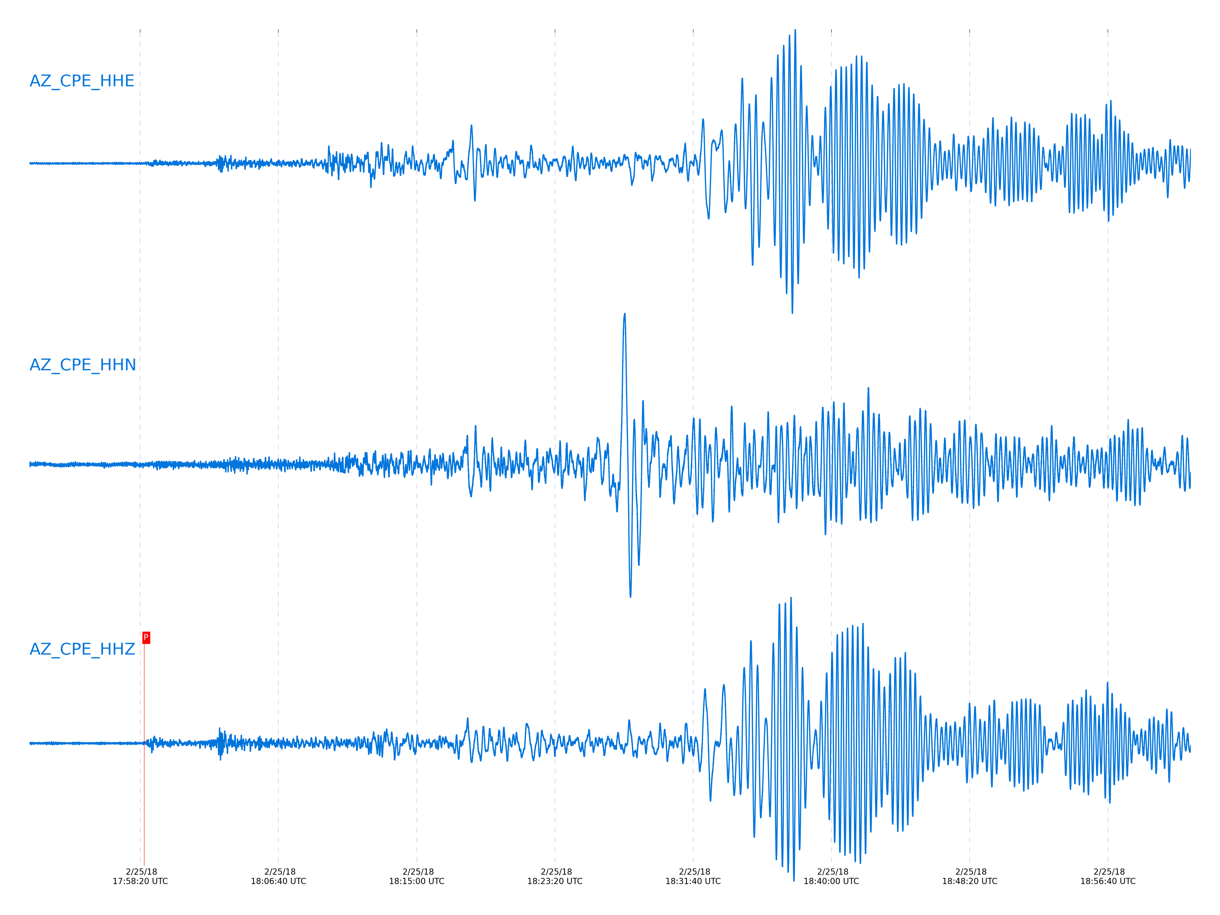
Closest station with identified signal. Not filtered.
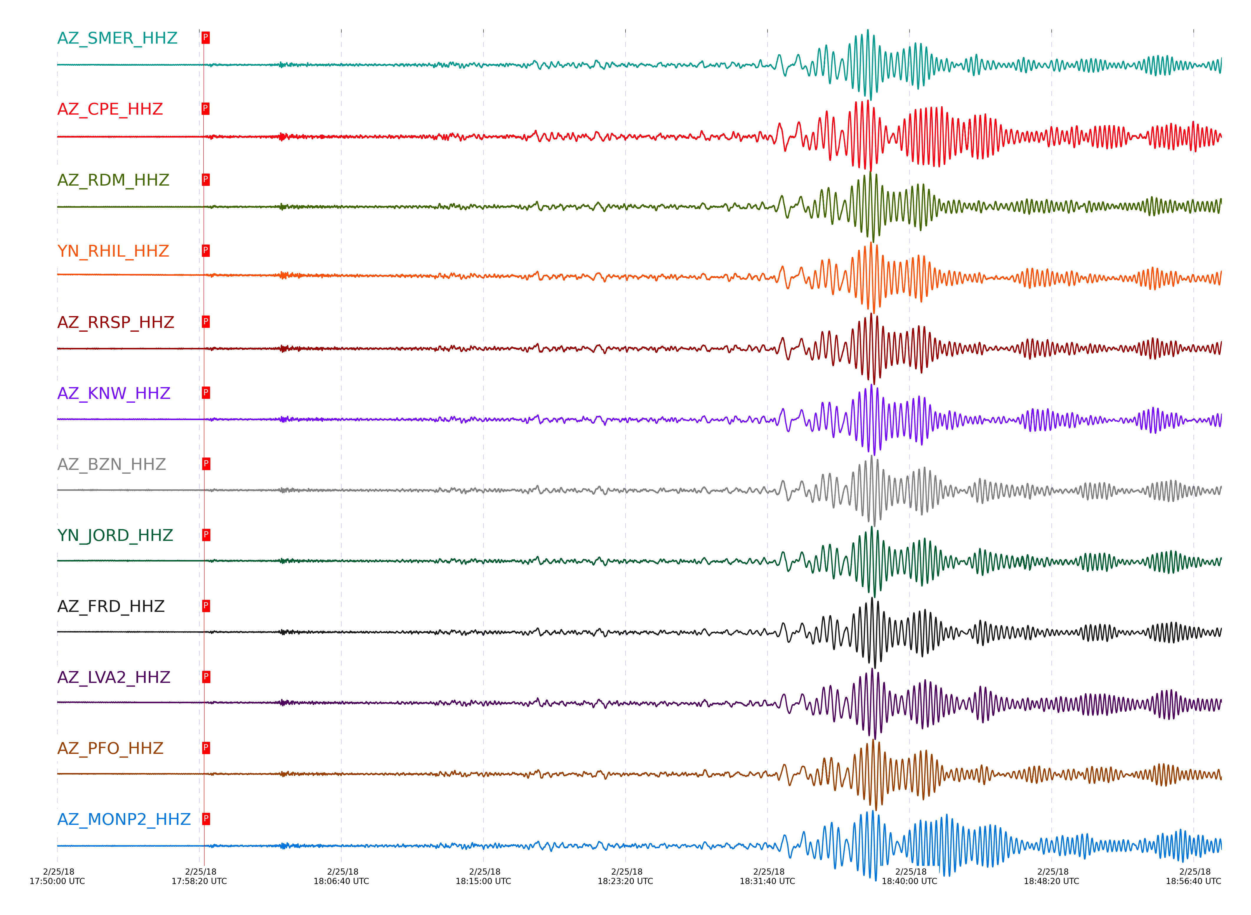
Subset of several stations close to the event. Not filtered.
| STA_CHAN | S-E Delta | S-E Azimuth | Phase | Time | Signal/Noise | Time Residual | V. Model | Auth | arid |
|---|---|---|---|---|---|---|---|---|---|
| SMER_HHZ | 101.77° | 270.38° | Pdiff | 2018-02-25 17:58:35.8923 UTC | 7.9332 | 2.47 | iasp91 | dbp:jtytell:180 | 1693282 |
| CPE_HHZ | 101.829° | 270.29° | Pdiff | 2018-02-25 17:58:35.0824 UTC | -1 | 1.401 | iasp91 | dbp:jtytell:180 | 1693896 |
| RDM_HHZ | 102.038° | 270.59° | Pdiff | 2018-02-25 17:58:36.2258 UTC | -1 | 1.615 | iasp91 | dbp:jtytell:180 | 1693897 |
| RHIL_HHZ | 102.101° | 270.64° | Pdiff | 2018-02-25 17:58:36.5064 UTC | -1 | 1.615 | iasp91 | dbp:jtytell:180 | 1693916 |
| RRSP_HHZ | 102.128° | 270.66° | Pdiff | 2018-02-25 17:58:36.6253 UTC | -1 | 1.615 | iasp91 | dbp:jtytell:180 | 1693900 |
| KNW_HHZ | 102.15° | 270.68° | Pdiff | 2018-02-25 17:58:36.9374 UTC | 9.4657 | 1.829 | iasp91 | dbp:jtytell:180 | 1693283 |
| BZN_HHZ | 102.19° | 270.66° | Pdiff | 2018-02-25 17:58:37.97 UTC | 10.225 | 2.684 | iasp91 | dbp:jtytell:180 | 1693284 |
| JORD_HHZ | 102.209° | 270.67° | Pdiff | 2018-02-25 17:58:38.0525 UTC | 7.0209 | 2.684 | iasp91 | dbp:jtytell:180 | 1693285 |
| FRD_HHZ | 102.244° | 270.7° | Pdiff | 2018-02-25 17:58:37.5684 UTC | 8.4519 | 2.043 | iasp91 | dbp:jtytell:180 | 1693286 |
| LVA2_HHZ | 102.28° | 270.69° | Pdiff | 2018-02-25 17:58:38.1544 UTC | 7.14 | 2.47 | iasp91 | dbp:jtytell:180 | 1693288 |
| PFO_HHZ | 102.362° | 270.8° | Pdiff | 2018-02-25 17:58:37.2348 UTC | 6.33 | 1.188 | iasp91 | dbp:jtytell:180 | 1693287 |
| MONP2_HHZ | 102.402° | 270.67° | Pdiff | 2018-02-25 17:58:37.841 UTC | -1 | 1.615 | iasp91 | dbp:jtytell:180 | 1693905 |
Click the link below to observe an interactive map of earthquakes recorded by the station deployment:
Broadband Seismic Data Collection Center (ANZA),
Institute of Geophysics & Planetary Physics
Scripps Institution of Oceanography,
University of California San Diego
Copyright © 1989 - 2014. All Rights Reserved.