
last update to page: May 04 2018 22:16:50 (UTC).
SummaryThe red marker denotes the earthquake epicenter. On Fri May 4th 2018 21:32:44 (UTC) the seismic network recorded an earthquake (preliminary 5.4 mww) located in Hawaii. Seismic region Pacific Basin. The epicentral distance (i.e. distance separating the location to the epicenter) to the closest station SCI2 in the network is 3,927.3 km. If you felt the quake, the USGS would like to know. Please add your comments to the USGS page "Did you feel it?". |
Details
Proximity to Population Centers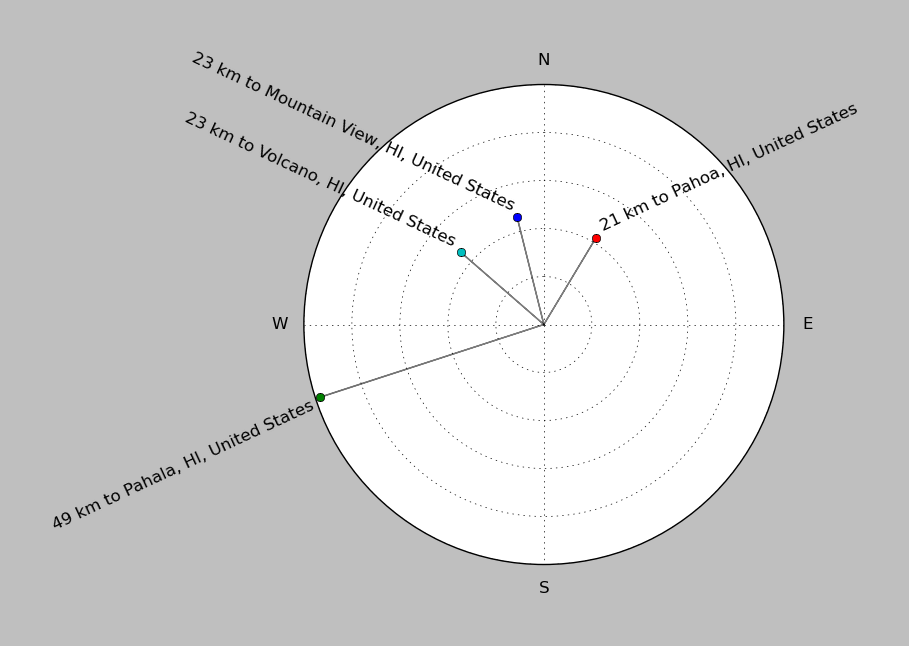
| ||||||||||||||||
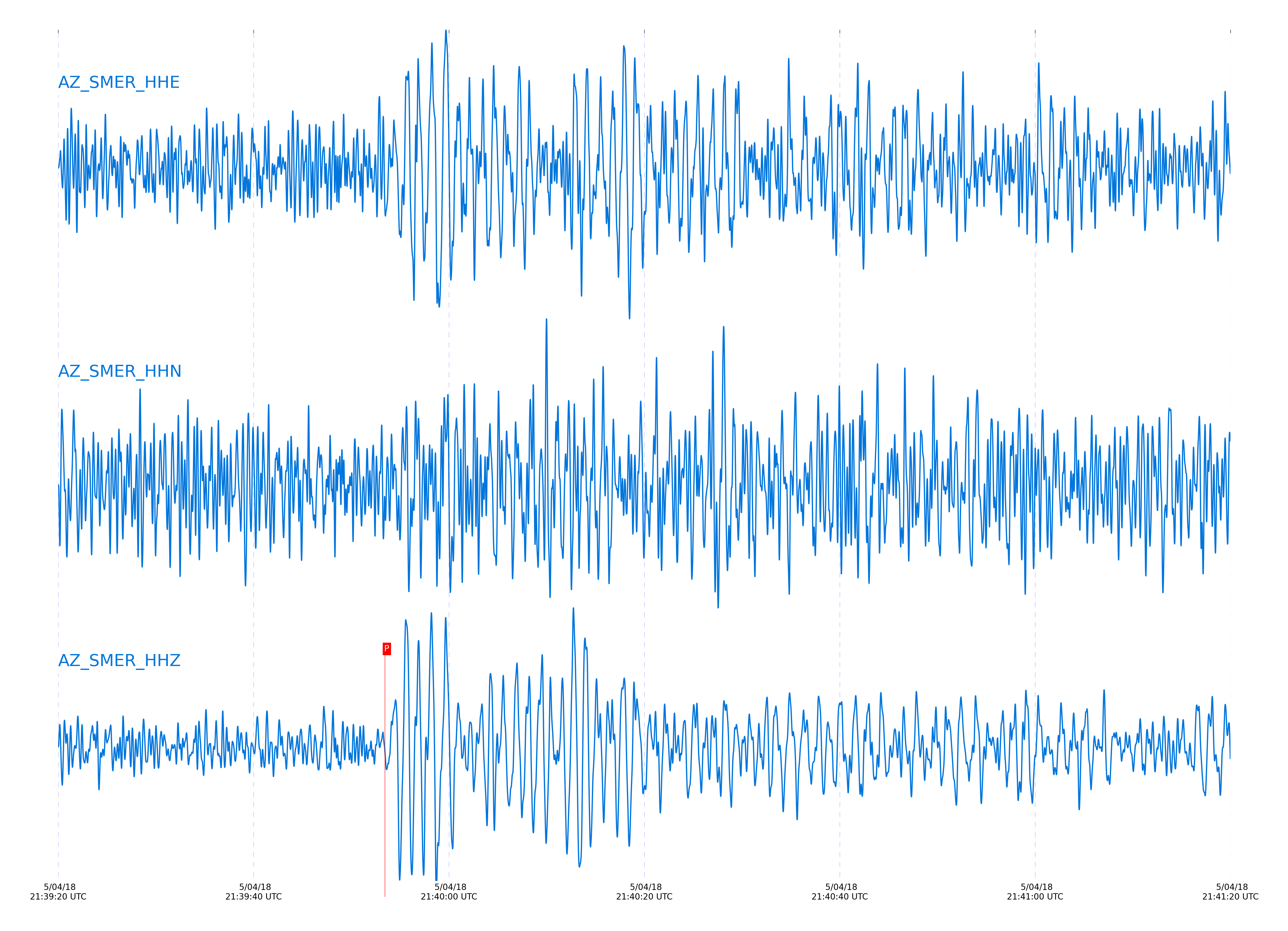
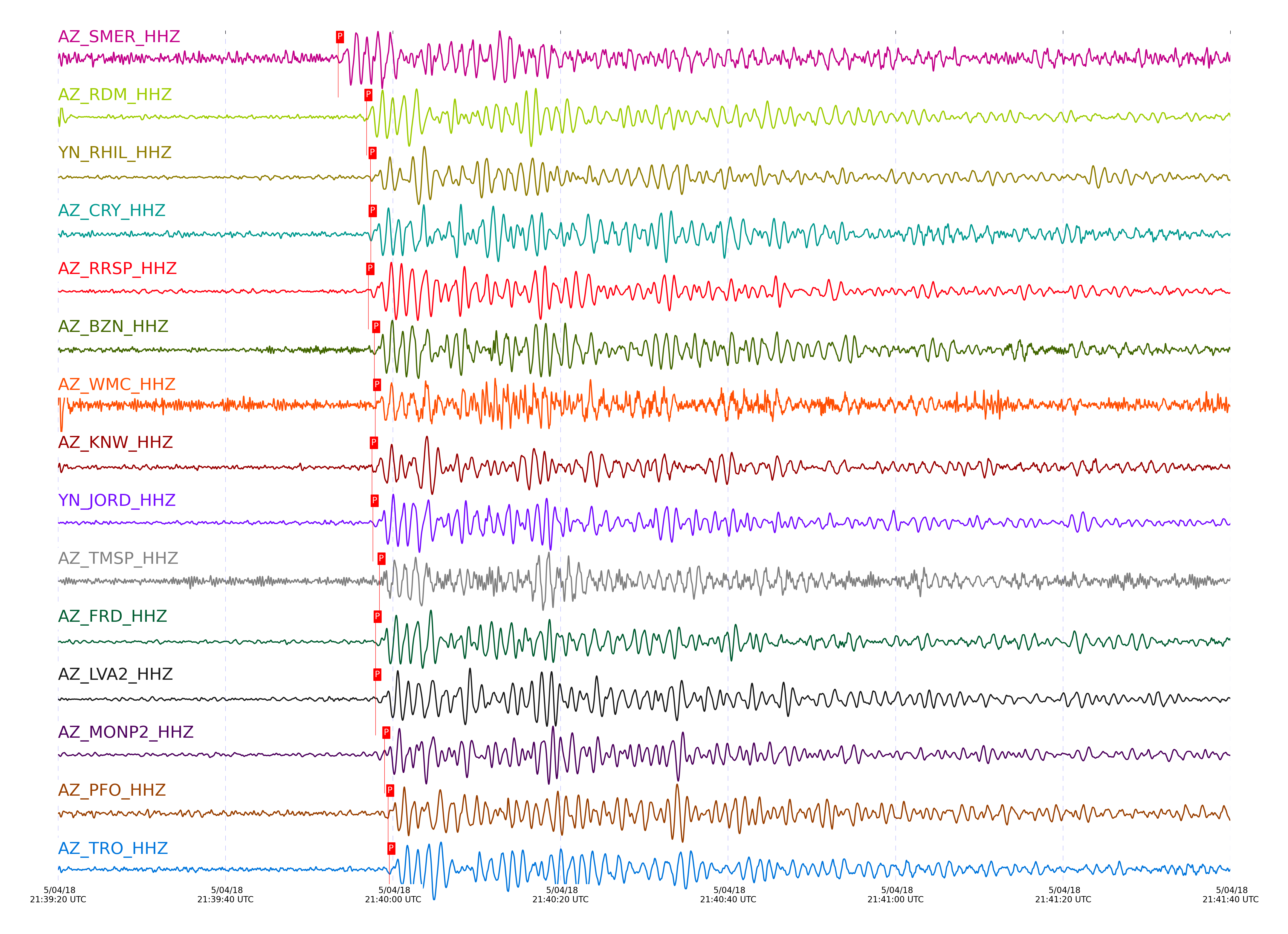
Event and active stations
|
|||||||||||||||||
Closest station with identified signal. 0.8 to 3 Hz bandpass Butterworth filter has been applied to data.
Subset of several stations close to the event. 0.8 to 3 Hz bandpass Butterworth filter has been applied to data.
| STA_CHAN | S-E Delta | S-E Azimuth | Phase | Time | Signal/Noise | Time Residual | V. Model | Auth | arid |
|---|---|---|---|---|---|---|---|---|---|
| SMER_HHZ | 36.477° | 256.94° | pP | 2018-05-04 21:39:53.4445 UTC | -1 | 1.424 | iasp91 | dbp:jtytell:181 | 1744797 |
| RDM_HHZ | 36.778° | 256.97° | pP | 2018-05-04 21:39:56.8302 UTC | -1 | 2.244 | iasp91 | dbp:jtytell:181 | 1744819 |
| RHIL_HHZ | 36.85° | 256.98° | pP | 2018-05-04 21:39:57.3154 UTC | -1 | 2.118 | iasp91 | dbp:jtytell:181 | 1744802 |
| CRY_HHZ | 36.853° | 257.14° | pP | 2018-05-04 21:39:57.3447 UTC | 14.768 | 2.118 | iasp91 | dbp:jtytell:181 | 1744753 |
| RRSP_HHZ | 36.871° | 257.03° | pP | 2018-05-04 21:39:57.0551 UTC | -1 | 1.679 | iasp91 | dbp:jtytell:181 | 1744804 |
| BZN_HHZ | 36.894° | 257.3° | pP | 2018-05-04 21:39:57.7647 UTC | 21.259 | 2.191 | iasp91 | dbp:jtytell:181 | 1744745 |
| WMC_HHZ | 36.906° | 257.18° | pP | 2018-05-04 21:39:57.8695 UTC | -1 | 2.195 | iasp91 | dbp:jtytell:181 | 1744821 |
| KNW_HHZ | 36.907° | 256.97° | pP | 2018-05-04 21:39:57.4908 UTC | -1 | 1.805 | iasp91 | dbp:jtytell:181 | 1744822 |
| JORD_HHZ | 36.908° | 257.34° | pP | 2018-05-04 21:39:57.5883 UTC | 20.565 | 1.898 | iasp91 | dbp:jtytell:181 | 1744751 |
| TMSP_HHZ | 36.911° | 257.12° | pP | 2018-05-04 21:39:58.3845 UTC | -1 | 2.666 | iasp91 | dbp:jtytell:181 | 1744806 |
| FRD_HHZ | 36.947° | 257.34° | pP | 2018-05-04 21:39:57.9263 UTC | 19.887 | 1.898 | iasp91 | dbp:jtytell:181 | 1744757 |
| LVA2_HHZ | 36.949° | 257.56° | pP | 2018-05-04 21:39:57.9072 UTC | 21.381 | 1.861 | iasp91 | dbp:jtytell:181 | 1744755 |
| MONP2_HHZ | 36.967° | 258.27° | pP | 2018-05-04 21:39:58.9719 UTC | 11.34 | 2.775 | iasp91 | dbp:jtytell:181 | 1744768 |
| PFO_HHZ | 37.089° | 257.3° | pP | 2018-05-04 21:39:59.427 UTC | 11.075 | 2.194 | iasp91 | dbp:jtytell:181 | 1744763 |
| TRO_HHZ | 37.097° | 257.45° | pP | 2018-05-04 21:39:59.5651 UTC | 18.722 | 2.263 | iasp91 | dbp:jtytell:181 | 1744761 |
Click the link below to observe an interactive map of earthquakes recorded by the station deployment:
Broadband Seismic Data Collection Center (ANZA),
Institute of Geophysics & Planetary Physics
Scripps Institution of Oceanography,
University of California San Diego
Copyright © 1989 - 2014. All Rights Reserved.