
last update to page: September 09 2016 17:34:15 (UTC).
SummaryThe red marker denotes the earthquake epicenter. On Wed Jan 6th 2016 01:30:02 (UTC) the seismic network recorded an earthquake (preliminary 5.1 mb) located in North Korea. Seismic region Eastern Asia. The epicentral distance (i.e. distance separating the location to the epicenter) to the closest station CSLB in the network is 9,222.7 km. If you felt the quake, the USGS would like to know. Please add your comments to the USGS page "Did you feel it?". |
Details
Proximity to Population Centers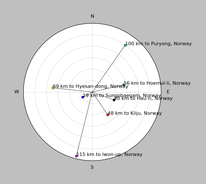
| ||||||||||||||||
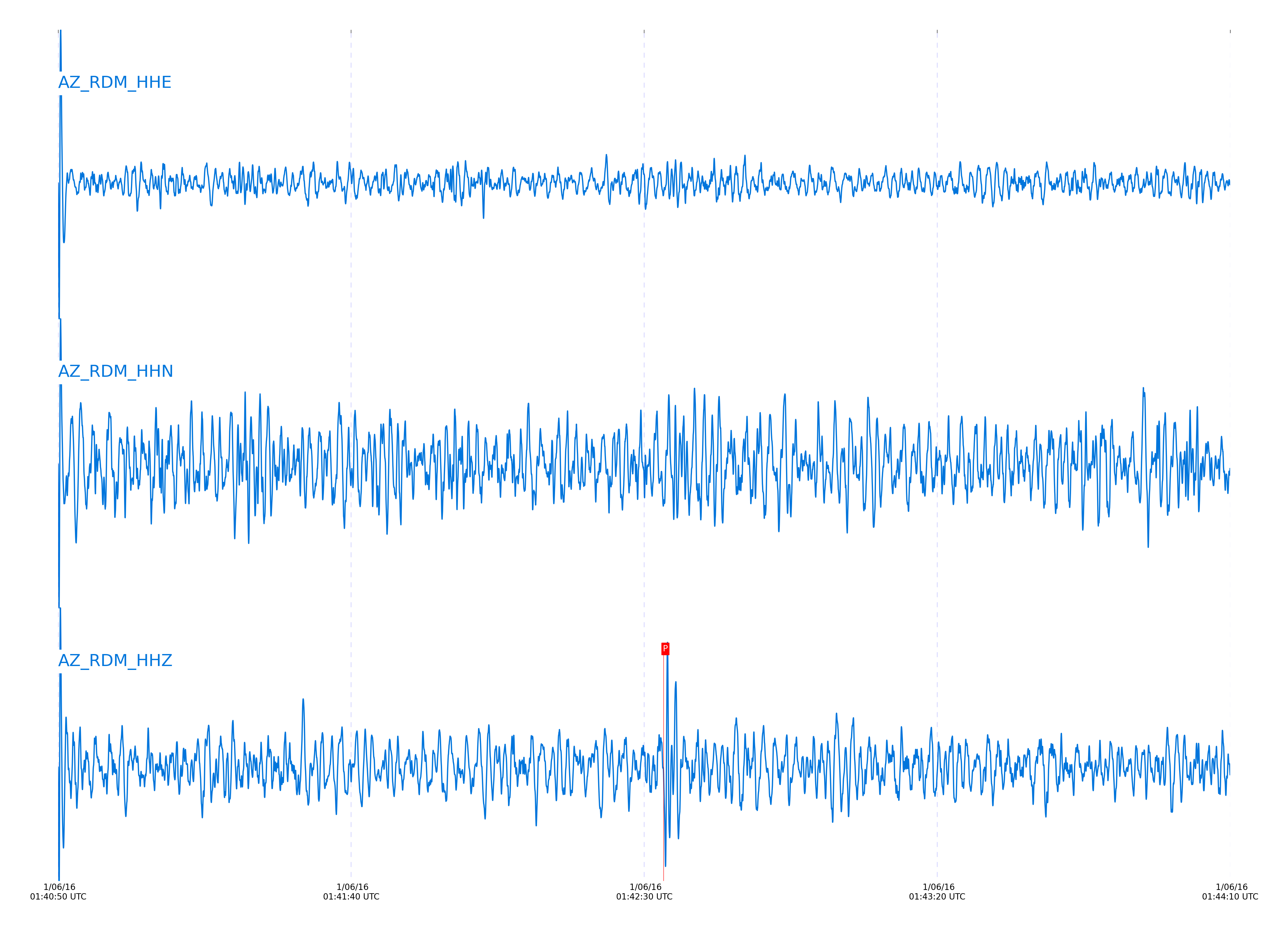
Event and active stations
|
|||||||||||||||||
Closest station with identified signal. 0.8 to 3 Hz bandpass Butterworth filter has been applied to data.
Subset of several stations close to the event. 0.8 to 3 Hz bandpass Butterworth filter has been applied to data.
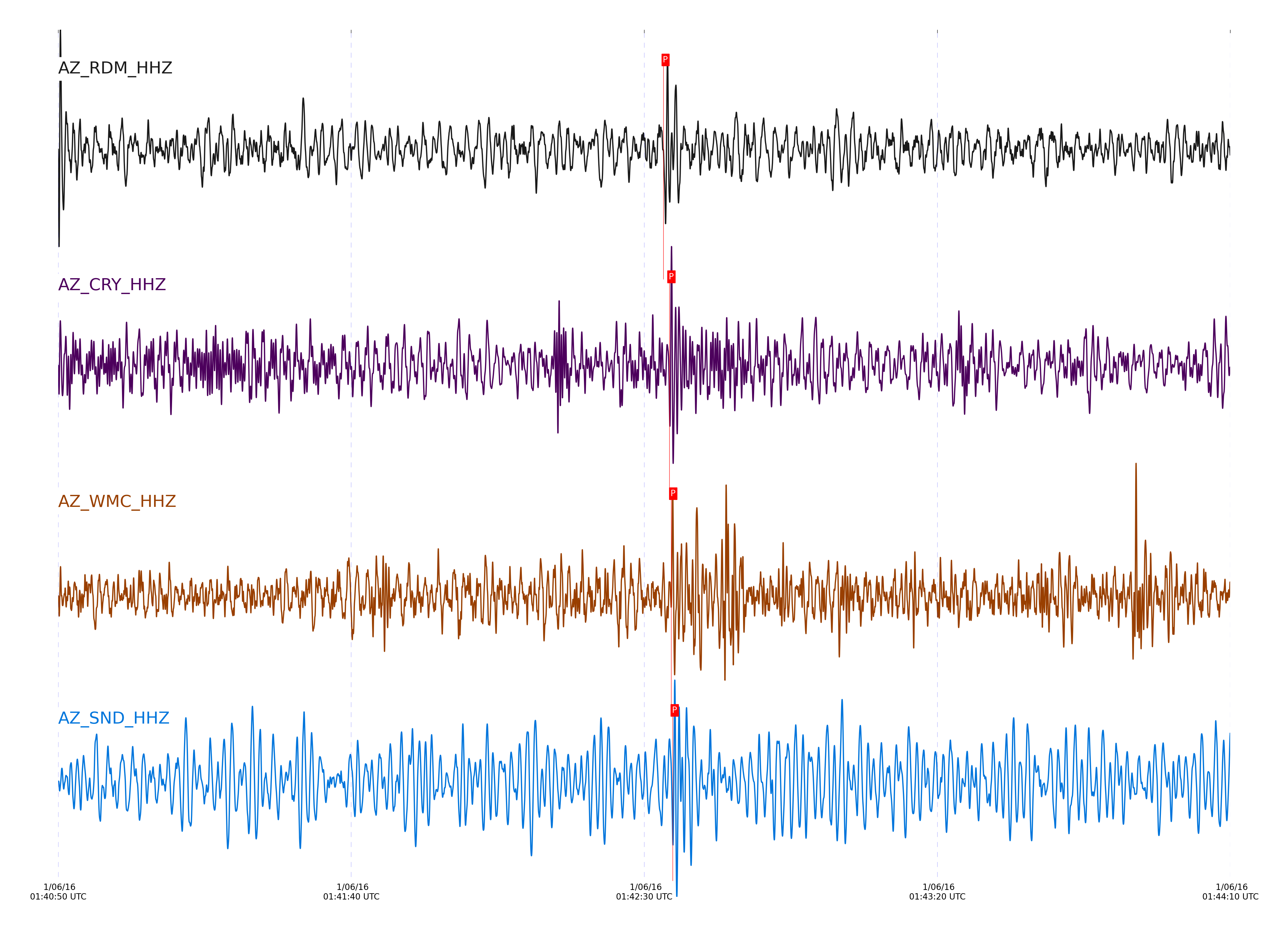
| STA_CHAN | S-E Delta | S-E Azimuth | Phase | Time | Signal/Noise | Time Residual | V. Model | Auth | arid |
|---|---|---|---|---|---|---|---|---|---|
| RDM_HHZ | 83.686° | 316.41° | P | 2016-01-06 01:42:33.2888 UTC | -1 | 1.556 | iasp91 | dbp:jtytell:160 | 902194 |
| CRY_HHZ | 83.796° | 316.47° | pP | 2016-01-06 01:42:34.2997 UTC | -1 | -1.32 | iasp91 | dbp:jtytell:160 | 902223 |
| WMC_HHZ | 83.826° | 316.5° | pP | 2016-01-06 01:42:34.602 UTC | -1 | -1.171 | iasp91 | dbp:jtytell:160 | 902224 |
| SND_HHZ | 83.877° | 316.53° | pP | 2016-01-06 01:42:34.8633 UTC | -1 | -1.171 | iasp91 | dbp:jtytell:160 | 902225 |
Click the link below to observe an interactive map of earthquakes recorded by the station deployment:
Broadband Seismic Data Collection Center (ANZA),
Institute of Geophysics & Planetary Physics
Scripps Institution of Oceanography,
University of California San Diego
Copyright © 1989 - 2014. All Rights Reserved.