
Recent earthquake near Hector Mine / Joshua Tree
Last updated: 2018-03-26 17:50:55 UTC
Translations
![]()
![]()
![]()
![]()
![]()
![]()
![]()
![]()
![]()
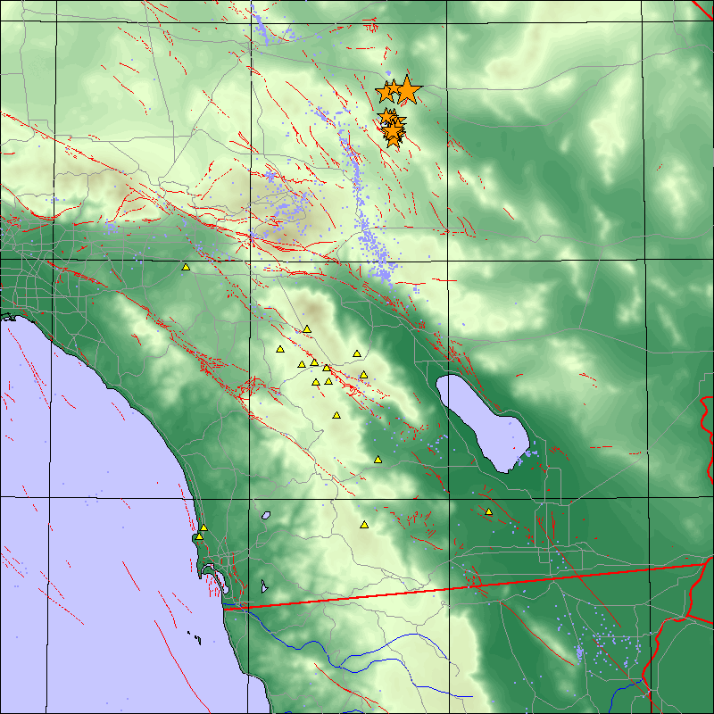
Early Saturday morning, October 16th, 1999 at approximately 2:46 PST we recorded an earthquake located in a sparsely populated area 55 km (34 miles) northwest of Twentynine Palms and 76 km (47 miles) east-southeast of Barstow. This earthquake was felt in the San Diego area. Preliminary source parameters are shown below.
| Pre-shocks | Main Event and Aftershocks |
 |
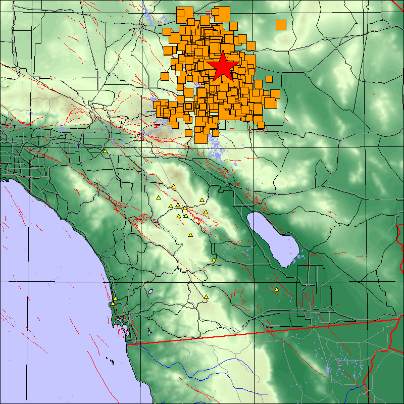 |
- Yellow triangles are ANZA broadband stations.
- Blue dots are background seismicity.
- Thin red lines are fault lines.
- Thin grey lines are major roads or highways.
View most recently updated map
| Latitude | Longitude | Origin time | Depth | Mw | Author | Waveforms |
|---|---|---|---|---|---|---|
| 34.412 | -116.338 | 10/16/1999 (289) 09:46:47.103 | 0.000 | UCSD | available | |
| 34.600 | -116.270 | 10/16/1999 (289) 09:46:44.000 | 6.000 | 7.00 | SCEC | available |
| 34.640 | -116.440 | 10/16/1999 (289) 09:59:34.000 | 10.0 | 5.3 | QED | available |
| 34.440 | -116.250 | 10/16/1999 (289) 12:57:21.000 | 1.0 | 5.8 | QED | available |
| 34.860 | -116.35 | 10/21/1999 (294) 01:54:06.000 | 4.5 | 5.1 | SCEC | available |
| 34.800 | -116.41 | 10/21/1999 (294) 01:54:35.000 | 1.7 | 5.0 | SCEC | available |
| 34.860 | -116.40 | 10/21/1999 (294) 01:57:38.000 | 1.4 | 5.0 | SCEC | available |
| 34.85 | -116.42 | 10/22/1999 (295) 16:08:48.000 | 6.0 | 5.1 | SCEC | |
| 34.520 | -116.27 | 10/29/1999 (302) 12:36:37.000 | 0.1 | 4.5 | SCEC |
The event parameters for the main shock are shown in red in the above table. The event parameters for significant aftershocks are shown in orange.
The Anza group at the University of California San Diego currently operates three broadband seismic networks.
Learn more about the Anza group (including who works here, other networks, nuclear tests in China/India/Pakistan).
Learn more about the ANZA network (includes more station information, research, etc).
URL: http://eqinfo.ucsd.edu/special_events/1999/290/a/index.php [Last updated: 2018-03-26 17:50:55 UTC]