
Earthquake swarm near the Salton Sea, CA
Last updated: 2018-03-26 17:50:59 UTC
Quick Links
- Location map
- Initial source parameters
- 3 components [closest Anza station]
- Vertical components [all Anza stations]
- Waveforms recorded at Mt. Soledad
![3 components [closest Anza station]](3comp_vert.gif)
![Vertical components [all Anza stations]](Anza_verts.gif)
Translations
![]()
![]()
![]()
![]()
![]()
![]()
![]()
![]()
![]()
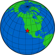
The Anza group at the University of California San Diego operates a broadband seismograph network consisting of 17 three component broadband seismograph stations centered near Anza, California (see map).
On Wednesday, August 31, 2005 we recorded a swarm of earthquakes with several medium–sized events located around the southern edge of the Salton Sea. The epicentral area is in the southern Brawley Seismic Zone. This zone connects the San Andreas fault (at its northern end) with the Imperial fault (at its southern end). In the past few decades, the Brawley Seismic Zone has been a prolific source of earthquake swarms.
If you felt the quakes, the USGS would like to know. Please add to the USGS "Did you feel it?" page.
View the most recent map of local events near San Diego or a slightly wider regional view of events recorded by ANZA, or a map of events recoded by ANZA from around the globe.
Initial source parameters for the recent ≥ 4.5 events are shown below. The epicentral distance (distance separating the epicenter and the closest station in the recording network) for Anza is 66 km (0.60 degrees).
This map shows the first mainshock (red star). Anza network stations are yellow triangles.
Event map for the first 4.5 earthquake
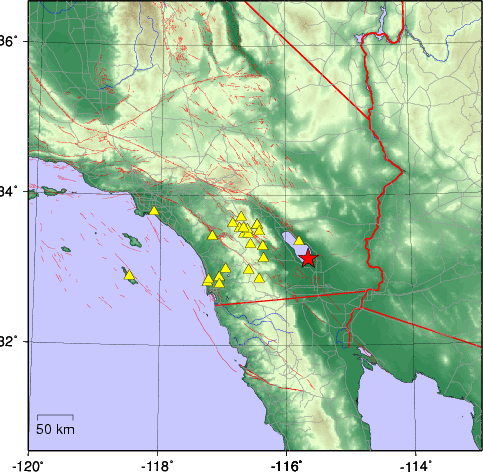
Detailed event map & aftershocks recorded from the swarm
The map below shows the earthquake swarm in detail. There are a total of 227 events plotted, which reflects the number of events in the area from 2005-08-31 00:54:28 UTC (2005-08-30 17:54:28 PDT) until 2005-09-01 16:16:40 UTC (09:16:40 PDT).
There are three main shocks plotted (magnitudes ≥ 4.5) and 224 pre– and after–shocks to these events. There may be more earthquakes related to this swarm after this date, however these are not plotted on the map below.

&ge 4.5 Event Parameters
| Latitude | Longitude | Origin time (UTC) | Origin time (PDT) | Depth (km) | ml | Author |
|---|---|---|---|---|---|---|
| 33.160 | -115.630 | 08/31/05 (243) 22:47.44 | 08/31/05 (243) 3:47.44 PM | 0 | 4.6 | USGS |
| 33.173 | -115.611 | 08/31/05 (243) 22:50.24 | 08/31/05 (243) 3:50.24 PM | 2 | 4.5 | USGS |
| 33.186 | -115.597 | 08/31/05 (243) 23:32.11 | 08/31/05 (243) 4:32.11 PM | 3.6 | 4.5 | USGS |
* The location and magnitude determined for this event are preliminary and are subject to change upon further review of seismic data.
You may also view a plot showing
Of local interest:
We operate a broadband station on Mt. Soledad. At 15:48 (PDT) station SOL recorded the P wave from the first ≥ 4.5 event. Here is a view of that event as picked by our analyst. A red P indicates a P wave arrival, a red S indicates an S wave arrival. Note the rapid succession of events in this time window (~15 minutes).
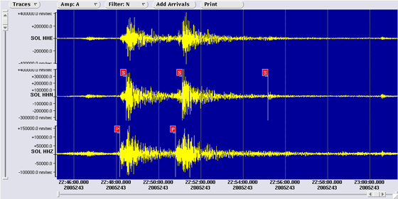
View a larger image showing the waveforms recorded at Mt. Soledad.
Visit the IRIS website with additional links to seismic data for this event.
Search the Internet
To search the internet for more information about this event, click on the button below:
![]()
Learn more about the Anza group (including who works here, other networks, nuclear tests in China/India/Pakistan).
Learn more about the ANZA network (includes more station information, research, etc).
URL: http://eqinfo.ucsd.edu/special_events/2005/243/a/index.php [Last updated: 2018-03-26 17:50:59 UTC]