Magnitude 6.4 quake near Michoacan, Mexico
Last updated: 2018-03-26 17:50:58 UTC
Quick Links
- Location map
- Initial source parameters
- Vertical components [all Anza stations]
- Vertical components [all KNET stations]
Translations
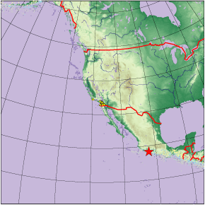
At approximately 11:41:46 GMT (04:41:46 PDT), August 9th, 2000 Mexico experienced a magnitude 6.4 earthquake. Preliminary source parameters are shown below.
| KNET | ANZA |
 |
 |
|
| Latitude | Longitude | Origin time | Depth | Mw | Author |
| 18.190 | -102.30 | 08/09/2000 (222) 11:41:46 | 33.000 | 6.40 | QED |
- Download waveforms via ftp in miniSEED format.
Phase information:
KNET:
| Station | iphase | phase | delta | seaz | esaz | timeres |
| KBK | P | PKiKP | 119.101 | 357.007 | 2.316 | 2.764 |
| EKS2 | P | PKiKP | 119.041 | 355.737 | 3.299 | 2.961 |
| KZA | P | PKiKP | 119.690 | 357.320 | 2.093 | 3.376 |
| TKM2 | P | PKiKP | 118.859 | 357.718 | 1.759 | 2.171 |
| ULHL | P | PKiKP | 119.549 | 358.407 | 1.241 | 3.160 |
| USP | P | PKiKP | 118.473 | 356.541 | 2.651 | 2.324 |
| CHM | P | PKiKP | 118.751 | 356.804 | 2.460 | 1.863 |
| AAK | P | PKiKP | 119.105 | 356.514 | 2.699 | 2.887 |
Mean square residual = 7.46349
ANZA:
| Station | iphase | phase | delta | seaz | esaz | timeres |
| SMTC | P | Pn | 19.092 | 137.308 | 323.205 | 1.329 |
| BZN | P | Pn | 19.987 | 136.395 | 322.741 | 0.672 |
| CRY | P | Pn | 20.081 | 136.380 | 322.766 | 0.355 |
| FRD | P | Pn | 19.952 | 136.545 | 322.862 | 0.6 |
| KNW | P | Pn | 20.174 | 136.715 | 323.107 | 0.271 |
| LVA2 | P | Pn | 19.825 | 136.363 | 322.644 | 0.702 |
| MONP | P | Pn | 19.413 | 135.781 | 321.946 | 1.061 |
| PFO | P | Pn | 19.956 | 137.084 | 323.351 | 0.636 |
| RDM | P | Pn | 20.191 | 136.259 | 322.702 | 0.38 |
| SND | P | Pn | 19.999 | 136.629 | 322.958 | 0.79 |
| SOL | P | Pn | 19.869 | 133.861 | 320.383 | 0.485 |
| TRO | P | Pn | 19.872 | 136.993 | 323.234 | 0.727 |
| WMC | P | Pn | 20.051 | 136.534 | 322.892 | 0.506 |
| YAQ | P | Pn | 19.571 | 136.472 | 322.639 | 0.841 |
| RSB | P | Pn | 20.714 | 135.862 | 322.562 | -0.225 |
| USB | P | P | 22.522 | 131.619 | 319.520 | 0.22 |
| SOL | S | S | 19.869 | 133.861 | 320.383 | 2.652 |
| LVA2 | S | S | 19.825 | 136.363 | 322.644 | 2.282 |
| YAQ | S | S | 19.571 | 136.472 | 322.639 | -3.275 |
| MONP | S | S | 19.413 | 135.781 | 321.946 | -3.487 |
| SMTC | S | S | 19.092 | 137.308 | 323.205 | 5.398 |
| FRD | S | S | 19.952 | 136.545 | 322.862 | 2.336 |
| PFO | S | S | 19.956 | 137.084 | 323.351 | 1.913 |
| BZN | S | S | 19.987 | 136.395 | 322.741 | -1.753 |
| SND | S | S | 19.999 | 136.629 | 322.958 | -1.266 |
| WMC | S | S | 20.051 | 136.534 | 322.892 | 1.628 |
| CRY | S | S | 20.081 | 136.380 | 322.766 | 1.243 |
| KNW | S | S | 20.174 | 136.715 | 323.107 | 1.162 |
| RDM | S | S | 20.191 | 136.259 | 322.702 | -1.439 |
Mean square residual = 3.20943
Dist is the distance in degrees from the array to the event. There are approximately 111km/deg. Seaz is the 'station to event azimuth': an angular distance measurement in degrees from the station to the earthquake. Esaz is the 'event to station azimuth': an angular distance measurement in degrees from the earthquake to the station.
You may view
- a plot showing the vertical components for all ANZA stations
- a plot showing the vertical components for all KNET stations
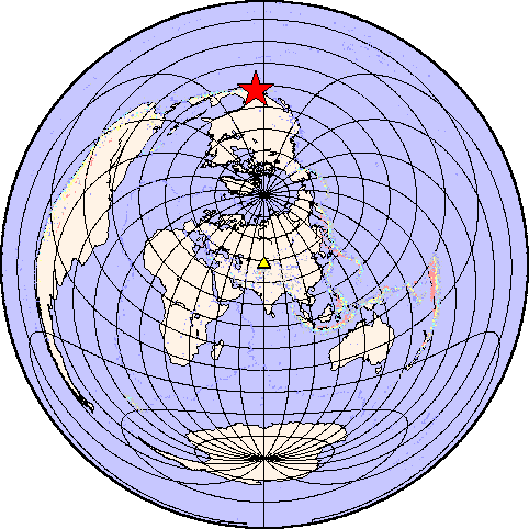
ANZA (2198 km)
dist ~19.8 deg.
seaz ~136.5 deg
KNET(13220 km)
dist ~119.1 deg.
seaz ~357.0 deg
The first 6 hours of data recorded at ANZA station PFO show that after the mainshock there were no large aftershocks recorded by ANZA. This is not unexpected because of the distance (19.8 deg) from the array to the source.
Learn more about
the Anza group (including
who works here, other networks, nuclear tests in China/India/Pakistan).
Learn more about the ANZA
network (includes more station information, research, etc).
URL: http://eqinfo.ucsd.edu/special_events/2000/222/a/index.php [Last updated: 2018-03-26 17:50:58 UTC]
