
Magnitude 7.0 quake south of Mariana Islands
Last updated: 2018-03-26 17:50:59 UTC
Quick Links
- Location map
- Initial source parameters
- 3 components [closest KNET station]
- Vertical components [all Anza stations]
- Vertical components [all KNET stations]
- Waveforms recorded at Mt. Soledad
![3 components [closest KNET station]](KN_3comp.gif)
![Vertical components [all Anza stations]](AZ_verts.gif)
![Vertical components [all KNET stations]](KN_verts.gif)
Translations
![]()
![]()
![]()
![]()
![]()
![]()
![]()
![]()
![]()
The Anza group at the University of California San Diego operates a broadband seismograph network consisting of 13 (+ 2) three component broadband seismograph stations centered near Anza Californa (see map).
On Friday, October 12th, 2001 at 08:02 (PDT) we recorded a quake (preliminary ml 7.0) located in the south Pacific near Guam.
If you felt the quake, the USGS would like to know. Add to the USGS "Did you feel it?" page.
View the most recent map of local events near San Diego or a map of events recoded by ANZA from around the globe. We also have a bulletin of recent events recorded by the Anza network.
Initial source parameters for the recent event and aftershocks are shown below. The epicentral distance (distance separating the epicenter and the recording network) for ANZA is 90.0 degrees (10017 km).
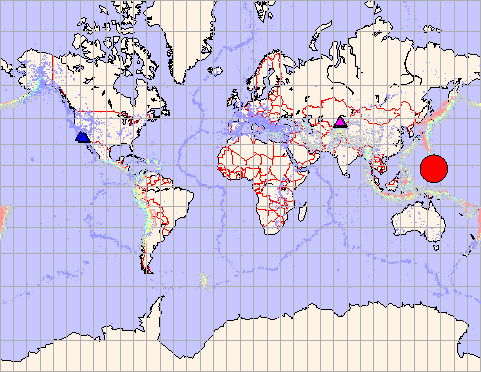
This map shows the mainshock (red circle). ANZA network stations are blue triangles, KNET network stations are pink triangles. Backgound seismicity is also plotted.
| Latitude | Longitude | Origin time | Depth | ml | Author |
|---|---|---|---|---|---|
| 12.82 | 144.92 | 10/12/2001 (285) 15:02:20 | 70.70 | 7.0* | QED |
*note that the location and magnitude determined for this event is preliminary and is subject to change upon further review of seismic data.
You may view a plot showing
- the 3 components recorded by the closest KNET station
- the vertical components for all ANZA stations
- the vertical components for all KNET stations
Of local interest:
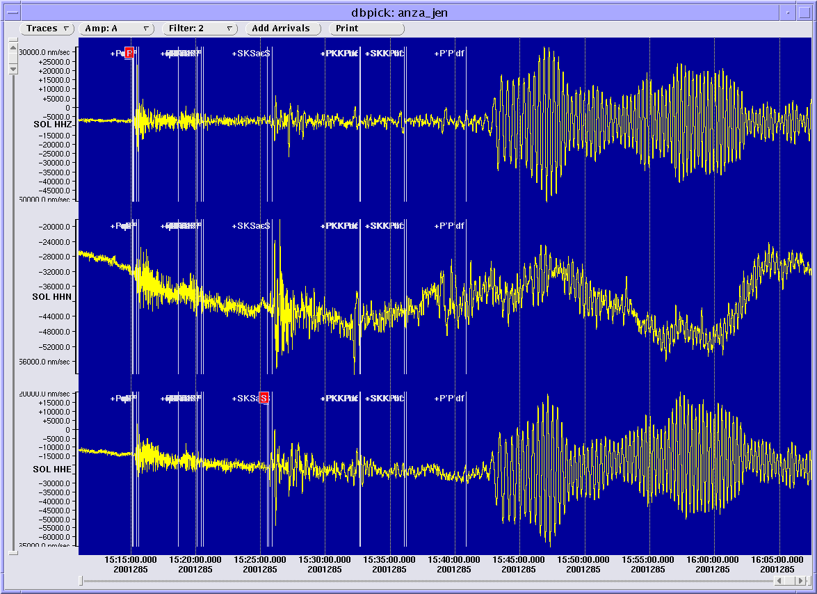
We operate a broadband station on Mt. Soledad. At 08:15:13 PDT station SOL recorded the P wave from this event.
Here is a view of that event as picked by our analyst. The pink "P" indicates a P wave arrival, the "S" indicates an S wave arrival. Click here to see a full size image.
Learn more about the Anza group (including who works here, other networks, nuclear tests in China, India and Pakistan).
Learn more about the ANZA network (includes more station information, research, etc).
URL: http://eqinfo.ucsd.edu/special_events/2001/285/a/index.php [Last updated: 2018-03-26 17:50:59 UTC]