
last update to page: February 07 2017 23:58:53 (UTC).
SummaryThe red marker denotes the earthquake epicenter. On Tue Feb 7th 2017 22:03:56 (UTC) the seismic network recorded an earthquake (preliminary 6.3 mww) located in Southwestern Pakistan. Seismic region Western Asia. The epicentral distance (i.e. distance separating the location to the epicenter) to the closest station CSLB in the network is 13,468.5 km. If you felt the quake, the USGS would like to know. Please add your comments to the USGS page "Did you feel it?". |
Details
Proximity to Population Centers
| ||||||||||||||||
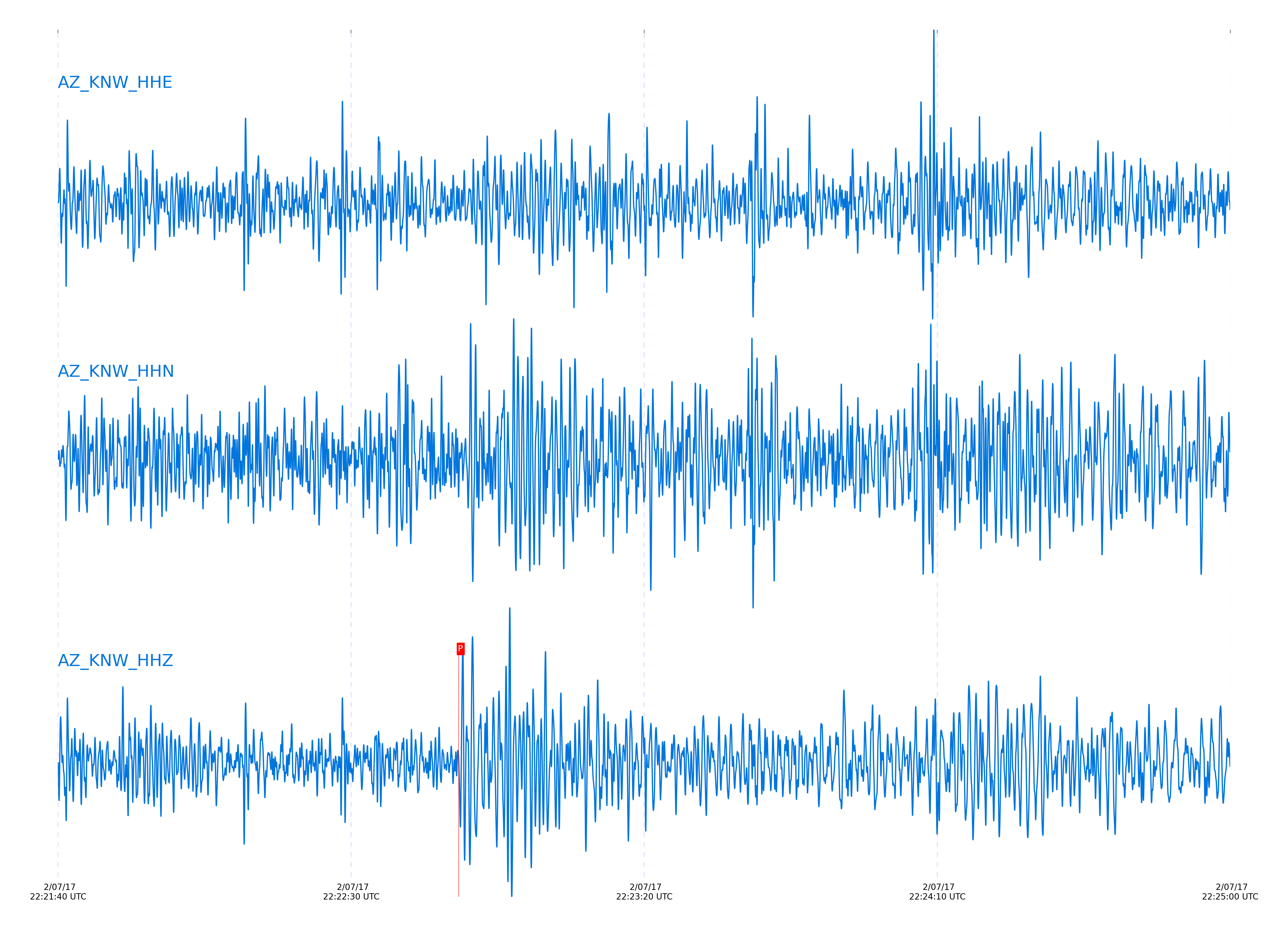
Event and active stations
|
|||||||||||||||||
Closest station with identified signal. 0.8 to 3 Hz bandpass Butterworth filter has been applied to data.
Subset of several stations close to the event. 0.8 to 3 Hz bandpass Butterworth filter has been applied to data.

| STA_CHAN | S-E Delta | S-E Azimuth | Phase | Time | Signal/Noise | Time Residual | V. Model | Auth | arid |
|---|---|---|---|---|---|---|---|---|---|
| KNW_HHZ | 121.069° | 0.02° | PKiKP | 2017-02-07 22:22:48.357 UTC | -1 | 1.716 | iasp91 | dbp:jtytell:170 | 1337351 |
| RRSP_HHZ | 121.132° | 359.99° | PKiKP | 2017-02-07 22:22:48.5807 UTC | -1 | 1.816 | iasp91 | dbp:jtytell:170 | 1337352 |
| RDM_HHZ | 121.153° | 359.87° | PKiKP | 2017-02-07 22:22:48.4479 UTC | -1 | 1.641 | iasp91 | dbp:jtytell:170 | 1337354 |
| PFO_HHZ | 121.171° | 0.28° | PKiKP | 2017-02-07 22:22:49.0377 UTC | -1 | 2.196 | iasp91 | dbp:jtytell:170 | 1337357 |
| WMC_HHZ | 121.21° | 0.06° | PKiKP | 2017-02-07 22:22:48.9726 UTC | -1 | 2.055 | iasp91 | dbp:jtytell:170 | 1337364 |
| TFRD_HHZ | 121.289° | 0.13° | PKiKP | 2017-02-07 22:22:48.3935 UTC | -1 | 1.321 | iasp91 | dbp:jtytell:170 | 1337369 |
| FRD_HHZ | 121.289° | 0.13° | PKiKP | 2017-02-07 22:22:48.3937 UTC | -1 | 1.321 | iasp91 | dbp:jtytell:170 | 1337368 |
| JORD_HHZ | 121.311° | 0.09° | PKiKP | 2017-02-07 22:22:48.8189 UTC | -1 | 1.702 | iasp91 | dbp:jtytell:170 | 1337367 |
| TR03_HHZ | 121.373° | 0.32° | PKiKP | 2017-02-07 22:22:48.6247 UTC | -1 | 1.385 | iasp91 | dbp:jtytell:170 | 1337371 |
| LVA2_HHZ | 121.432° | 0.18° | PKiKP | 2017-02-07 22:22:49.5698 UTC | -1 | 2.215 | iasp91 | dbp:jtytell:170 | 1337374 |
| MONP2_HHZ | 121.891° | 0.33° | PKiKP | 2017-02-07 22:22:50.3075 UTC | -1 | 2.049 | iasp91 | dbp:jtytell:170 | 1337376 |
Click the link below to observe an interactive map of earthquakes recorded by the station deployment:
Broadband Seismic Data Collection Center (ANZA),
Institute of Geophysics & Planetary Physics
Scripps Institution of Oceanography,
University of California San Diego
Copyright © 1989 - 2014. All Rights Reserved.