
last update to page: May 01 2017 18:52:06 (UTC).
SummaryThe red marker denotes the earthquake epicenter. On Mon May 1st 2017 14:18:15 (UTC) the seismic network recorded an earthquake (preliminary 6.3 mww) located in Southeastern Alaska. Seismic region Eastern Alaska To Vancouver Island. The epicentral distance (i.e. distance separating the location to the epicenter) to the closest station CSLB in the network is 3,194.0 km. If you felt the quake, the USGS would like to know. Please add your comments to the USGS page "Did you feel it?". |
Details
Proximity to Population Centers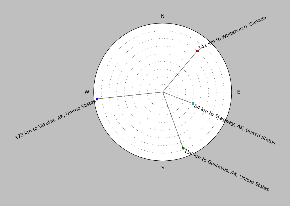
| ||||||||||||||||
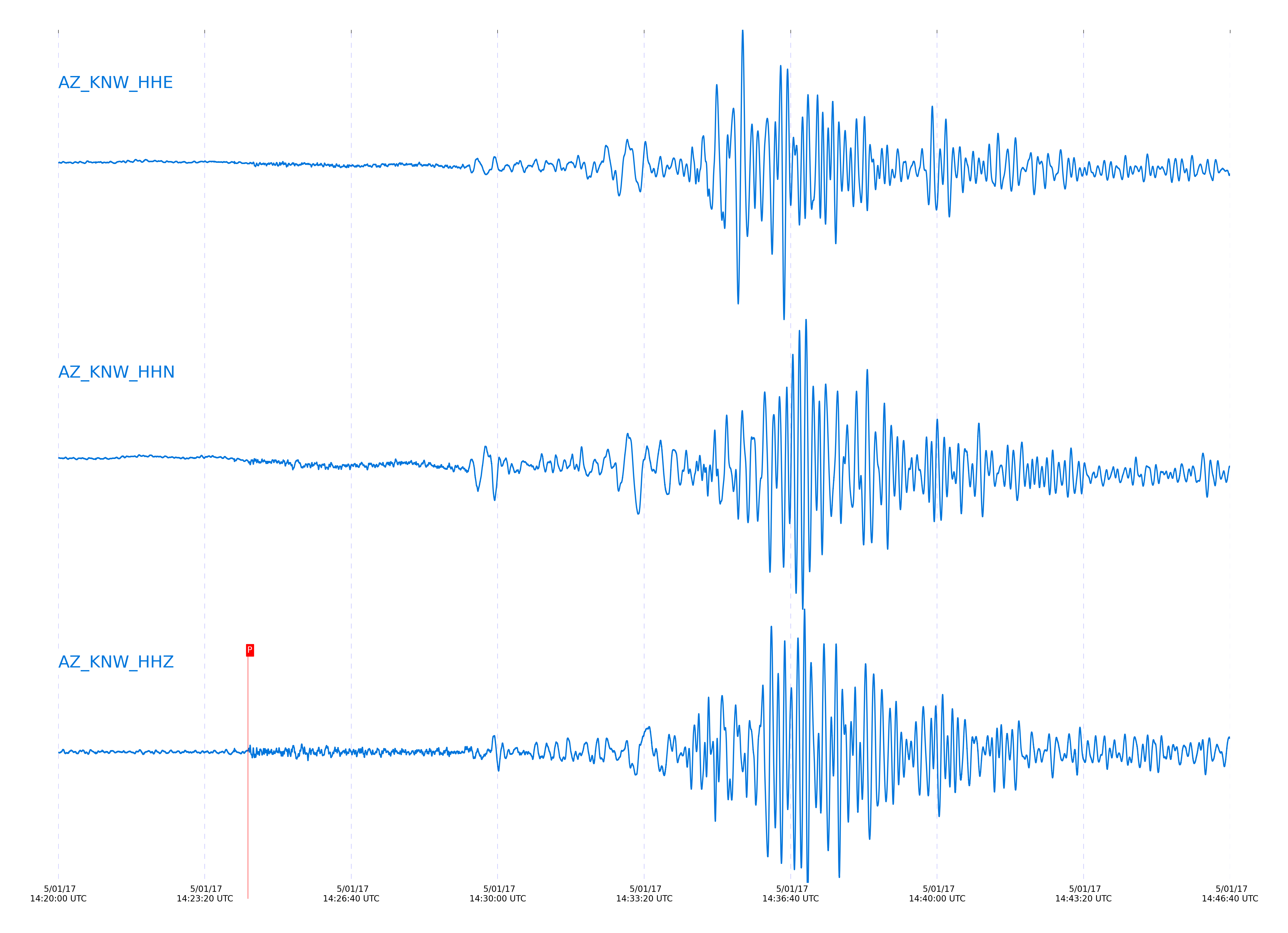
Event and active stations
|
|||||||||||||||||
Closest station with identified signal. Not filtered.
Subset of several stations close to the event. Not filtered.
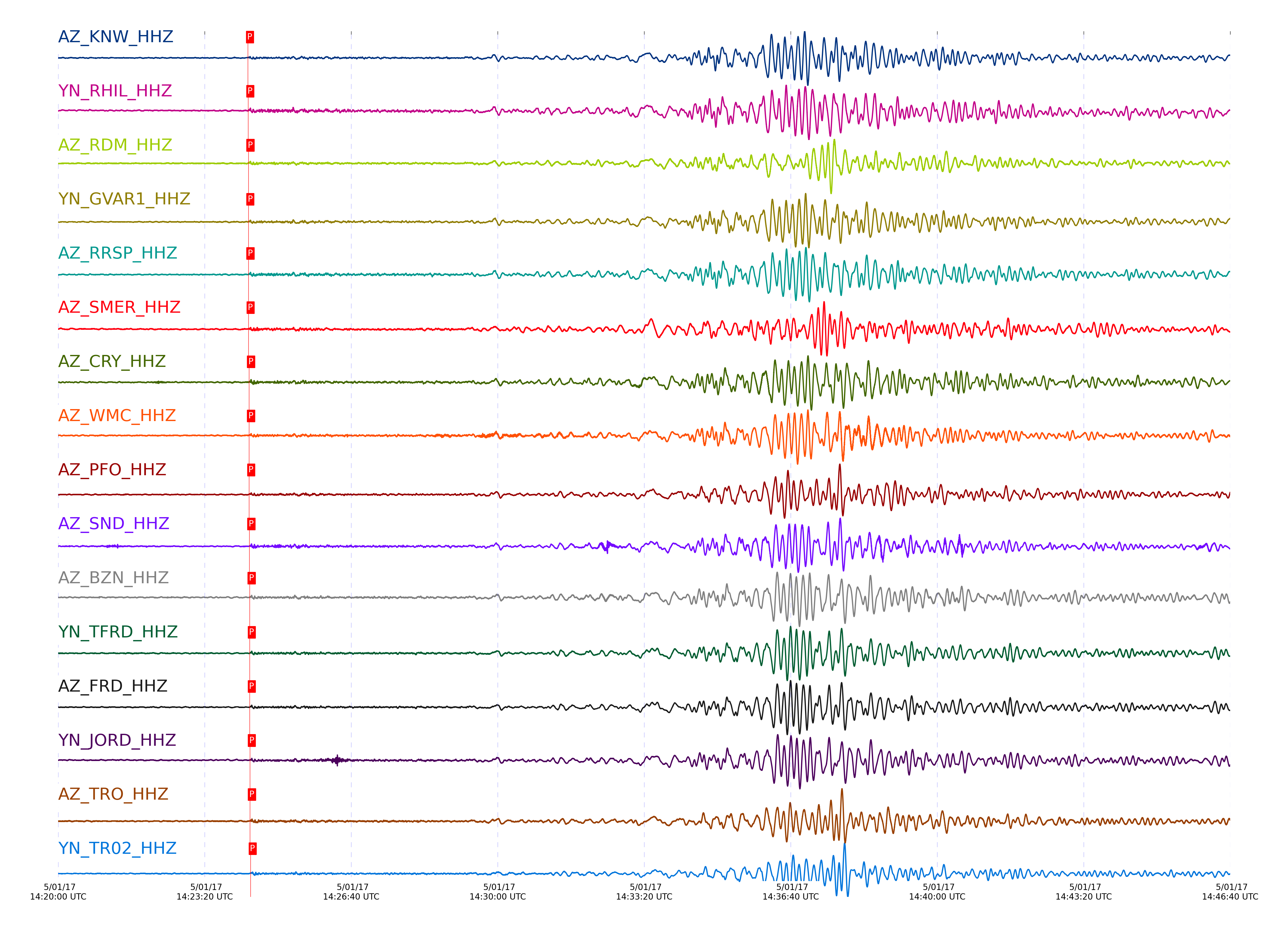
| STA_CHAN | S-E Delta | S-E Azimuth | Phase | Time | Signal/Noise | Time Residual | V. Model | Auth | arid |
|---|---|---|---|---|---|---|---|---|---|
| KNW_HHZ | 29.154° | 339.29° | pP | 2017-05-01 14:24:19.1578 UTC | 32.358 | -0.671 | iasp91 | dbp:jtytell:171 | 1387076 |
| RHIL_HHZ | 29.175° | 339.37° | pP | 2017-05-01 14:24:19.6408 UTC | -1 | -0.372 | iasp91 | dbp:jtytell:171 | 1387189 |
| RDM_HHZ | 29.193° | 339.46° | pP | 2017-05-01 14:24:19.9004 UTC | -1 | -0.273 | iasp91 | dbp:jtytell:171 | 1387190 |
| GVAR1_HHZ | 29.201° | 339.32° | pP | 2017-05-01 14:24:19.7672 UTC | -1 | -0.472 | iasp91 | dbp:jtytell:171 | 1387191 |
| RRSP_HHZ | 29.205° | 339.36° | pP | 2017-05-01 14:24:19.8544 UTC | -1 | -0.422 | iasp91 | dbp:jtytell:171 | 1387192 |
| SMER_HHZ | 29.261° | 339.84° | pP | 2017-05-01 14:24:20.0063 UTC | 28.098 | -0.77 | iasp91 | dbp:jtytell:171 | 1387102 |
| CRY_HHZ | 29.286° | 339.41° | pP | 2017-05-01 14:24:20.6245 UTC | 48.615 | -0.373 | iasp91 | dbp:jtytell:171 | 1387108 |
| WMC_HHZ | 29.297° | 339.35° | pP | 2017-05-01 14:24:20.7194 UTC | 31.022 | -0.373 | iasp91 | dbp:jtytell:171 | 1387086 |
| PFO_HHZ | 29.325° | 339.15° | pP | 2017-05-01 14:24:20.8179 UTC | 31.136 | -0.522 | iasp91 | dbp:jtytell:171 | 1387082 |
| SND_HHZ | 29.335° | 339.31° | pP | 2017-05-01 14:24:21.1104 UTC | 34.113 | -0.323 | iasp91 | dbp:jtytell:171 | 1387084 |
| BZN_HHZ | 29.376° | 339.4° | pP | 2017-05-01 14:24:21.4706 UTC | 37.685 | -0.324 | iasp91 | dbp:jtytell:171 | 1387088 |
| TFRD_HHZ | 29.392° | 339.34° | pP | 2017-05-01 14:24:21.6121 UTC | -1 | -0.324 | iasp91 | dbp:jtytell:171 | 1387199 |
| FRD_HHZ | 29.392° | 339.34° | pP | 2017-05-01 14:24:21.5632 UTC | 32.933 | -0.373 | iasp91 | dbp:jtytell:171 | 1387090 |
| JORD_HHZ | 29.4° | 339.39° | pP | 2017-05-01 14:24:21.7874 UTC | -1 | -0.224 | iasp91 | dbp:jtytell:171 | 1387200 |
| TRO_HHZ | 29.417° | 339.18° | pP | 2017-05-01 14:24:21.9364 UTC | 35.311 | -0.224 | iasp91 | dbp:jtytell:171 | 1387092 |
| TR02_HHZ | 29.518° | 339.23° | pP | 2017-05-01 14:24:22.781 UTC | -1 | -0.274 | iasp91 | dbp:jtytell:171 | 1387205 |
| TR03_HHZ | 29.524° | 339.25° | pP | 2017-05-01 14:24:22.8369 UTC | -1 | -0.274 | iasp91 | dbp:jtytell:171 | 1387206 |
| LVA2_HHZ | 29.538° | 339.4° | pP | 2017-05-01 14:24:23.1545 UTC | 24.596 | -0.076 | iasp91 | dbp:jtytell:171 | 1387096 |
| CPE_HHZ | 29.814° | 340.13° | pP | 2017-05-01 14:24:26.6978 UTC | 27.203 | 1.017 | iasp91 | dbp:jtytell:171 | 1387098 |
| MONP2_HHZ | 30.009° | 339.56° | pP | 2017-05-01 14:24:27.4759 UTC | -1 | 0.072 | iasp91 | dbp:jtytell:171 | 1387212 |
Click the link below to observe an interactive map of earthquakes recorded by the station deployment:
Broadband Seismic Data Collection Center (ANZA),
Institute of Geophysics & Planetary Physics
Scripps Institution of Oceanography,
University of California San Diego
Copyright © 1989 - 2014. All Rights Reserved.