
last update to page: May 17 2017 15:38:40 (UTC).
SummaryThe red marker denotes the earthquake epicenter. On Wed May 17th 2017 04:42:25 (UTC) the seismic network recorded an earthquake (preliminary 4.06 mw) located in Southern California. Seismic region California - Nevada Region. The epicentral distance (i.e. distance separating the location to the epicenter) to the closest station CSLB in the network is 188.2 km. If you felt the quake, the USGS would like to know. Please add your comments to the USGS page "Did you feel it?". |
Details
Proximity to Population Centers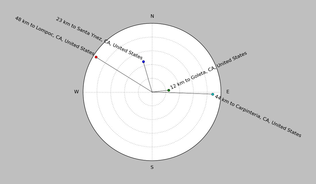
| ||||||||||||||||
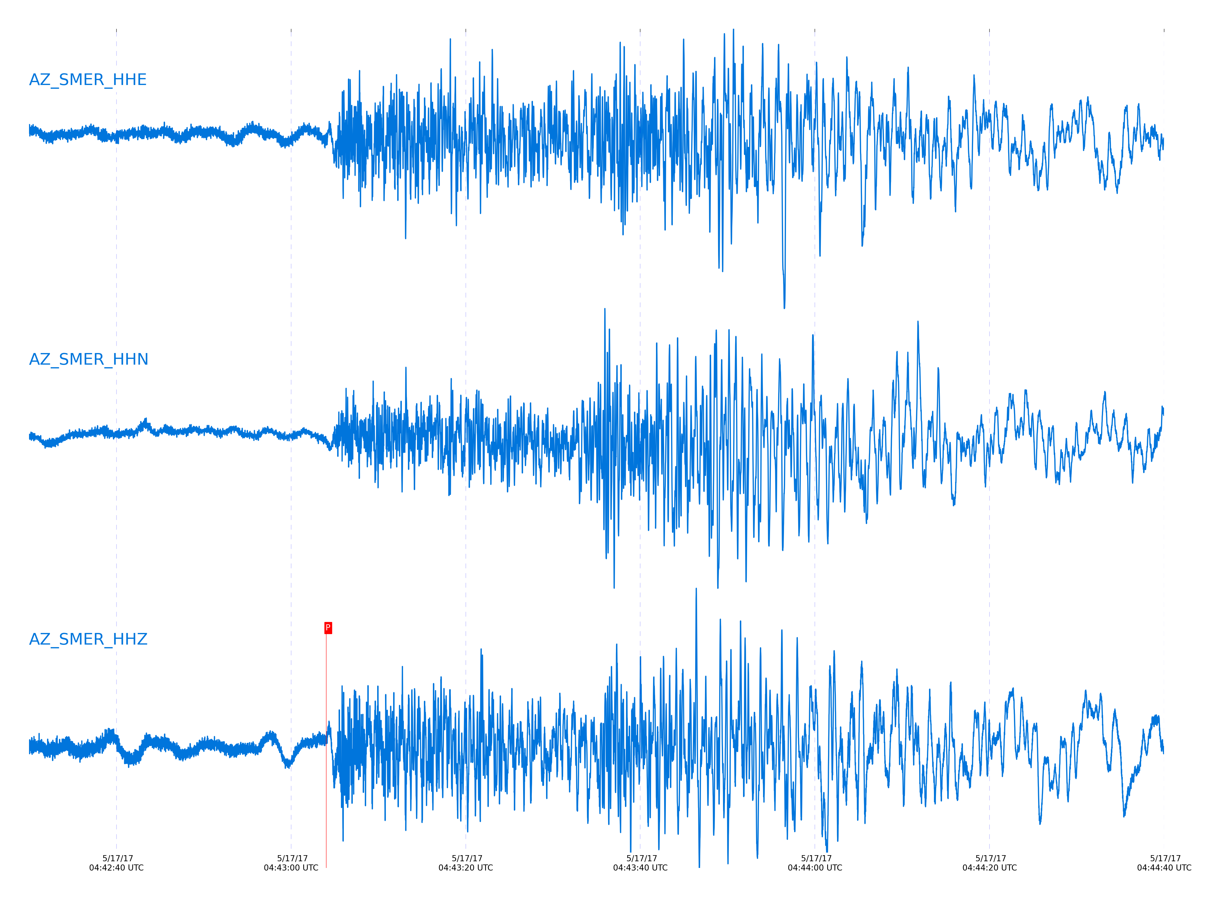
Event and active stations
|
|||||||||||||||||
Closest station with identified signal. Not filtered.
Subset of several stations close to the event. Not filtered.
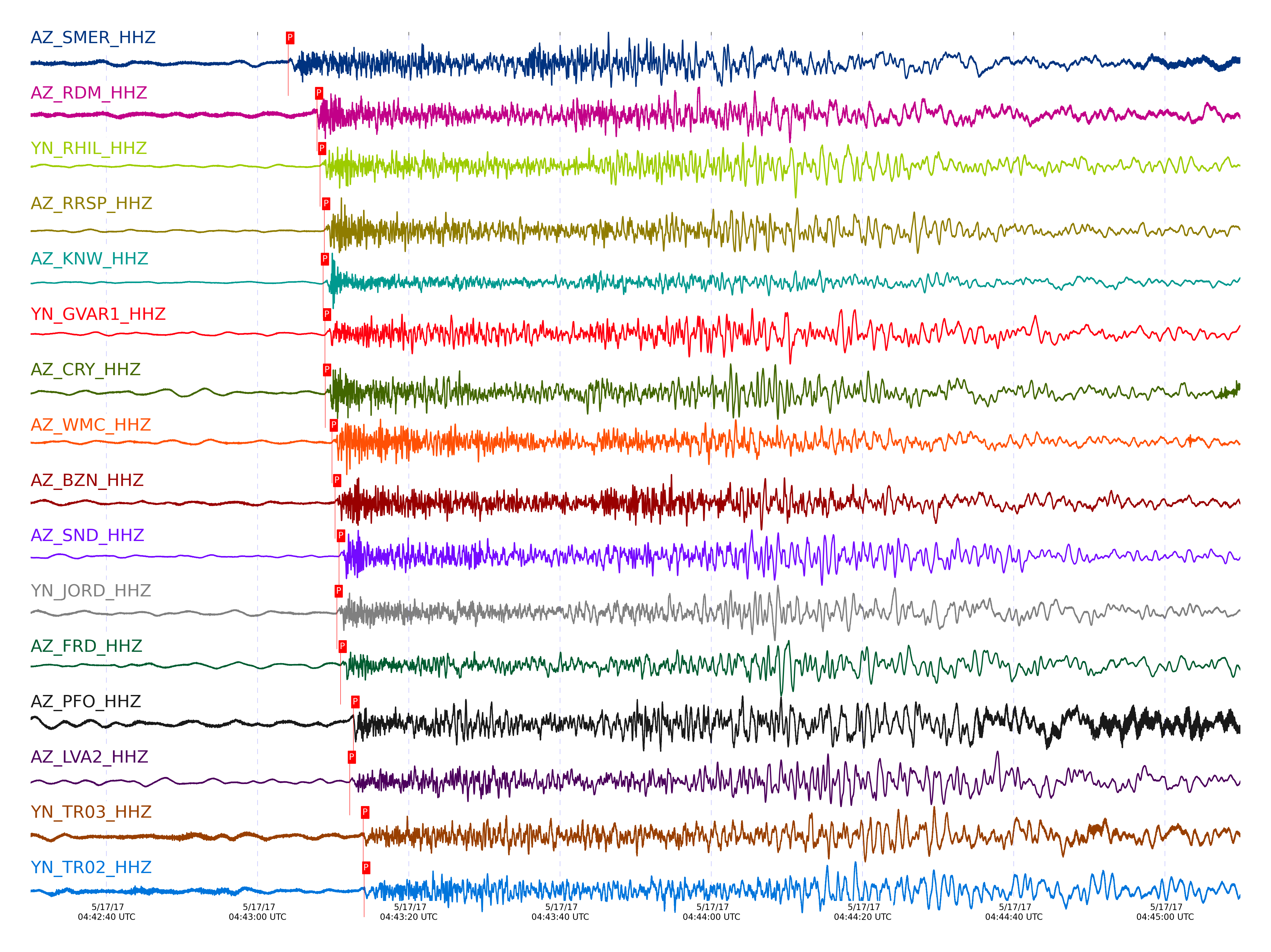
| STA_CHAN | S-E Delta | S-E Azimuth | Phase | Time | Signal/Noise | Time Residual | V. Model | Auth | arid |
|---|---|---|---|---|---|---|---|---|---|
| SMER_HHZ | 2.538° | 293.05° | Pn | 2017-05-17 04:43:04.0437 UTC | 18.08 | -3.443 | iasp91 | dbp:jtytell:171 | 1400461 |
| RDM_HHZ | 2.731° | 287.68° | Pn | 2017-05-17 04:43:07.8645 UTC | 10.025 | -2.271 | iasp91 | dbp:jtytell:171 | 1400462 |
| RHIL_HHZ | 2.779° | 286.47° | Pn | 2017-05-17 04:43:08.2633 UTC | -1 | -2.535 | iasp91 | dbp:jtytell:171 | 1400670 |
| RRSP_HHZ | 2.811° | 286.76° | Pn | 2017-05-17 04:43:08.8102 UTC | -1 | -2.424 | iasp91 | dbp:jtytell:171 | 1400669 |
| KNW_HHZ | 2.815° | 285.42° | Pn | 2017-05-17 04:43:08.6505 UTC | 139.56 | -2.647 | iasp91 | dbp:jtytell:171 | 1400463 |
| GVAR1_HHZ | 2.833° | 286.33° | Pn | 2017-05-17 04:43:08.909 UTC | -1 | -2.627 | iasp91 | dbp:jtytell:171 | 1400674 |
| CRY_HHZ | 2.838° | 288.41° | Pn | 2017-05-17 04:43:08.937 UTC | 48.452 | -2.678 | iasp91 | dbp:jtytell:171 | 1400464 |
| WMC_HHZ | 2.885° | 287.97° | Pn | 2017-05-17 04:43:09.8269 UTC | 17.398 | -2.434 | iasp91 | dbp:jtytell:171 | 1400473 |
| BZN_HHZ | 2.918° | 289.46° | Pn | 2017-05-17 04:43:10.2525 UTC | 37.863 | -2.454 | iasp91 | dbp:jtytell:171 | 1400466 |
| JORD_HHZ | 2.941° | 289.71° | Pn | 2017-05-17 04:43:10.4675 UTC | -1 | -2.566 | iasp91 | dbp:jtytell:171 | 1400677 |
| SND_HHZ | 2.941° | 288.09° | Pn | 2017-05-17 04:43:10.7653 UTC | 187.57 | -2.261 | iasp91 | dbp:jtytell:171 | 1400468 |
| SND_HHE | 2.941° | 288.09° | Sn | 2017-05-17 04:43:47.0256 UTC | -1 | -2.867 | iasp91 | dbp:jtytell:171 | 1400695 |
| FRD_HHZ | 2.968° | 289.09° | Pn | 2017-05-17 04:43:10.9801 UTC | 25.979 | -2.414 | iasp91 | dbp:jtytell:171 | 1400467 |
| PFO_HHZ | 3.045° | 286.36° | Pn | 2017-05-17 04:43:12.6686 UTC | 11.124 | -1.794 | iasp91 | dbp:jtytell:171 | 1400470 |
| LVA2_HHZ | 3.049° | 291.45° | Pn | 2017-05-17 04:43:12.1916 UTC | 32.986 | -2.322 | iasp91 | dbp:jtytell:171 | 1400469 |
| TR03_HHZ | 3.137° | 289.77° | Pn | 2017-05-17 04:43:13.965 UTC | -1 | -1.754 | iasp91 | dbp:jtytell:171 | 1400686 |
| TR02_HHZ | 3.139° | 289.59° | Pn | 2017-05-17 04:43:14.0913 UTC | -1 | -1.657 | iasp91 | dbp:jtytell:171 | 1400687 |
| MONP2_HHZ | 3.348° | 298.12° | Pn | 2017-05-17 04:43:15.846 UTC | 10.793 | -2.779 | iasp91 | dbp:jtytell:171 | 1400481 |
Click the link below to observe an interactive map of earthquakes recorded by the station deployment:
Broadband Seismic Data Collection Center (ANZA),
Institute of Geophysics & Planetary Physics
Scripps Institution of Oceanography,
University of California San Diego
Copyright © 1989 - 2014. All Rights Reserved.