
last update to page: August 08 2017 17:52:48 (UTC).
SummaryThe red marker denotes the earthquake epicenter. On Tue Aug 8th 2017 13:19:49 (UTC) the seismic network recorded an earthquake (preliminary 6.5 mww) located in Gansu, China. Seismic region Southern Sinkiang To Kansu. The epicentral distance (i.e. distance separating the location to the epicenter) to the closest station CSLB in the network is 11,384.8 km. If you felt the quake, the USGS would like to know. Please add your comments to the USGS page "Did you feel it?". |
Details
Proximity to Population Centers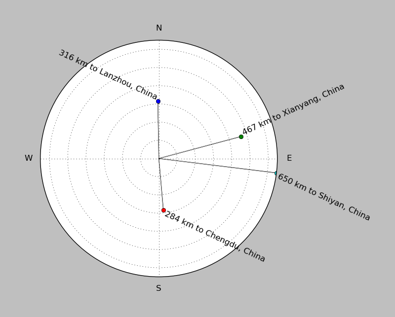
| ||||||||||||||||
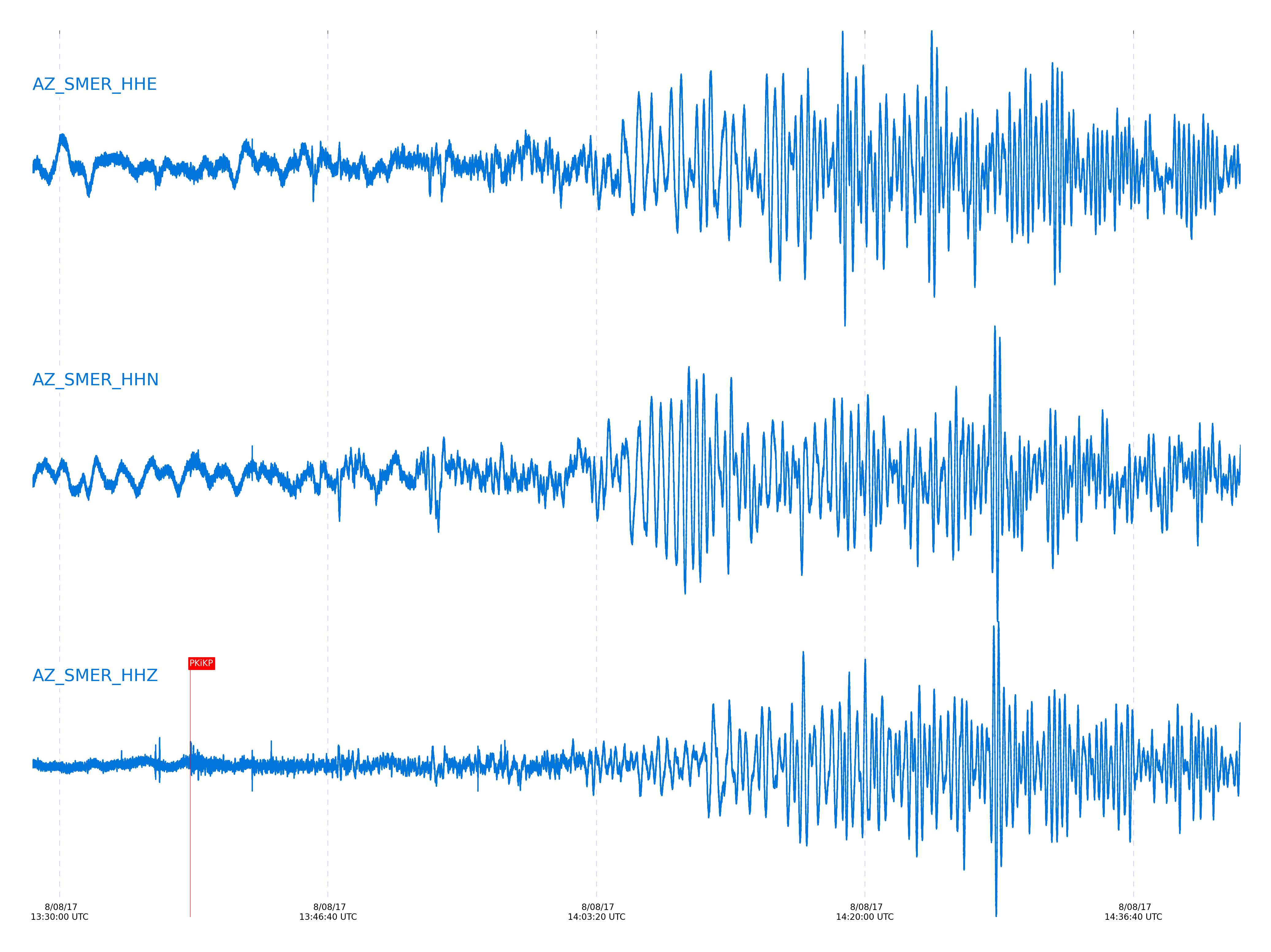
Event and active stations
|
|||||||||||||||||
Closest station with identified signal. Not filtered.
Subset of several stations close to the event. Not filtered.
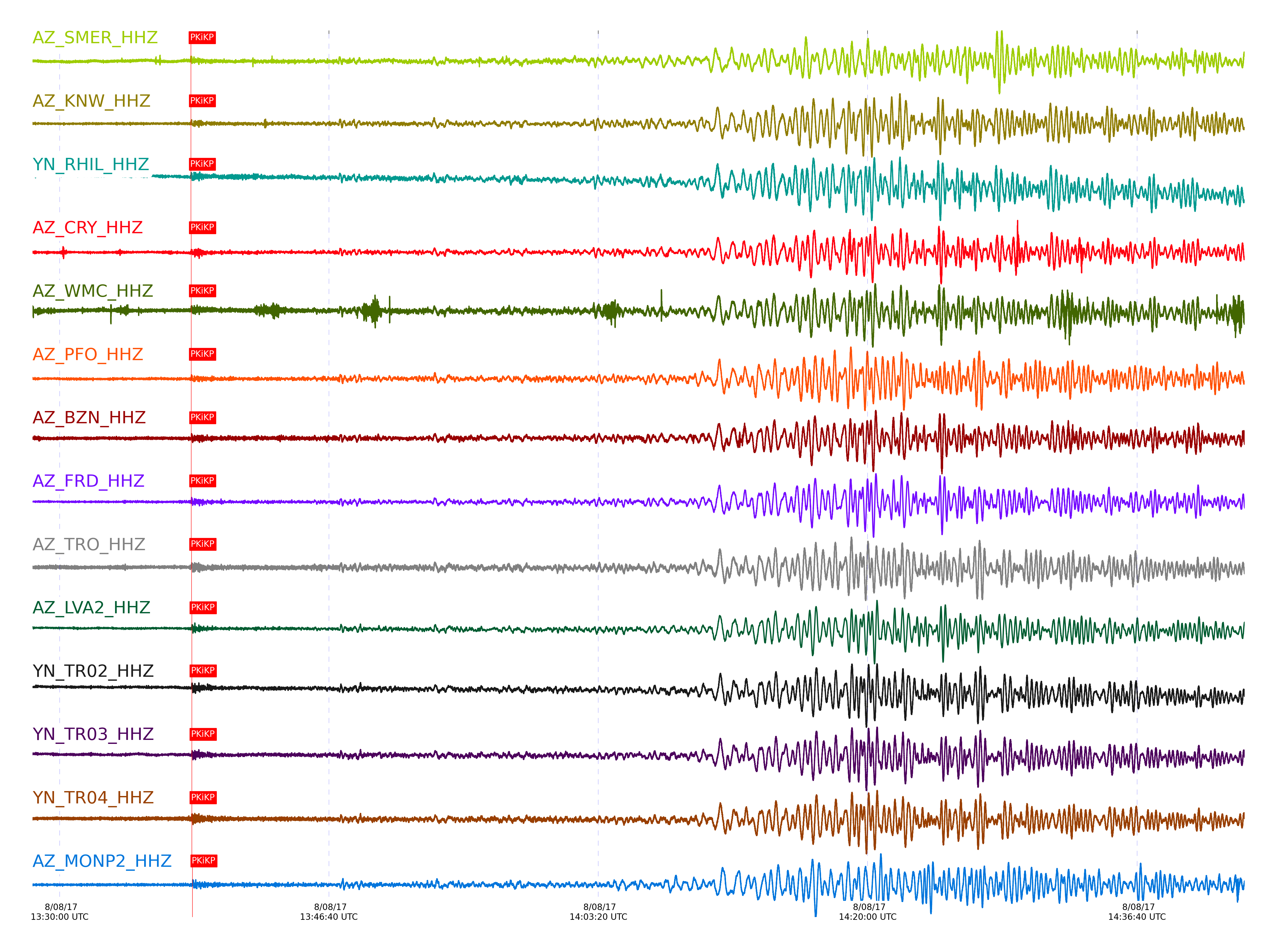
| STA_CHAN | S-E Delta | S-E Azimuth | Phase | Time | Signal/Noise | Time Residual | V. Model | Auth | arid |
|---|---|---|---|---|---|---|---|---|---|
| SMER_HHZ | 102.981° | 325.71° | PKiKP | 2017-08-08 13:38:07.3831 UTC | -1 | -0.682 | iasp91 | dbp:jtytell:172 | 1477593 |
| KNW_HHZ | 102.983° | 326.07° | PKiKP | 2017-08-08 13:38:07.8051 UTC | -1 | -0.263 | iasp91 | dbp:jtytell:172 | 1477594 |
| RHIL_HHZ | 102.99° | 326.02° | PKiKP | 2017-08-08 13:38:07.8332 UTC | -1 | -0.247 | iasp91 | dbp:jtytell:172 | 1477595 |
| CRY_HHZ | 103.095° | 326.03° | PKiKP | 2017-08-08 13:38:08.5753 UTC | -1 | 0.304 | iasp91 | dbp:jtytell:172 | 1477596 |
| WMC_HHZ | 103.117° | 326.08° | PKiKP | 2017-08-08 13:38:08.8119 UTC | -1 | 0.499 | iasp91 | dbp:jtytell:172 | 1477597 |
| PFO_HHZ | 103.185° | 326.24° | PKiKP | 2017-08-08 13:38:08.5646 UTC | -1 | 0.128 | iasp91 | dbp:jtytell:172 | 1477600 |
| BZN_HHZ | 103.189° | 326.07° | PKiKP | 2017-08-08 13:38:09.1303 UTC | -1 | 0.687 | iasp91 | dbp:jtytell:172 | 1477602 |
| FRD_HHZ | 103.216° | 326.12° | PKiKP | 2017-08-08 13:38:09.3898 UTC | -1 | 0.896 | iasp91 | dbp:jtytell:172 | 1477608 |
| TRO_HHZ | 103.274° | 326.25° | PKiKP | 2017-08-08 13:38:10.0602 UTC | -1 | 1.461 | iasp91 | dbp:jtytell:172 | 1477609 |
| LVA2_HHZ | 103.354° | 326.13° | pPKiKP | 2017-08-08 13:38:10.9641 UTC | -1 | -1.213 | iasp91 | dbp:jtytell:172 | 1477611 |
| TR02_HHZ | 103.366° | 326.24° | pPKiKP | 2017-08-08 13:38:11.1541 UTC | -1 | -1.045 | iasp91 | dbp:jtytell:172 | 1477612 |
| TR03_HHZ | 103.37° | 326.23° | pPKiKP | 2017-08-08 13:38:11.0357 UTC | -1 | -1.171 | iasp91 | dbp:jtytell:172 | 1477613 |
| TR04_HHZ | 103.378° | 326.23° | pPKiKP | 2017-08-08 13:38:11.0696 UTC | -1 | -1.151 | iasp91 | dbp:jtytell:172 | 1477614 |
| MONP2_HHZ | 103.801° | 326.17° | pPKiKP | 2017-08-08 13:38:13.9095 UTC | -1 | 0.915 | iasp91 | dbp:jtytell:172 | 1477618 |
Click the link below to observe an interactive map of earthquakes recorded by the station deployment:
Broadband Seismic Data Collection Center (ANZA),
Institute of Geophysics & Planetary Physics
Scripps Institution of Oceanography,
University of California San Diego
Copyright © 1989 - 2014. All Rights Reserved.