
last update to page: August 31 2017 21:04:20 (UTC).
SummaryThe red marker denotes the earthquake epicenter. On Thu Aug 31st 2017 17:46:02 (UTC) the seismic network recorded an earthquake (preliminary 5.4 ml) located in Kodiak Island Region, Alaska. Seismic region Alaska - Aleutian Arc. The epicentral distance (i.e. distance separating the location to the epicenter) to the closest station CSLB in the network is 3,799.0 km. If you felt the quake, the USGS would like to know. Please add your comments to the USGS page "Did you feel it?". |
Details
Proximity to Population Centers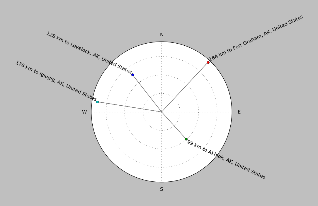
| ||||||||||||||||
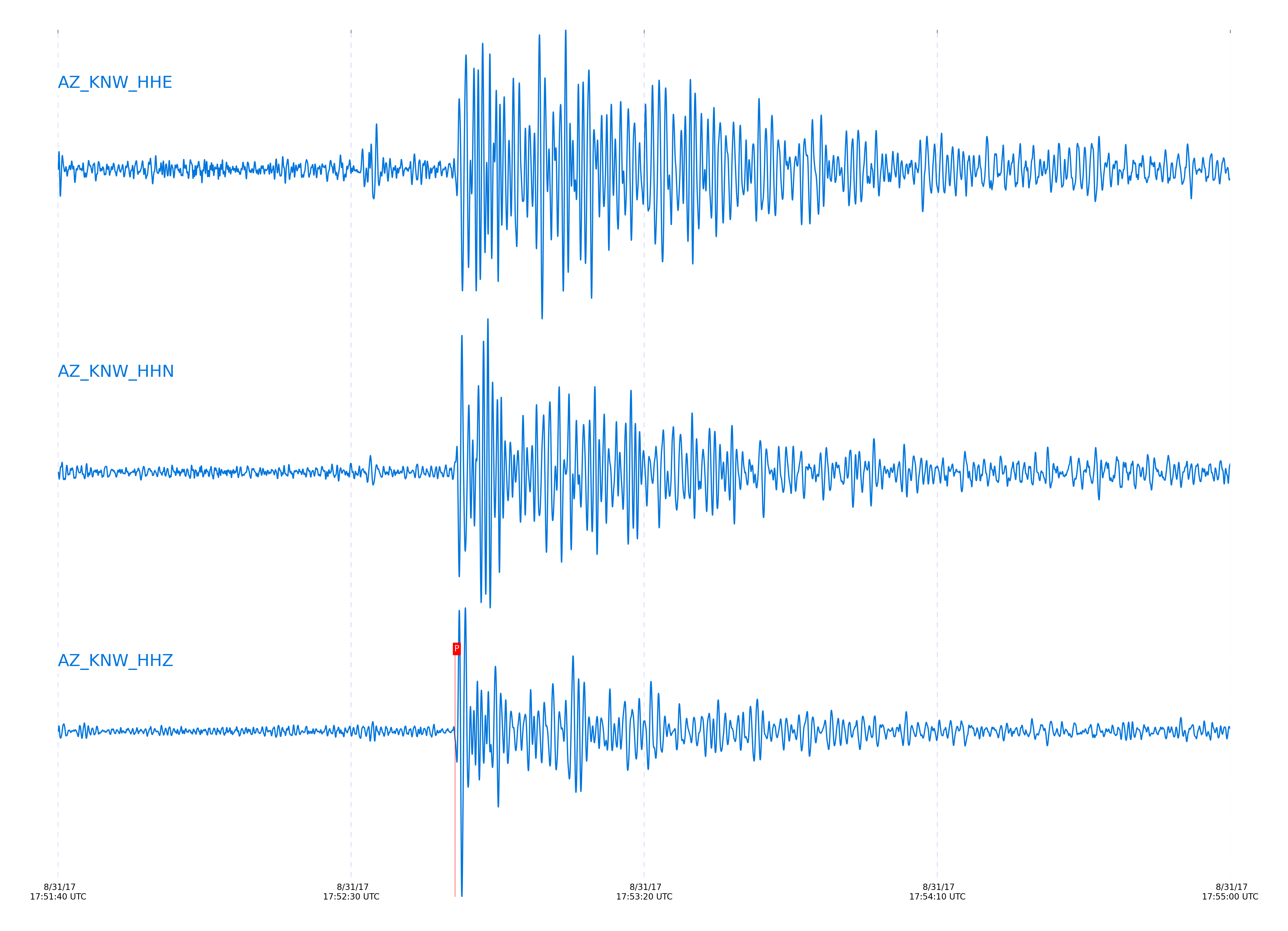
Event and active stations
|
|||||||||||||||||
Closest station with identified signal. 0.8 to 3 Hz bandpass Butterworth filter has been applied to data.
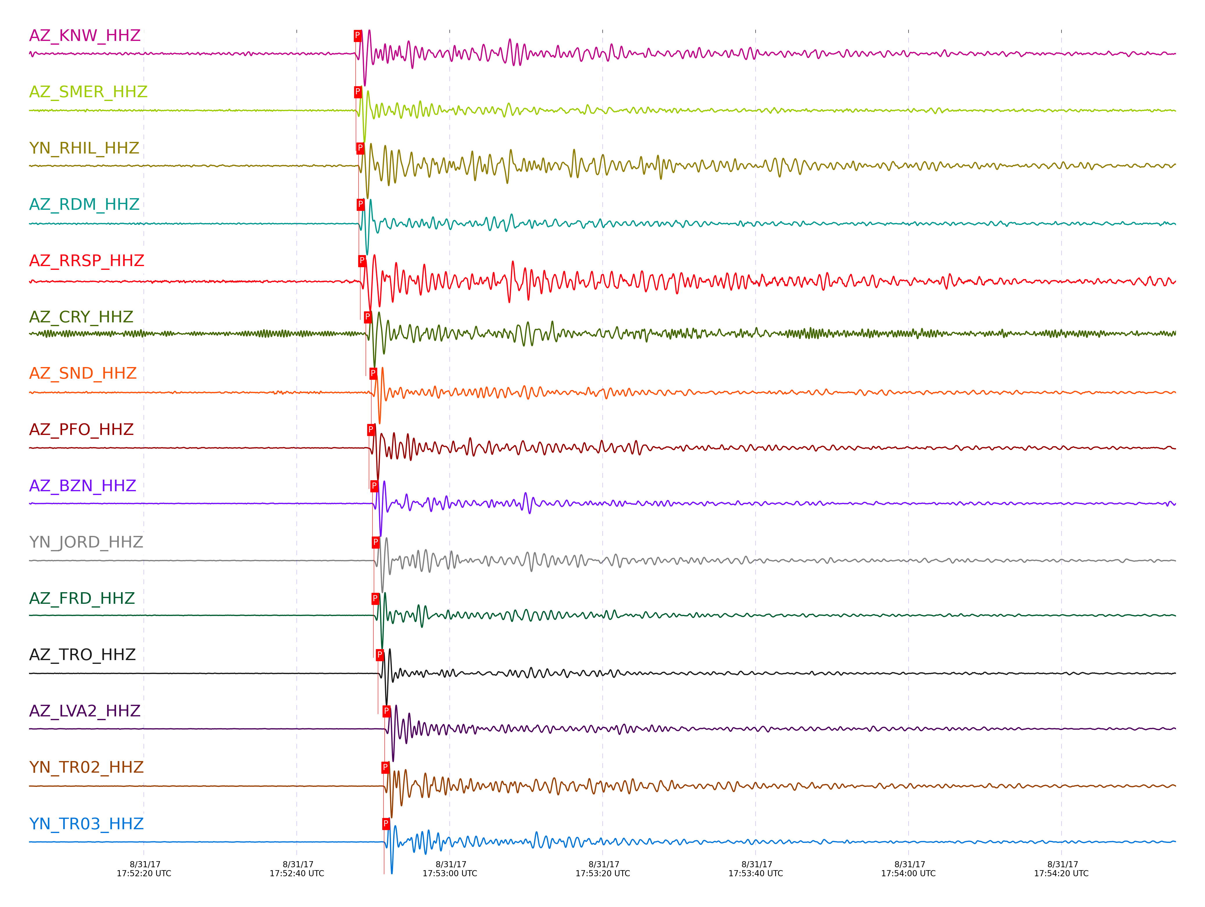
Subset of several stations close to the event. 0.8 to 3 Hz bandpass Butterworth filter has been applied to data.
| STA_CHAN | S-E Delta | S-E Azimuth | Phase | Time | Signal/Noise | Time Residual | V. Model | Auth | arid |
|---|---|---|---|---|---|---|---|---|---|
| KNW_HHZ | 34.818° | 326.58° | P | 2017-08-31 17:52:47.7061 UTC | 27.044 | 0.34 | iasp91 | dbp:jtytell:172 | 1499179 |
| SMER_HHZ | 34.823° | 326.99° | P | 2017-08-31 17:52:47.75 UTC | 37.731 | 0.34 | iasp91 | dbp:jtytell:172 | 1499181 |
| RHIL_HHZ | 34.825° | 326.64° | P | 2017-08-31 17:52:48.0597 UTC | -1 | 0.634 | iasp91 | dbp:jtytell:172 | 1499286 |
| RDM_HHZ | 34.826° | 326.71° | P | 2017-08-31 17:52:48.1183 UTC | 51.654 | 0.683 | iasp91 | dbp:jtytell:172 | 1499183 |
| RRSP_HHZ | 34.858° | 326.64° | P | 2017-08-31 17:52:48.2924 UTC | -1 | 0.585 | iasp91 | dbp:jtytell:172 | 1499287 |
| CRY_HHZ | 34.931° | 326.71° | P | 2017-08-31 17:52:49.0418 UTC | 38.163 | 0.707 | iasp91 | dbp:jtytell:172 | 1499187 |
| SND_HHZ | 34.999° | 326.67° | P | 2017-08-31 17:52:49.7506 UTC | 26.974 | 0.83 | iasp91 | dbp:jtytell:172 | 1499194 |
| PFO_HHZ | 35.019° | 326.55° | P | 2017-08-31 17:52:49.4612 UTC | 43.426 | 0.364 | iasp91 | dbp:jtytell:172 | 1499190 |
| BZN_HHZ | 35.025° | 326.74° | P | 2017-08-31 17:52:49.8982 UTC | 52.851 | 0.756 | iasp91 | dbp:jtytell:172 | 1499196 |
| JORD_HHZ | 35.051° | 326.74° | P | 2017-08-31 17:52:50.0744 UTC | 54.883 | 0.707 | iasp91 | dbp:jtytell:172 | 1499200 |
| FRD_HHZ | 35.052° | 326.71° | P | 2017-08-31 17:52:50.0321 UTC | 50.106 | 0.658 | iasp91 | dbp:jtytell:172 | 1499198 |
| TRO_HHZ | 35.108° | 326.61° | P | 2017-08-31 17:52:50.6189 UTC | 75.06 | 0.756 | iasp91 | dbp:jtytell:172 | 1499220 |
| LVA2_HHZ | 35.19° | 326.8° | P | 2017-08-31 17:52:51.4891 UTC | 47.8 | 0.928 | iasp91 | dbp:jtytell:172 | 1499224 |
| TR02_HHZ | 35.2° | 326.68° | P | 2017-08-31 17:52:51.3342 UTC | -1 | 0.683 | iasp91 | dbp:jtytell:172 | 1499300 |
| TR03_HHZ | 35.205° | 326.69° | P | 2017-08-31 17:52:51.4208 UTC | -1 | 0.732 | iasp91 | dbp:jtytell:172 | 1499301 |
| TR04_HHZ | 35.212° | 326.7° | P | 2017-08-31 17:52:51.5604 UTC | -1 | 0.805 | iasp91 | dbp:jtytell:172 | 1499302 |
| CPE_HHZ | 35.331° | 327.4° | P | 2017-08-31 17:52:52.6268 UTC | -1 | 0.854 | iasp91 | dbp:jtytell:172 | 1499306 |
| MONP2_HHZ | 35.639° | 327.09° | P | 2017-08-31 17:52:55.4334 UTC | -1 | 1.025 | iasp91 | dbp:jtytell:172 | 1499312 |
Click the link below to observe an interactive map of earthquakes recorded by the station deployment:
Broadband Seismic Data Collection Center (ANZA),
Institute of Geophysics & Planetary Physics
Scripps Institution of Oceanography,
University of California San Diego
Copyright © 1989 - 2014. All Rights Reserved.