last update to page: November 13 2017 05:35:20 (UTC).
SummaryThe red marker denotes the earthquake epicenter. On Mon Nov 13th 2017 02:28:24 (UTC) the seismic network recorded an earthquake (preliminary 6.5 mww) located in Costa Rica. Seismic region Central America. The epicentral distance (i.e. distance separating the location to the epicenter) to the closest station USGCB in the network is 4,161.5 km. If you felt the quake, the USGS would like to know. Please add your comments to the USGS page "Did you feel it?". |
Details
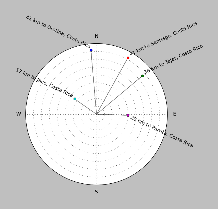
Proximity to Population Centers
| ||||||||||||||||
Event and active stations
|
|||||||||||||||||
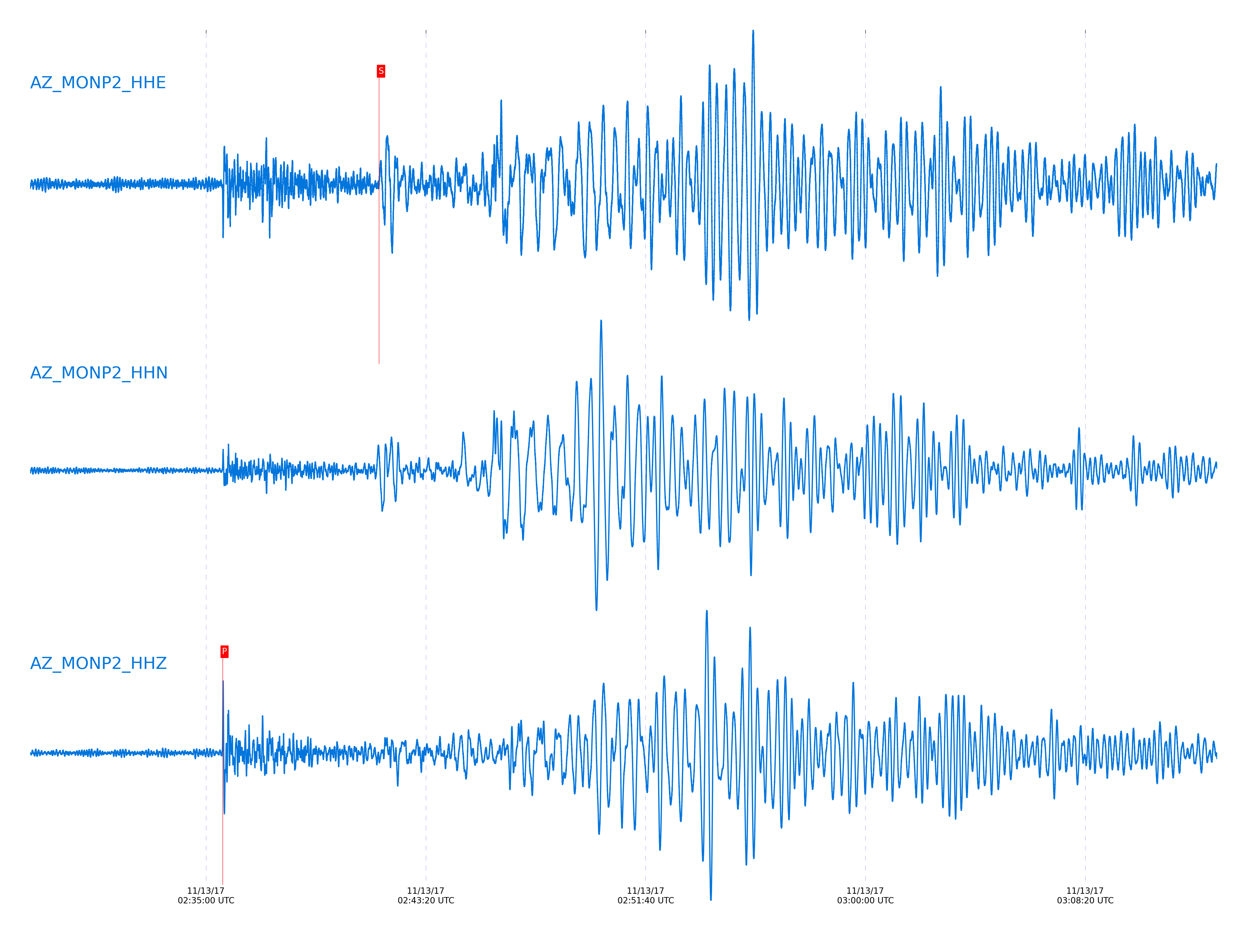
Closest station with identified signal. Not filtered.

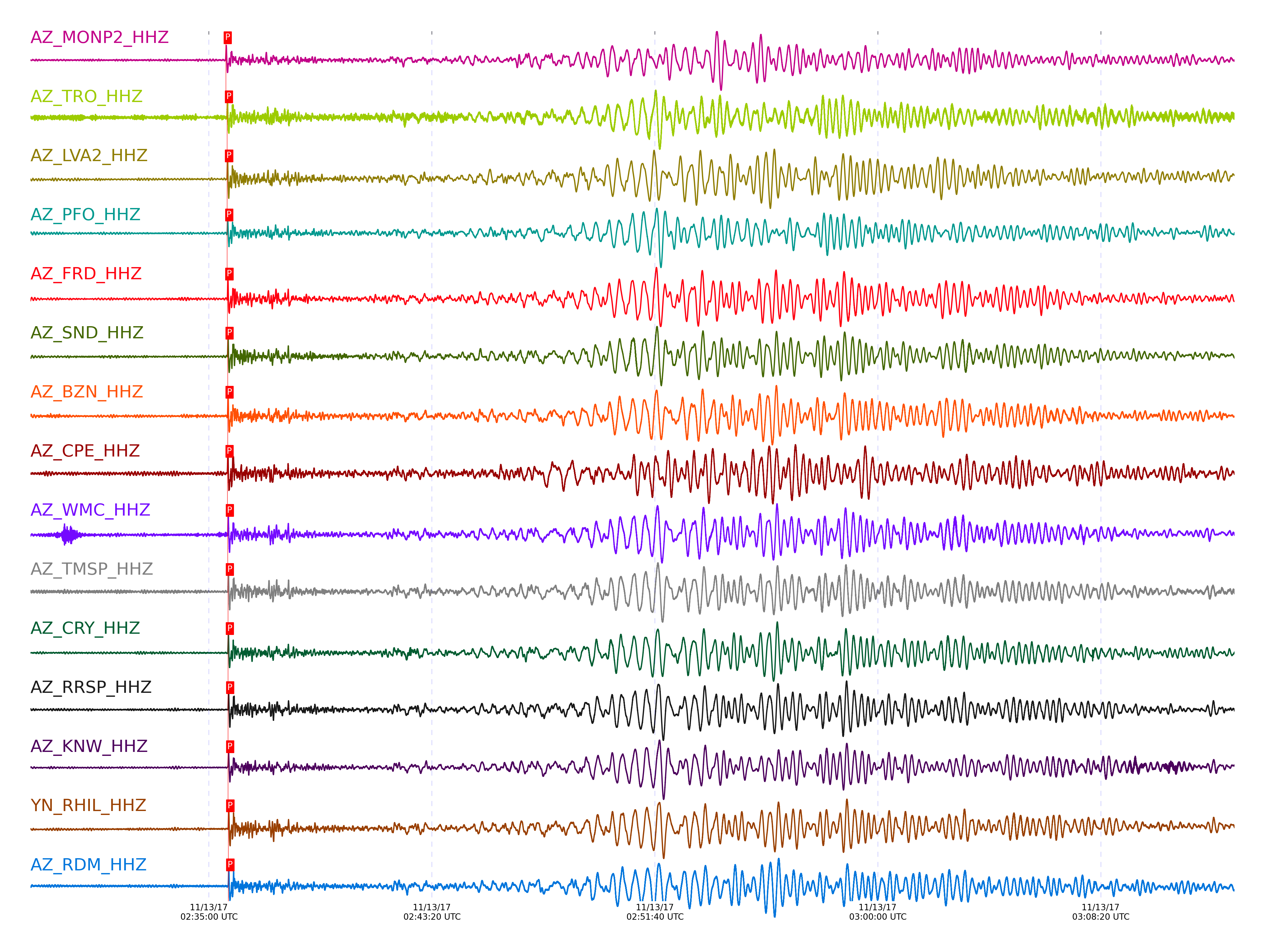
Subset of several stations close to the event. Not filtered.

| STA_CHAN | S-E Delta | S-E Azimuth | Phase | Time | Signal/Noise | Time Residual | V. Model | Auth | arid |
|---|---|---|---|---|---|---|---|---|---|
| MONP2_HHZ | 37.553° | 121.19° | P | 2017-11-13 02:35:37.6632 UTC | 27.657 | 0.614 | iasp91 | dbp:jtytell:173 | 1584856 |
| MONP2_HHE | 37.553° | 121.19° | S | 2017-11-13 02:41:33.0677 UTC | -1 | 7.059 | iasp91 | dbp:jtytell:173 | 1585060 |
| TRO_HHZ | 37.885° | 121.88° | P | 2017-11-13 02:35:40.5048 UTC | -1 | 0.645 | iasp91 | dbp:jtytell:173 | 1585009 |
| LVA2_HHZ | 37.891° | 121.54° | P | 2017-11-13 02:35:40.5876 UTC | 45.262 | 0.676 | iasp91 | dbp:jtytell:173 | 1584878 |
| LVA2_HHN | 37.891° | 121.54° | ScP | 2017-11-13 02:41:36.9736 UTC | -1 | -5.045 | iasp91 | dbp:jtytell:173 | 1585070 |
| PFO_HHZ | 37.956° | 121.94° | P | 2017-11-13 02:35:40.8173 UTC | -1 | 0.363 | iasp91 | dbp:jtytell:173 | 1585017 |
| PFO_HHN | 37.956° | 121.94° | S | 2017-11-13 02:41:36.4727 UTC | -1 | 4.358 | iasp91 | dbp:jtytell:173 | 1585076 |
| FRD_HHZ | 37.995° | 121.65° | P | 2017-11-13 02:35:41.2758 UTC | 47.704 | 0.488 | iasp91 | dbp:jtytell:173 | 1584858 |
| FRD_HHN | 37.995° | 121.65° | S | 2017-11-13 02:41:36.8058 UTC | -1 | 4.093 | iasp91 | dbp:jtytell:173 | 1585079 |
| SND_HHZ | 38.033° | 121.7° | P | 2017-11-13 02:35:41.6871 UTC | 39.027 | 0.582 | iasp91 | dbp:jtytell:173 | 1584868 |
| SND_HHN | 38.033° | 121.7° | ScP | 2017-11-13 02:41:39.1258 UTC | -1 | -3.429 | iasp91 | dbp:jtytell:173 | 1585082 |
| BZN_HHZ | 38.04° | 121.58° | P | 2017-11-13 02:35:41.8064 UTC | 48.136 | 0.645 | iasp91 | dbp:jtytell:173 | 1584864 |
| BZN_HHN | 38.04° | 121.58° | S | 2017-11-13 02:41:37.9478 UTC | -1 | 4.564 | iasp91 | dbp:jtytell:173 | 1585083 |
| CPE_HHZ | 38.043° | 120.44° | P | 2017-11-13 02:35:41.3995 UTC | 60.654 | 0.206 | iasp91 | dbp:jtytell:173 | 1584860 |
| CPE_HHN | 38.043° | 120.44° | S | 2017-11-13 02:41:35.5108 UTC | -1 | 2.07 | iasp91 | dbp:jtytell:173 | 1585084 |
| WMC_HHZ | 38.088° | 121.66° | P | 2017-11-13 02:35:42.1837 UTC | 54.929 | 0.614 | iasp91 | dbp:jtytell:173 | 1584866 |
| WMC_HHN | 38.088° | 121.66° | ScP | 2017-11-13 02:41:39.1795 UTC | -1 | -3.585 | iasp91 | dbp:jtytell:173 | 1585086 |
| TMSP_HHZ | 38.116° | 121.7° | P | 2017-11-13 02:35:42.3911 UTC | -1 | 0.582 | iasp91 | dbp:jtytell:173 | 1585027 |
| TMSP_HHN | 38.116° | 121.7° | ScP | 2017-11-13 02:41:40.6529 UTC | -1 | -2.219 | iasp91 | dbp:jtytell:173 | 1585089 |
| SIO5_HHZ | 38.124° | 120.23° | P | 2017-11-13 02:35:42.2972 UTC | 21.814 | 0.426 | iasp91 | dbp:jtytell:173 | 1584872 |
| CRY_HHZ | 38.128° | 121.58° | P | 2017-11-13 02:35:42.3648 UTC | 56.535 | 0.457 | iasp91 | dbp:jtytell:173 | 1584870 |
| CRY_HHN | 38.128° | 121.58° | ScP | 2017-11-13 02:41:39.929 UTC | -1 | -2.988 | iasp91 | dbp:jtytell:173 | 1585090 |
| RRSP_HHZ | 38.175° | 121.67° | P | 2017-11-13 02:35:42.7575 UTC | -1 | 0.457 | iasp91 | dbp:jtytell:173 | 1585031 |
| RRSP_HHN | 38.175° | 121.67° | ScP | 2017-11-13 02:41:41.1447 UTC | -1 | -1.949 | iasp91 | dbp:jtytell:173 | 1585092 |
| KNW_HHZ | 38.188° | 121.77° | P | 2017-11-13 02:35:42.7452 UTC | -1 | 0.331 | iasp91 | dbp:jtytell:173 | 1585032 |
| KNW_HHN | 38.188° | 121.77° | ScP | 2017-11-13 02:41:40.0234 UTC | -1 | -3.122 | iasp91 | dbp:jtytell:173 | 1585093 |
| RHIL_HHZ | 38.209° | 121.66° | P | 2017-11-13 02:35:43.2632 UTC | -1 | 0.676 | iasp91 | dbp:jtytell:173 | 1585035 |
| RHIL_HHN | 38.209° | 121.66° | ScP | 2017-11-13 02:41:40.6078 UTC | -1 | -2.615 | iasp91 | dbp:jtytell:173 | 1585094 |
| RDM_HHZ | 38.24° | 121.53° | P | 2017-11-13 02:35:43.2783 UTC | 84.709 | 0.426 | iasp91 | dbp:jtytell:173 | 1584874 |
| RDM_HHN | 38.24° | 121.53° | ScP | 2017-11-13 02:41:40.4623 UTC | -1 | -2.881 | iasp91 | dbp:jtytell:173 | 1585095 |
| SMER_HHZ | 38.381° | 120.99° | P | 2017-11-13 02:35:43.9287 UTC | 54.782 | -0.108 | iasp91 | dbp:jtytell:173 | 1584876 |
| SMER_HHN | 38.381° | 120.99° | ScP | 2017-11-13 02:41:42.8805 UTC | -1 | -0.999 | iasp91 | dbp:jtytell:173 | 1585100 |
Click the link below to observe an interactive map of earthquakes recorded by the station deployment: