
last update to page: January 25 2018 18:10:50 (UTC).
SummaryThe red marker denotes the earthquake epicenter. On Thu Jan 25th 2018 16:39:43 (UTC) the seismic network recorded an earthquake (preliminary 5.8 mww) located in Off Coast Of Northern California. Seismic region California - Nevada Region. The epicentral distance (i.e. distance separating the location to the epicenter) to the closest station CSLB in the network is 1,038.6 km. If you felt the quake, the USGS would like to know. Please add your comments to the USGS page "Did you feel it?". |
Details
Proximity to Population Centers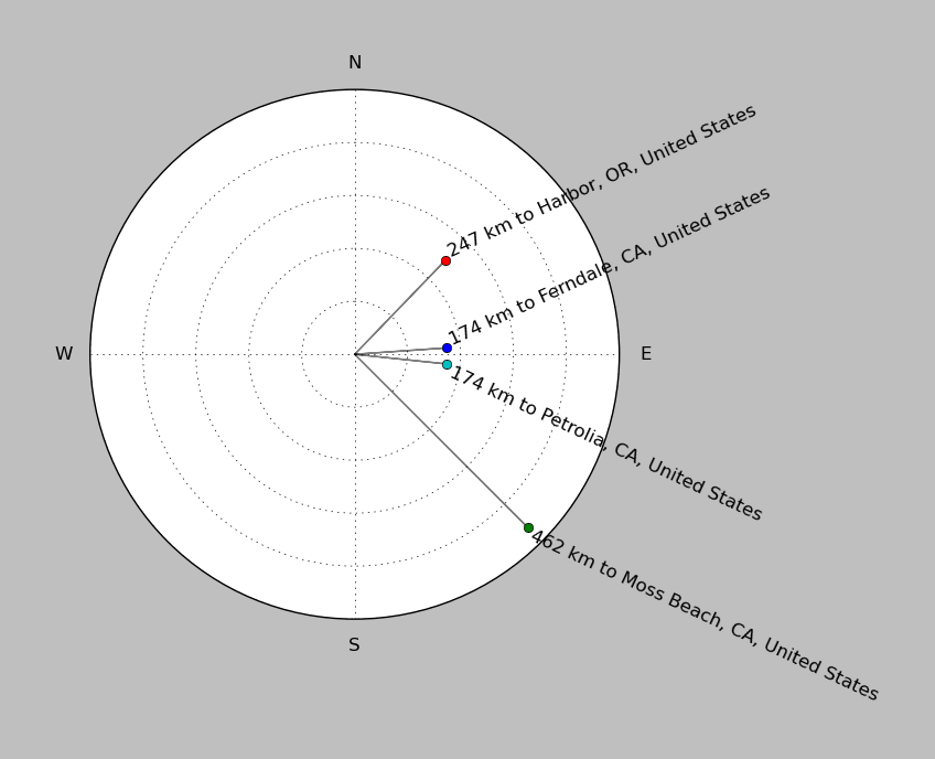
| ||||||||||||||||
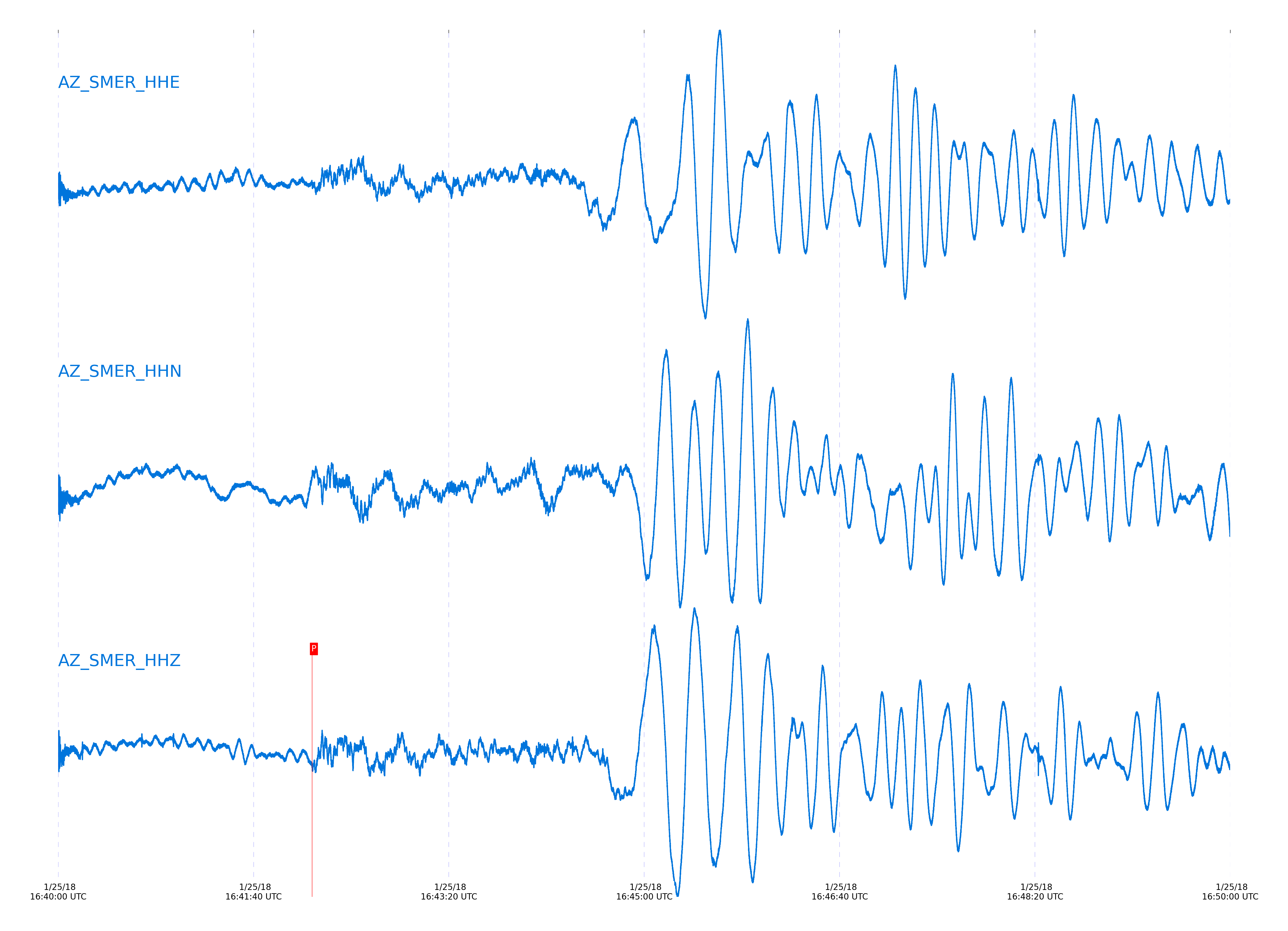
Event and active stations
|
|||||||||||||||||
Closest station with identified signal. Not filtered.
Subset of several stations close to the event. Not filtered.
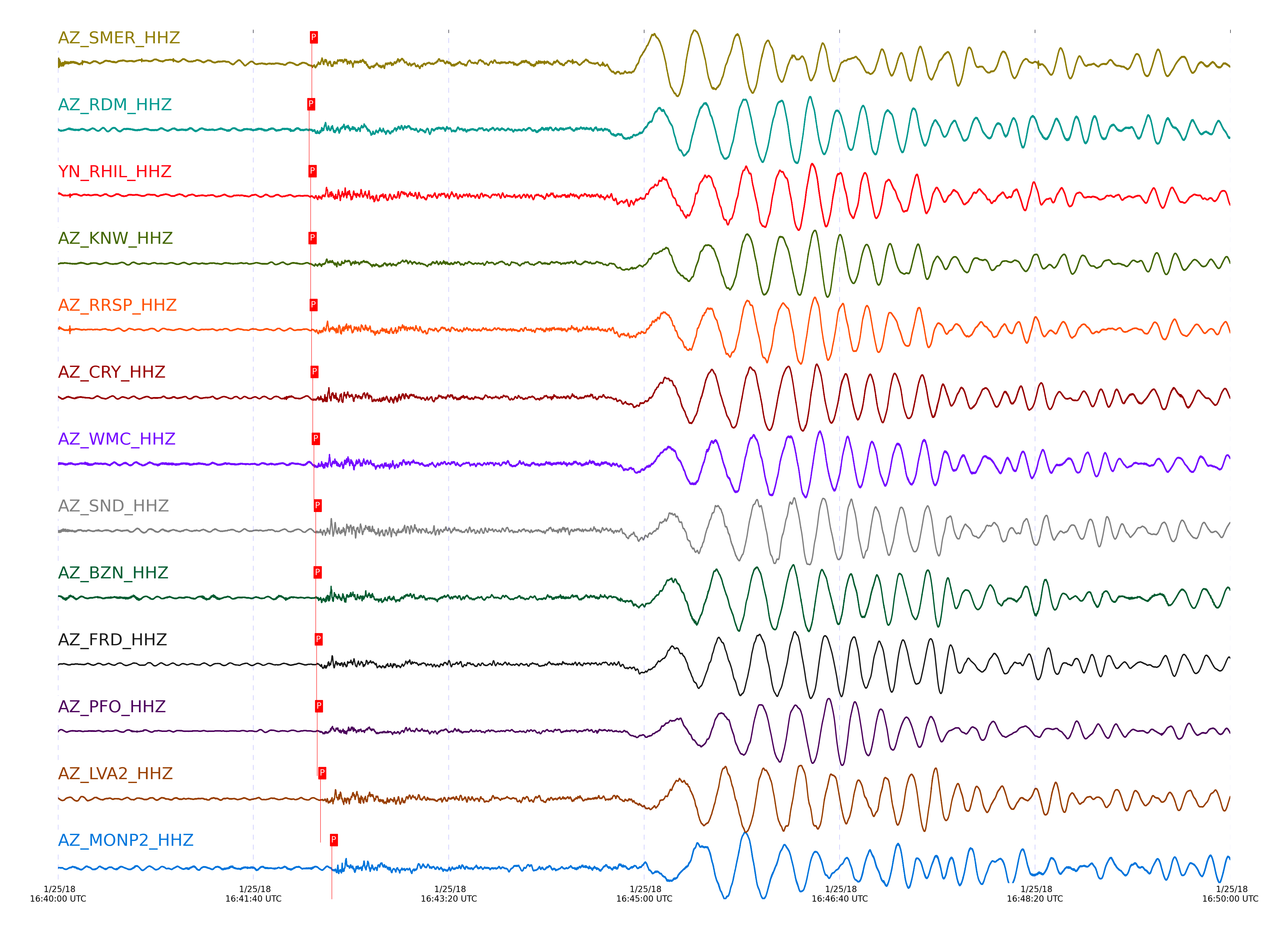
| STA_CHAN | S-E Delta | S-E Azimuth | Phase | Time | Signal/Noise | Time Residual | V. Model | Auth | arid |
|---|---|---|---|---|---|---|---|---|---|
| SMER_HHZ | 10.099° | 316.47° | pPn | 2018-01-25 16:42:09.9306 UTC | 21.179 | -0.134 | iasp91 | dbp:jtytell:180 | 1667226 |
| RDM_HHZ | 10.164° | 314.89° | Pn | 2018-01-25 16:42:08.5825 UTC | 30.735 | -1.143 | iasp91 | dbp:jtytell:180 | 1667224 |
| RHIL_HHZ | 10.179° | 314.52° | Pn | 2018-01-25 16:42:09.2831 UTC | -1 | -0.646 | iasp91 | dbp:jtytell:180 | 1667277 |
| KNW_HHZ | 10.185° | 314.19° | Pn | 2018-01-25 16:42:09.2761 UTC | 25.008 | -0.745 | iasp91 | dbp:jtytell:180 | 1667222 |
| RRSP_HHZ | 10.213° | 314.52° | Pn | 2018-01-25 16:42:09.8005 UTC | -1 | -0.596 | iasp91 | dbp:jtytell:180 | 1667278 |
| CRY_HHZ | 10.275° | 314.85° | Pn | 2018-01-25 16:42:10.299 UTC | 50.545 | -0.944 | iasp91 | dbp:jtytell:180 | 1667230 |
| WMC_HHZ | 10.306° | 314.65° | Pn | 2018-01-25 16:42:10.9758 UTC | 28.635 | -0.696 | iasp91 | dbp:jtytell:180 | 1667232 |
| SND_HHZ | 10.358° | 314.57° | Pn | 2018-01-25 16:42:11.9351 UTC | 44.988 | -0.447 | iasp91 | dbp:jtytell:180 | 1667234 |
| BZN_HHZ | 10.368° | 314.95° | Pn | 2018-01-25 16:42:11.8802 UTC | 48.78 | -0.646 | iasp91 | dbp:jtytell:180 | 1667236 |
| FRD_HHZ | 10.404° | 314.76° | Pn | 2018-01-25 16:42:12.3739 UTC | 47.231 | -0.646 | iasp91 | dbp:jtytell:180 | 1667238 |
| PFO_HHZ | 10.408° | 313.93° | Pn | 2018-01-25 16:42:12.618 UTC | 20.634 | -0.447 | iasp91 | dbp:jtytell:180 | 1667240 |
| LVA2_HHZ | 10.529° | 315.2° | Pn | 2018-01-25 16:42:14.287 UTC | 30.447 | -0.447 | iasp91 | dbp:jtytell:180 | 1667244 |
| MONP2_HHZ | 10.941° | 316.53° | Pn | 2018-01-25 16:42:20.1634 UTC | 28.685 | -0.199 | iasp91 | dbp:jtytell:180 | 1667247 |
Click the link below to observe an interactive map of earthquakes recorded by the station deployment:
Broadband Seismic Data Collection Center (ANZA),
Institute of Geophysics & Planetary Physics
Scripps Institution of Oceanography,
University of California San Diego
Copyright © 1989 - 2014. All Rights Reserved.