
last update to page: March 29 2018 23:00:06 (UTC).
SummaryThe red marker denotes the earthquake epicenter. On Thu Mar 29th 2018 21:25:36 (UTC) the seismic network recorded an earthquake (preliminary 6.9 mww) located in New Britain Region, P.n.g.. Seismic region Bismarck And Solomon Islands. The epicentral distance (i.e. distance separating the location to the epicenter) to the closest station SCI2 in the network is 10,356.1 km. If you felt the quake, the USGS would like to know. Please add your comments to the USGS page "Did you feel it?". |
Details
Proximity to Population Centers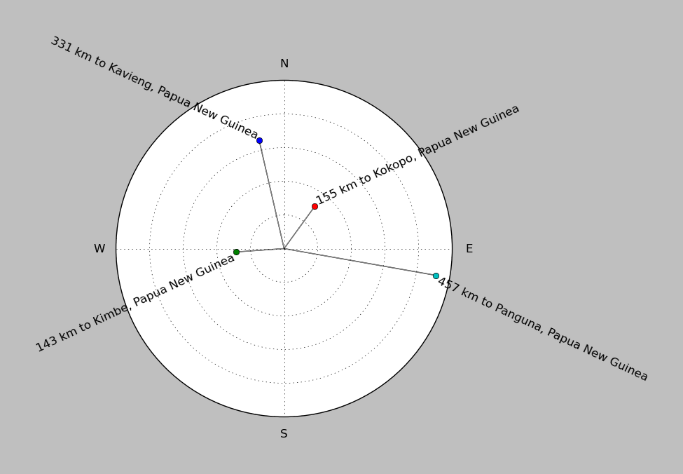
| ||||||||||||||||
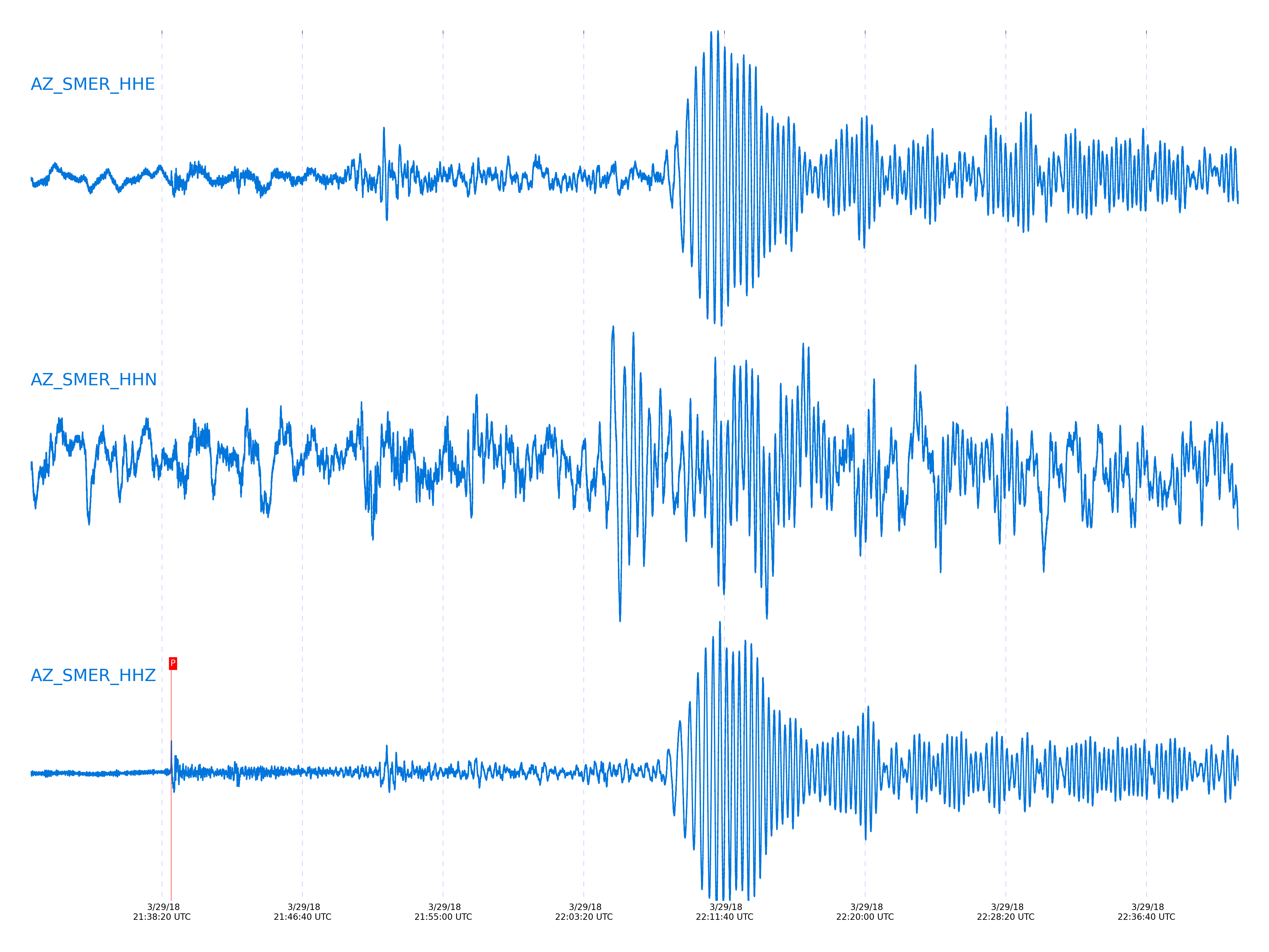
Event and active stations
|
|||||||||||||||||
Closest station with identified signal. Not filtered.
Subset of several stations close to the event. Not filtered.
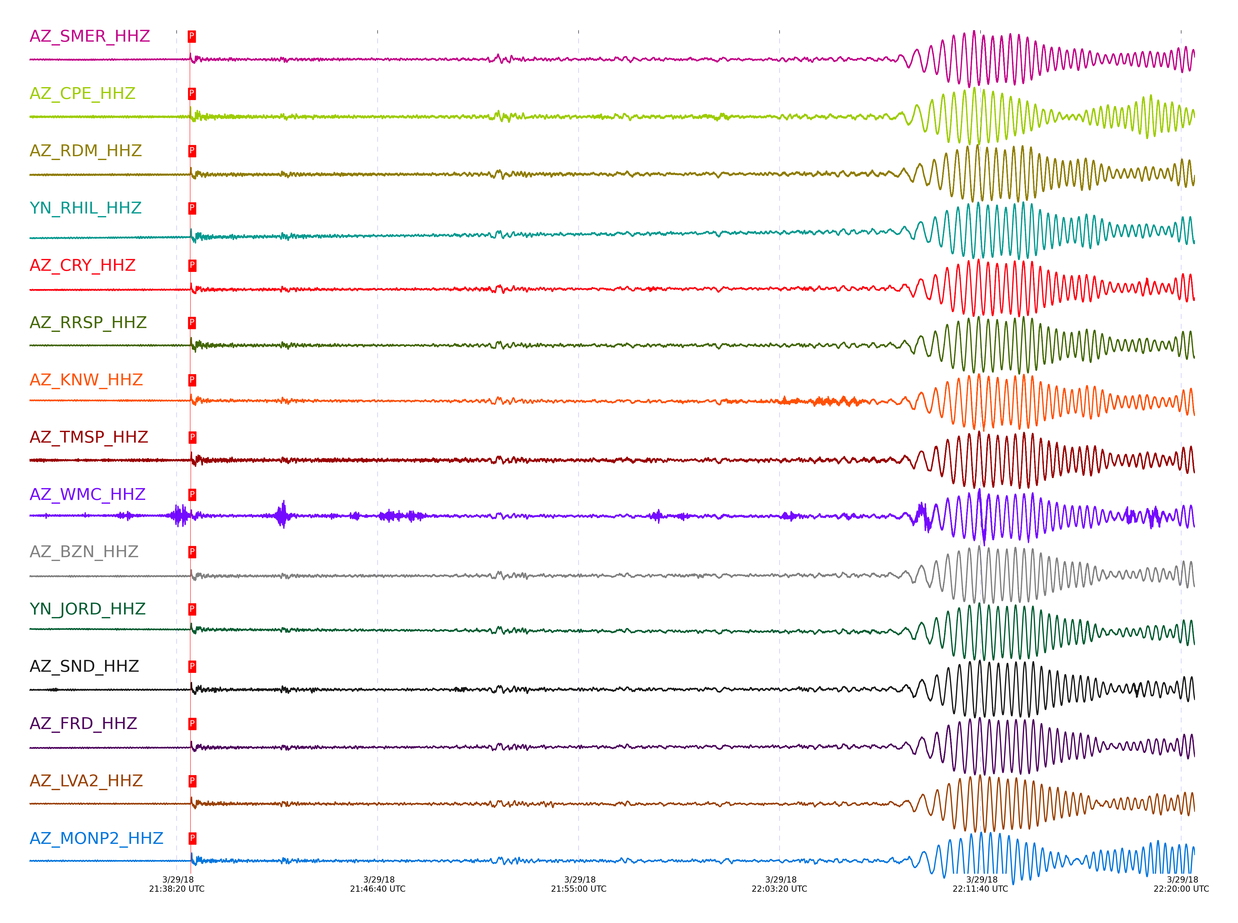
| STA_CHAN | S-E Delta | S-E Azimuth | Phase | Time | Signal/Noise | Time Residual | V. Model | Auth | arid |
|---|---|---|---|---|---|---|---|---|---|
| SMER_HHZ | 94.169° | 266.19° | PcP | 2018-03-29 21:38:52.6954 UTC | 33.82 | 0.899 | iasp91 | dbp:rrodd:18088 | 1714720 |
| CPE_HHZ | 94.186° | 266.18° | PcP | 2018-03-29 21:38:52.9719 UTC | 38.95 | 1.1 | iasp91 | dbp:rrodd:18088 | 1714687 |
| RDM_HHZ | 94.449° | 266.38° | PcP | 2018-03-29 21:38:53.7253 UTC | 53.73 | 0.687 | iasp91 | dbp:rrodd:18088 | 1714689 |
| RHIL_HHZ | 94.515° | 266.42° | PcP | 2018-03-29 21:38:53.829 UTC | -1 | 0.497 | iasp91 | dbp:rrodd:18088 | 1714748 |
| CRY_HHZ | 94.537° | 266.43° | PcP | 2018-03-29 21:38:54.1261 UTC | 41.858 | 0.699 | iasp91 | dbp:rrodd:18088 | 1714693 |
| RRSP_HHZ | 94.541° | 266.44° | P | 2018-03-29 21:38:53.1984 UTC | -1 | -0.004 | iasp91 | dbp:rrodd:18088 | 1714751 |
| KNW_HHZ | 94.567° | 266.46° | PcP | 2018-03-29 21:38:53.5687 UTC | 70.517 | 0.007 | iasp91 | dbp:rrodd:18088 | 1714691 |
| TMSP_HHZ | 94.587° | 266.47° | PcP | 2018-03-29 21:38:54.6533 UTC | -1 | 1.003 | iasp91 | dbp:rrodd:18088 | 1714753 |
| WMC_HHZ | 94.59° | 266.47° | PcP | 2018-03-29 21:38:53.9187 UTC | 47.907 | 0.258 | iasp91 | dbp:rrodd:18088 | 1714706 |
| BZN_HHZ | 94.591° | 266.47° | PcP | 2018-03-29 21:38:53.9745 UTC | 31.88 | 0.308 | iasp91 | dbp:rrodd:18088 | 1714718 |
| JORD_HHZ | 94.608° | 266.48° | PcP | 2018-03-29 21:38:53.7048 UTC | 45.055 | -0.038 | iasp91 | dbp:rrodd:18088 | 1714697 |
| SND_HHZ | 94.64° | 266.5° | PcP | 2018-03-29 21:38:53.9482 UTC | 29.401 | 0.065 | iasp91 | dbp:rrodd:18088 | 1714714 |
| FRD_HHZ | 94.645° | 266.5° | PcP | 2018-03-29 21:38:54.2213 UTC | 35.099 | 0.314 | iasp91 | dbp:rrodd:18088 | 1714712 |
| LVA2_HHZ | 94.67° | 266.51° | PcP | 2018-03-29 21:38:54.3362 UTC | 32.556 | 0.318 | iasp91 | dbp:rrodd:18088 | 1714710 |
| MONP2_HHZ | 94.759° | 266.55° | PcP | 2018-03-29 21:38:54.7397 UTC | 62.547 | 0.328 | iasp91 | dbp:rrodd:18088 | 1714724 |
| PFO_HHZ | 94.771° | 266.59° | P | 2018-03-29 21:38:54.3478 UTC | -1 | 0.096 | iasp91 | dbp:rrodd:18088 | 1714764 |
| TRO_HHZ | 94.794° | 266.6° | PcP | 2018-03-29 21:38:55.495 UTC | 48.576 | 0.929 | iasp91 | dbp:rrodd:18088 | 1714726 |
Click the link below to observe an interactive map of earthquakes recorded by the station deployment:
Broadband Seismic Data Collection Center (ANZA),
Institute of Geophysics & Planetary Physics
Scripps Institution of Oceanography,
University of California San Diego
Copyright © 1989 - 2014. All Rights Reserved.