last update to page: May 01 2018 19:23:19 (UTC).
SummaryThe red marker denotes the earthquake epicenter. On Tue May 1st 2018 11:22:22 (UTC) the seismic network recorded an earthquake (preliminary 3.74 ml) located in Off Coast Of California. Seismic region California - Nevada Region. The epicentral distance (i.e. distance separating the location to the epicenter) to the closest station SCI2 in the network is 14.9 km. If you felt the quake, the USGS would like to know. Please add your comments to the USGS page "Did you feel it?". |
Details
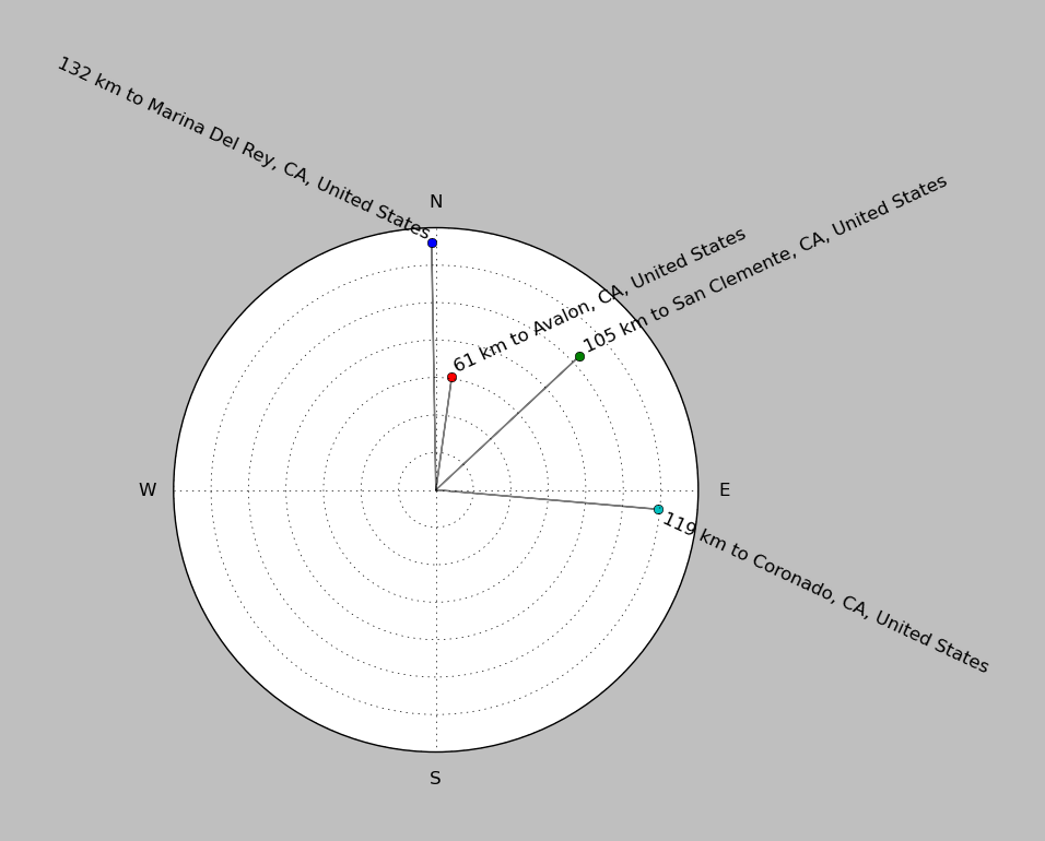
Proximity to Population Centers
| ||||||||||||||||
Event and active stations
|
|||||||||||||||||
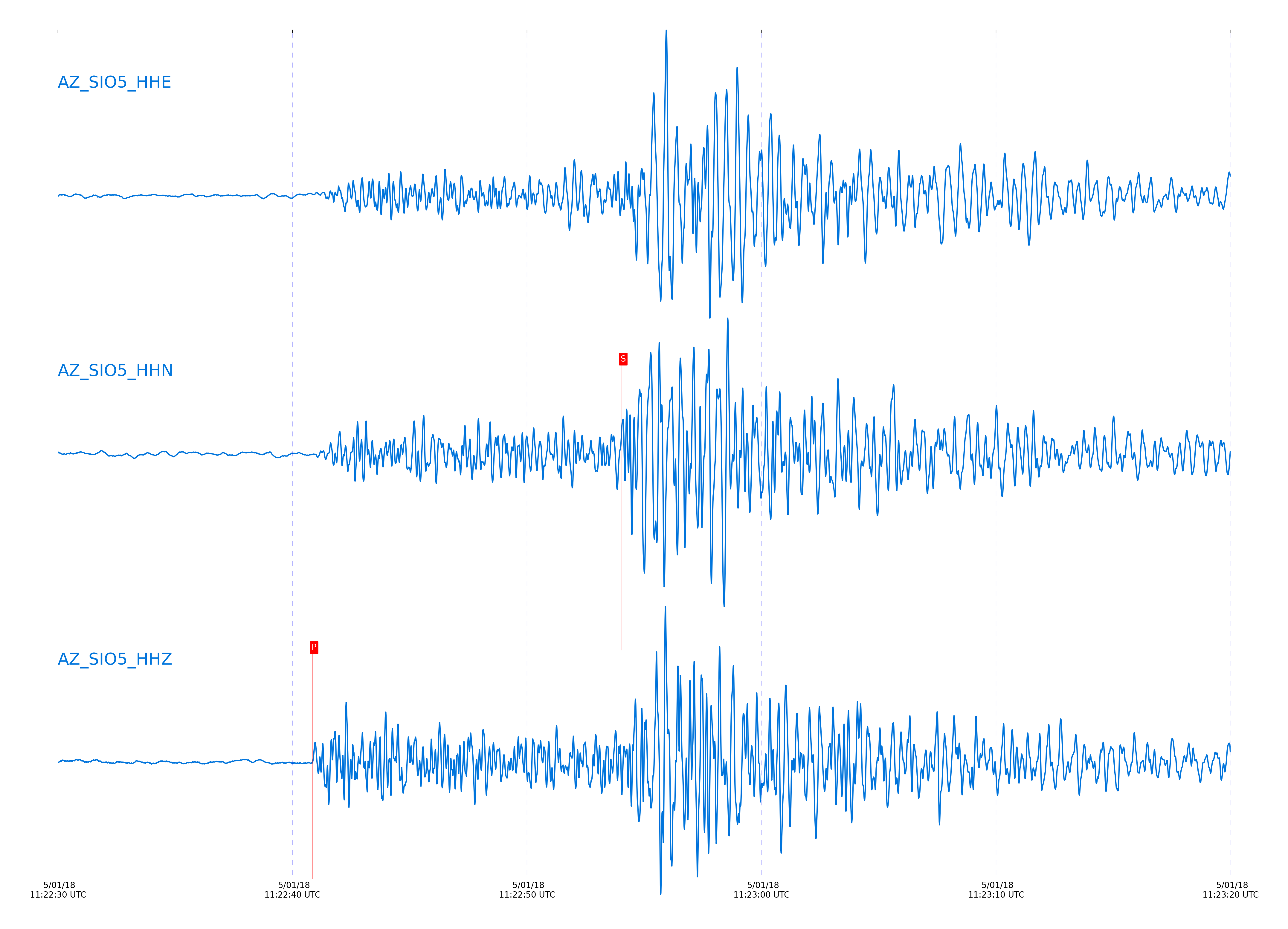
Closest station with identified signal. Not filtered.

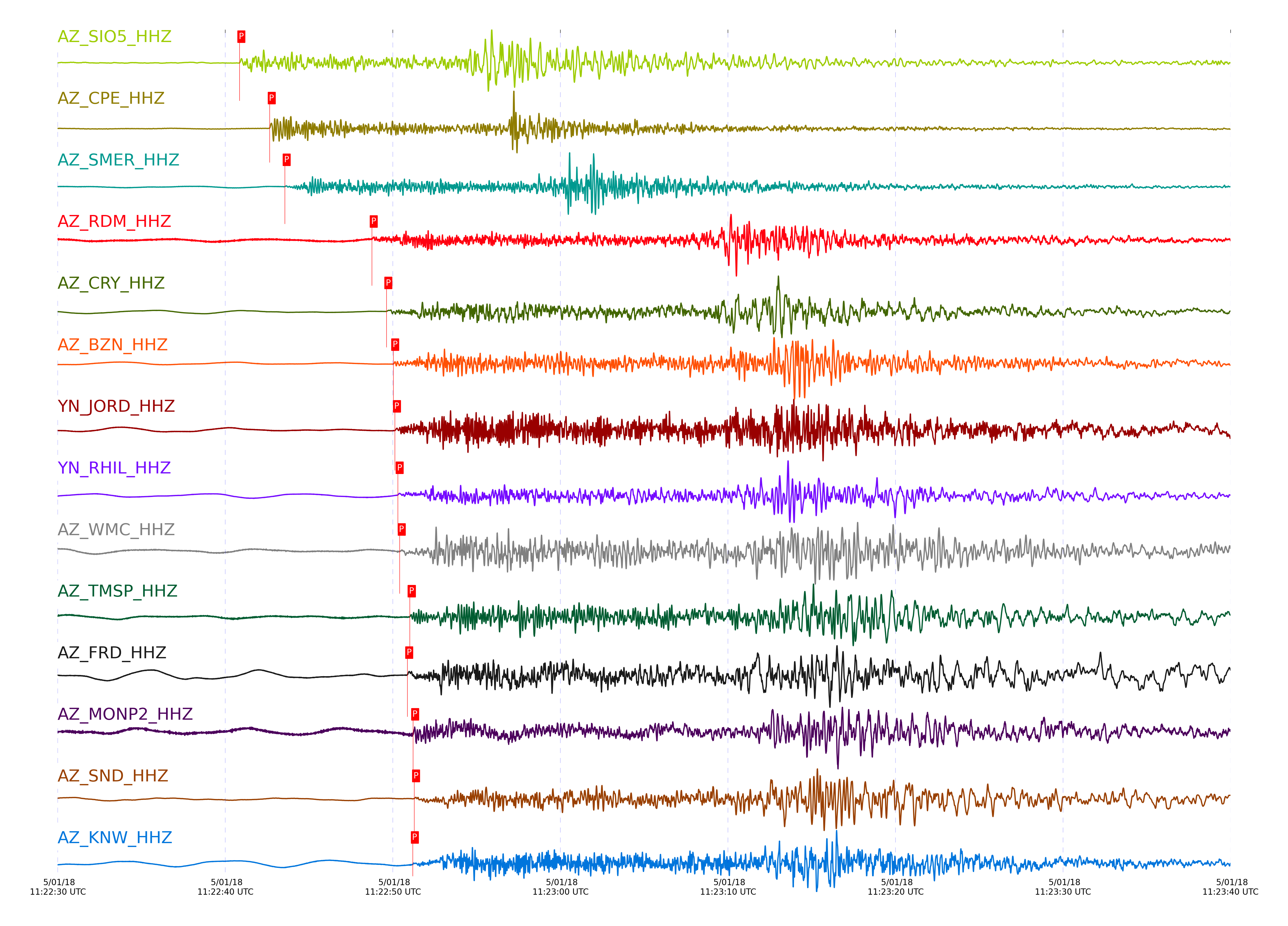
Subset of several stations close to the event. Not filtered.

| STA_CHAN | S-E Delta | S-E Azimuth | Phase | Time | Signal/Noise | Time Residual | V. Model | Auth | arid |
|---|---|---|---|---|---|---|---|---|---|
| SIO5_HHZ | 1.005° | 267.23° | Pg | 2018-05-01 11:22:40.8431 UTC | 81.291 | -0.594 | iasp91 | dbp:jtytell:181 | 1741764 |
| SIO5_HHN | 1.005° | 267.23° | Sg | 2018-05-01 11:22:54.017 UTC | -1 | -1.433 | iasp91 | dbp:jtytell:181 | 1742102 |
| CPE_HHZ | 1.129° | 265.16° | Pg | 2018-05-01 11:22:42.646 UTC | 106.35 | -1.169 | iasp91 | dbp:jtytell:181 | 1741787 |
| CPE_HHE | 1.129° | 265.16° | Sg | 2018-05-01 11:22:56.4965 UTC | -1 | -3.059 | iasp91 | dbp:jtytell:181 | 1742108 |
| SMER_HHZ | 1.259° | 238.15° | Pn | 2018-05-01 11:22:43.5447 UTC | 85.604 | -2.478 | iasp91 | dbp:jtytell:181 | 1741804 |
| SMER_HHE | 1.259° | 238.15° | Sb | 2018-05-01 11:22:59.7502 UTC | -1 | -3.871 | iasp91 | dbp:jtytell:181 | 1742123 |
| RDM_HHZ | 1.579° | 238.15° | Pn | 2018-05-01 11:22:48.7425 UTC | 8.3915 | -1.676 | iasp91 | dbp:jtytell:181 | 1741774 |
| RDM_HHN | 1.579° | 238.15° | Sn | 2018-05-01 11:23:07.5804 UTC | -1 | -4.303 | iasp91 | dbp:jtytell:181 | 1742121 |
| CRY_HHZ | 1.626° | 241.86° | Pn | 2018-05-01 11:22:49.6134 UTC | 132.77 | -1.457 | iasp91 | dbp:jtytell:181 | 1741772 |
| CRY_HHE | 1.626° | 241.86° | Sn | 2018-05-01 11:23:09.0925 UTC | -1 | -3.964 | iasp91 | dbp:jtytell:181 | 1742125 |
| BZN_HHZ | 1.646° | 245.13° | Pn | 2018-05-01 11:22:50.0253 UTC | 120.52 | -1.313 | iasp91 | dbp:jtytell:181 | 1741776 |
| BZN_HHN | 1.646° | 245.13° | Sn | 2018-05-01 11:23:09.8992 UTC | -1 | -3.639 | iasp91 | dbp:jtytell:181 | 1742127 |
| JORD_HHZ | 1.655° | 246.01° | Pn | 2018-05-01 11:22:50.1229 UTC | 102.68 | -1.336 | iasp91 | dbp:jtytell:181 | 1741778 |
| RHIL_HHZ | 1.656° | 238.09° | Pn | 2018-05-01 11:22:50.2915 UTC | -1 | -1.184 | iasp91 | dbp:jtytell:181 | 1742084 |
| WMC_HHZ | 1.676° | 242.48° | Pn | 2018-05-01 11:22:50.411 UTC | 42.73 | -1.347 | iasp91 | dbp:jtytell:181 | 1741780 |
| WMC_HHE | 1.676° | 242.48° | Sn | 2018-05-01 11:23:10.4687 UTC | -1 | -3.824 | iasp91 | dbp:jtytell:181 | 1742129 |
| TMSP_HHZ | 1.693° | 241.03° | Pn | 2018-05-01 11:22:51.0091 UTC | -1 | -0.983 | iasp91 | dbp:jtytell:181 | 1742088 |
| FRD_HHZ | 1.696° | 245.83° | Pn | 2018-05-01 11:22:50.8605 UTC | 80.085 | -1.172 | iasp91 | dbp:jtytell:181 | 1741779 |
| FRD_HHE | 1.696° | 245.83° | Sn | 2018-05-01 11:23:11.0146 UTC | -1 | -3.773 | iasp91 | dbp:jtytell:181 | 1742130 |
| MONP2_HHE | 1.701° | 266.99° | Sn | 2018-05-01 11:23:11.726 UTC | -1 | -3.181 | iasp91 | dbp:jtytell:181 | 1742134 |
| MONP2_HHZ | 1.701° | 266.99° | Pn | 2018-05-01 11:22:51.2076 UTC | 8.249 | -0.892 | iasp91 | dbp:jtytell:181 | 1741782 |
| SND_HHE | 1.713° | 243.96° | Sn | 2018-05-01 11:23:11.9255 UTC | -1 | -3.263 | iasp91 | dbp:jtytell:181 | 1742133 |
| SND_HHZ | 1.713° | 243.96° | Pn | 2018-05-01 11:22:51.2693 UTC | 68.87 | -0.986 | iasp91 | dbp:jtytell:181 | 1741783 |
| KNW_HHZ | 1.72° | 237.83° | Pn | 2018-05-01 11:22:51.1919 UTC | 62.361 | -1.158 | iasp91 | dbp:jtytell:181 | 1741781 |
| KNW_HHE | 1.72° | 237.83° | Sn | 2018-05-01 11:23:11.5205 UTC | -1 | -3.838 | iasp91 | dbp:jtytell:181 | 1742135 |
Click the link below to observe an interactive map of earthquakes recorded by the station deployment: