
last update to page: July 06 2019 16:22:21 (UTC).
SummaryThe red marker denotes the earthquake epicenter. On Sat Jul 6th 2019 03:16:32 (UTC) the seismic network recorded an earthquake (preliminary 4.97 mw) located in Central California. Seismic region California - Nevada Region. The epicentral distance (i.e. distance separating the location to the epicenter) to the closest station CSLB in the network is 222.5 km. If you felt the quake, the USGS would like to know. Please add your comments to the USGS page "Did you feel it?". |
Details
Proximity to Population Centers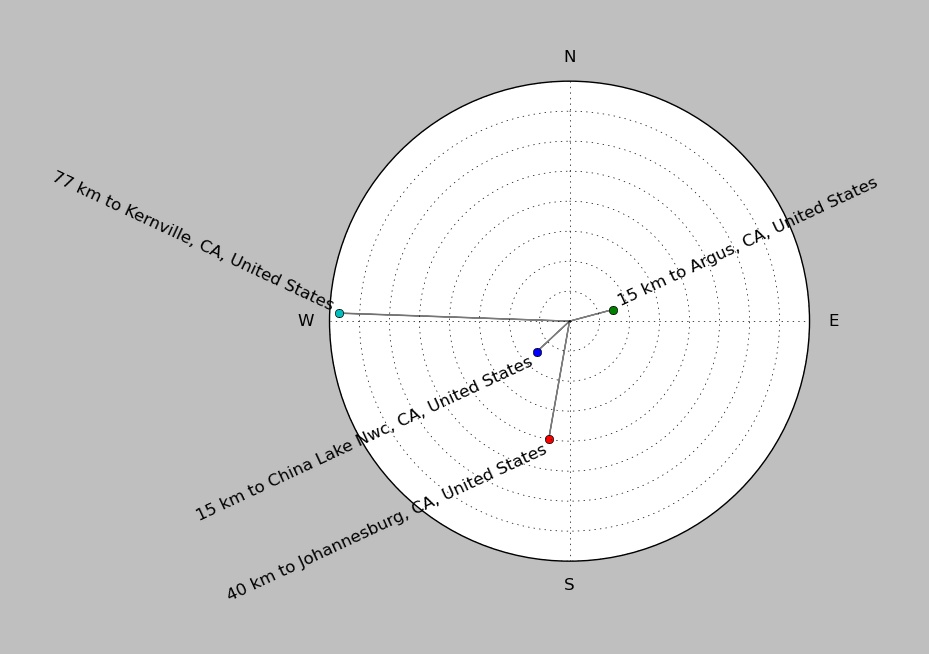
| ||||||||||||||||
Event and active stations
|
|||||||||||||||||
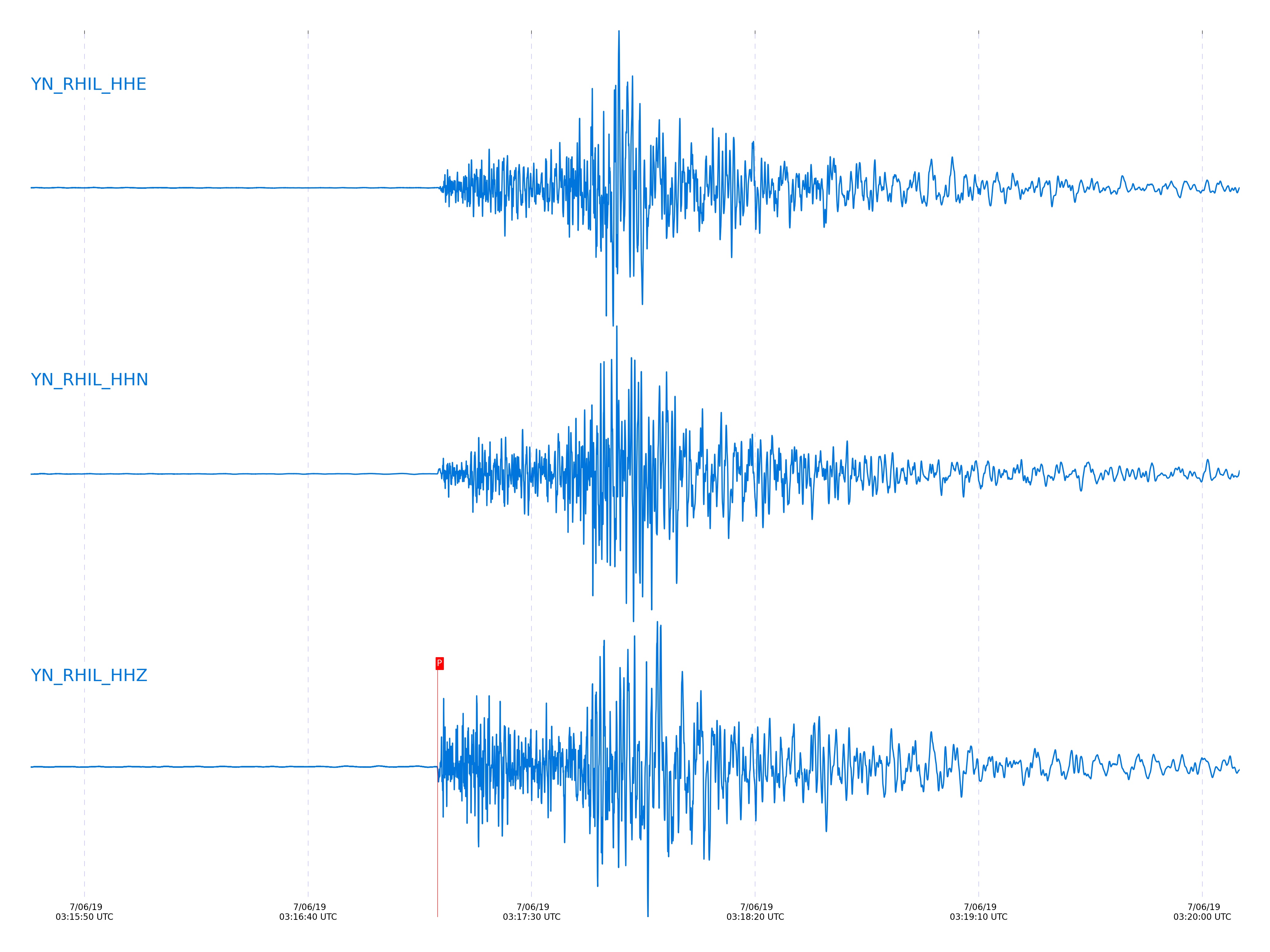
Closest station with identified signal. Not filtered.
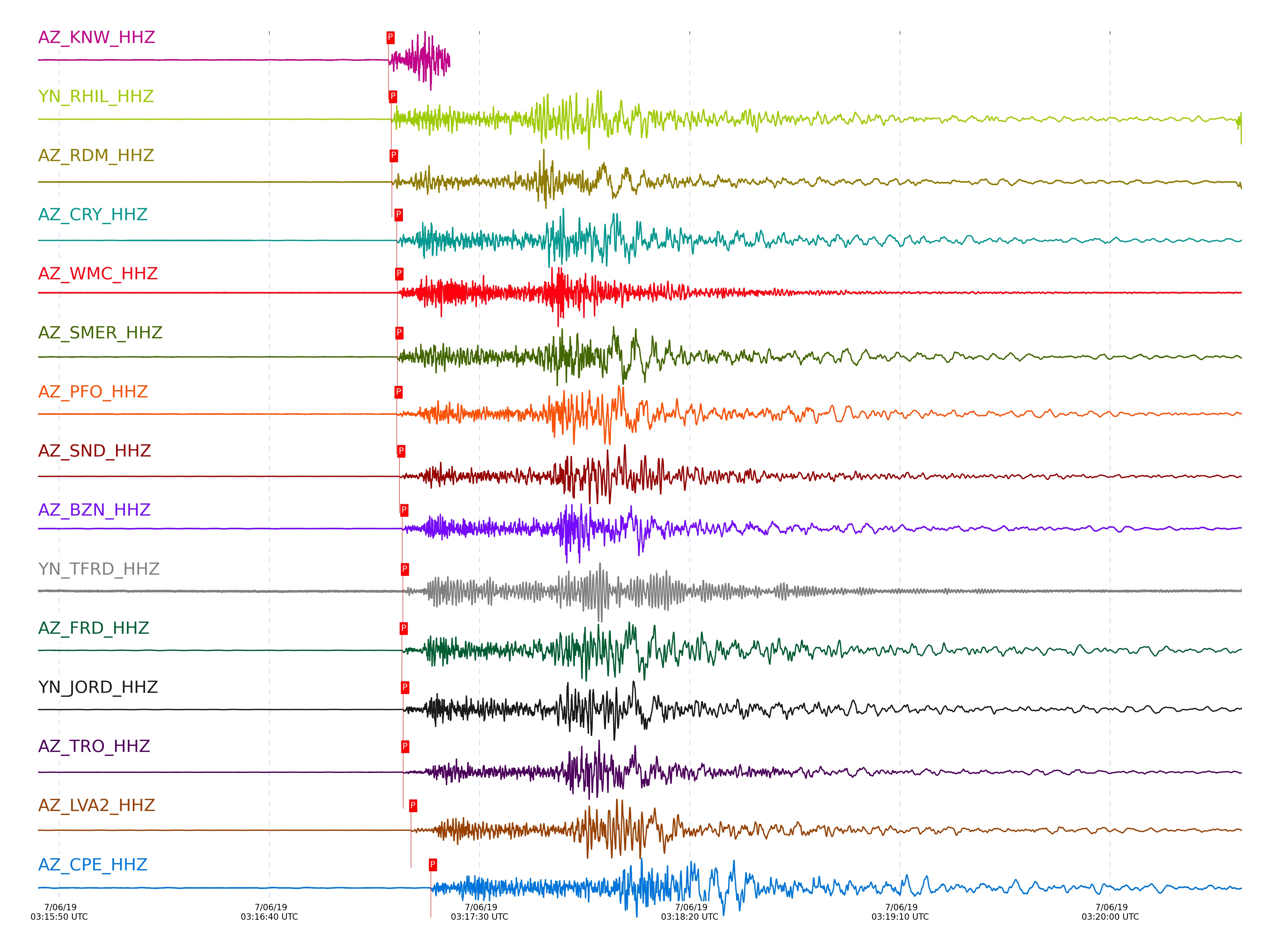
Subset of several stations close to the event. Not filtered.
| STA_CHAN | S-E Delta | S-E Azimuth | Phase | Time | Signal/Noise | Time Residual | V. Model | Auth | arid |
|---|---|---|---|---|---|---|---|---|---|
| KNW_HHZ | 2.127° | 341.27° | Pn | 2019-07-06 03:17:08.3831 UTC | 130.19 | -0.696 | iasp91 | socal | 2101626 |
| RHIL_HHZ | 2.15° | 342.83° | Pn | 2019-07-06 03:17:08.9845 UTC | 547.73 | -0.42 | iasp91 | socal | 2101627 |
| RDM_HHZ | 2.174° | 344.73° | Pn | 2019-07-06 03:17:09.1384 UTC | 1096.5 | -0.592 | iasp91 | socal | 2101663 |
| CRY_HHZ | 2.262° | 342.97° | Pn | 2019-07-06 03:17:10.2992 UTC | 738.41 | -0.637 | iasp91 | dbp:rt:19187 | 2101667 |
| WMC_HHZ | 2.27° | 341.69° | Pn | 2019-07-06 03:17:10.4513 UTC | 1021.3 | -0.595 | iasp91 | dbp:rt:19187 | 2101668 |
| SMER_HHZ | 2.289° | 352.21° | Pn | 2019-07-06 03:17:10.4684 UTC | 123.97 | -0.847 | iasp91 | socal | 2101629 |
| PFO_HHZ | 2.297° | 337.26° | Pn | 2019-07-06 03:17:10.2928 UTC | 42.702 | -1.128 | iasp91 | dbp:rt:19187 | 2101631 |
| SND_HHZ | 2.307° | 340.68° | Pn | 2019-07-06 03:17:10.93 UTC | 84.164 | -0.627 | iasp91 | dbp:rt:19187 | 2101633 |
| BZN_HHZ | 2.35° | 342.17° | Pn | 2019-07-06 03:17:11.6151 UTC | 23.33 | -0.532 | iasp91 | dbp:rt:19187 | 2101635 |
| TFRD_HHZ | 2.364° | 340.94° | Pn | 2019-07-06 03:17:11.7738 UTC | 73.216 | -0.566 | iasp91 | dbp:rt:19187 | 2101683 |
| FRD_HHZ | 2.364° | 340.94° | Pn | 2019-07-06 03:17:11.5086 UTC | 204.06 | -0.832 | iasp91 | dbp:rt:19187 | 2101634 |
| JORD_HHZ | 2.374° | 341.9° | Pn | 2019-07-06 03:17:11.8232 UTC | 143.52 | -0.654 | iasp91 | dbp:rt:19187 | 2101678 |
| TRO_HHZ | 2.389° | 337.47° | Pn | 2019-07-06 03:17:11.8584 UTC | 690.96 | -0.832 | iasp91 | dbp:rt:19187 | 2101679 |
| LVA2_HHZ | 2.51° | 341.29° | Pn | 2019-07-06 03:17:13.717 UTC | 229.38 | -0.637 | iasp91 | dbp:rt:19187 | 2101637 |
| CPE_HHZ | 2.86° | 352.69° | Pn | 2019-07-06 03:17:18.4374 UTC | 133.88 | -0.732 | iasp91 | dbp:rt:19187 | 2101672 |
| SIO5_HHZ | 2.895° | 355.12° | Pn | 2019-07-06 03:17:19.186 UTC | 75.151 | -0.465 | iasp91 | dbp:rt:19187 | 2101673 |
| MONP2_HHZ | 2.983° | 342.07° | Pn | 2019-07-06 03:17:20.1397 UTC | 60.825 | -0.718 | iasp91 | dbp:rt:19187 | 2101680 |
Click the link below to observe an interactive map of earthquakes recorded by the station deployment:
Broadband Seismic Data Collection Center (ANZA),
Institute of Geophysics & Planetary Physics
Scripps Institution of Oceanography,
University of California San Diego
Copyright © 1989 - 2014. All Rights Reserved.