
last update to page: March 15 2016 22:15:33 (UTC).
SummaryThe red marker denotes the earthquake epicenter. On Tue Nov 24th 2015 22:45:38 (UTC) the seismic network recorded an earthquake (preliminary 7.6 mww) located in Peru-brazil Border Region. Seismic region Andean South America. The epicentral distance (i.e. distance separating the location to the epicenter) to the closest station USGCB in the network is 6,817.0 km. If you felt the quake, the USGS would like to know. Please add your comments to the USGS page "Did you feel it?". |
Details
Proximity to Population Centers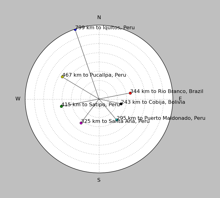
| ||||||||||||||||
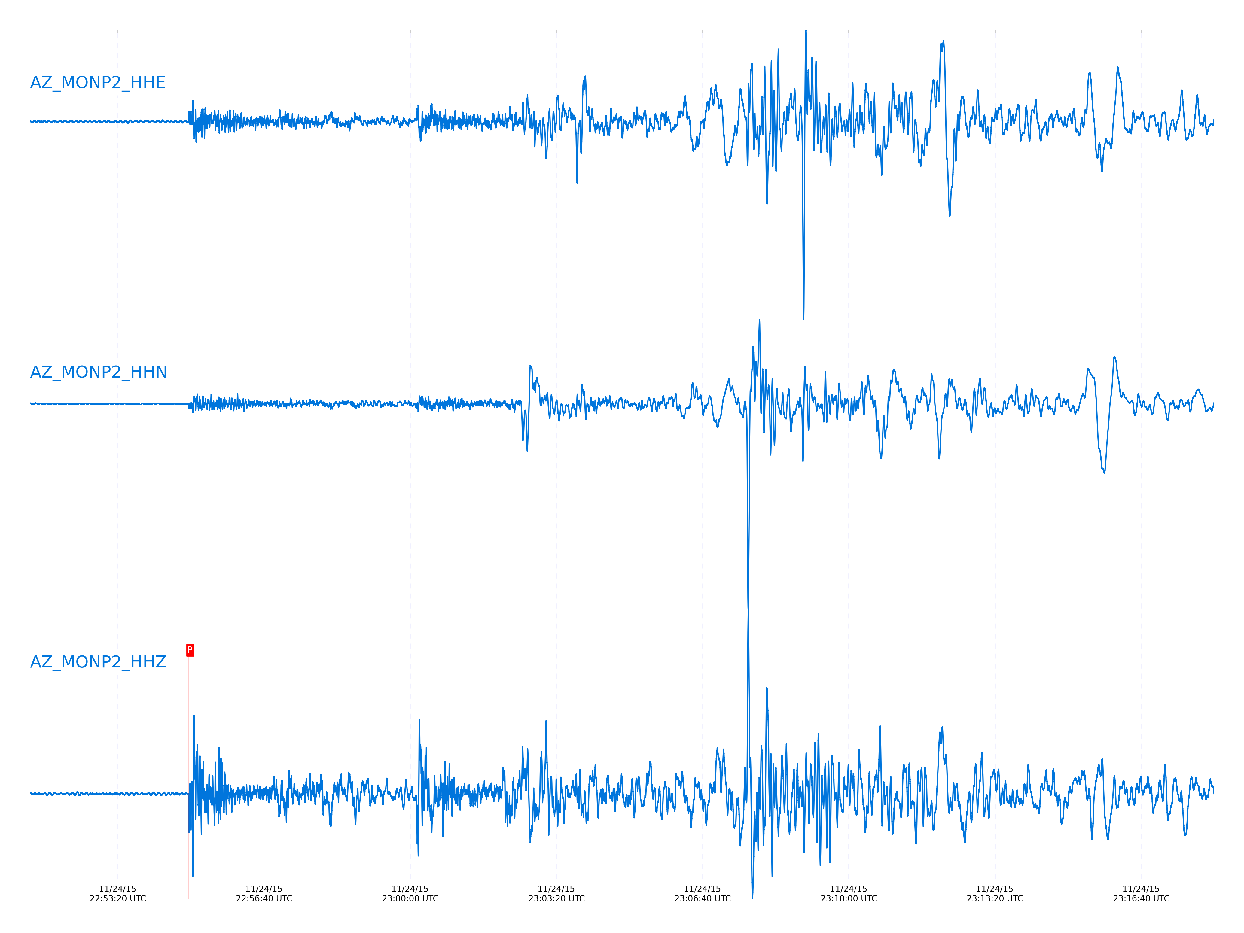
Event and active stations
|
|||||||||||||||||
Closest station with identified signal. Not filtered.
Subset of several stations close to the event. Not filtered.
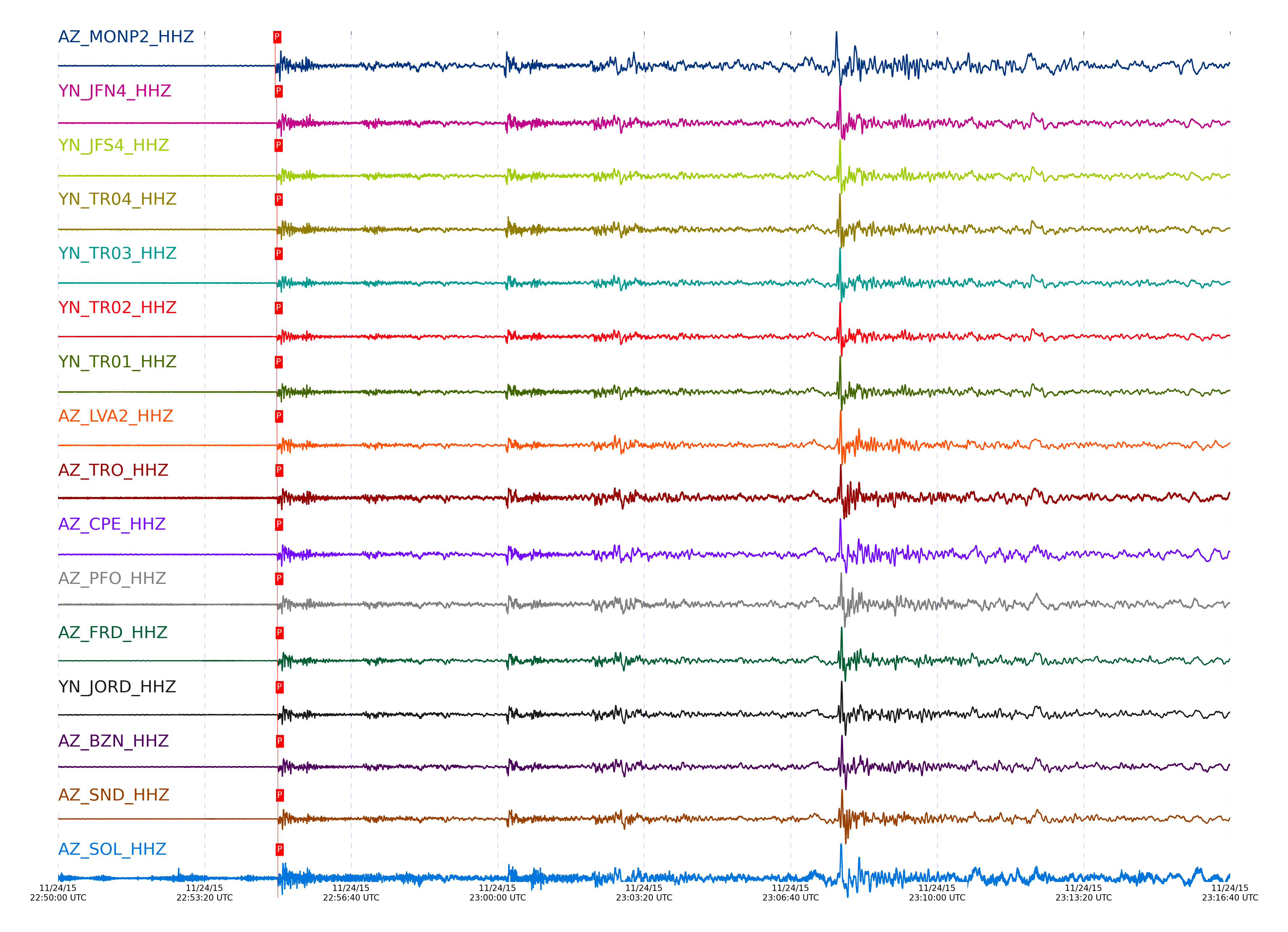
| STA_CHAN | S-E Delta | S-E Azimuth | Phase | Time | Signal/Noise | Time Residual | V. Model | Auth | arid |
|---|---|---|---|---|---|---|---|---|---|
| MONP2_HHZ | 61.38° | 126.96° | P | 2015-11-24 22:54:56.3414 UTC | -1 | -0.614 | iasp91 | dbp:jtytell:153 | 795196 |
| JFS4_HHZ | 61.687° | 127.2° | P | 2015-11-24 22:54:58.3103 UTC | -1 | -0.644 | iasp91 | dbp:jtytell:153 | 795197 |
| JFN4_HHZ | 61.687° | 127.21° | P | 2015-11-24 22:54:58.4066 UTC | -1 | -0.544 | iasp91 | dbp:jtytell:153 | 795198 |
| TR04_HHZ | 61.688° | 127.18° | P | 2015-11-24 22:54:58.613 UTC | -1 | -0.345 | iasp91 | dbp:jtytell:153 | 795202 |
| TR03_HHZ | 61.693° | 127.18° | P | 2015-11-24 22:54:58.4438 UTC | -1 | -0.544 | iasp91 | dbp:jtytell:153 | 795199 |
| TR02_HHZ | 61.694° | 127.19° | P | 2015-11-24 22:54:58.4504 UTC | -1 | -0.544 | iasp91 | dbp:jtytell:153 | 795200 |
| TR01_HHZ | 61.694° | 127.2° | P | 2015-11-24 22:54:58.4542 UTC | 8.2853 | -0.544 | iasp91 | dbp:jtytell:153 | 795201 |
| LVA2_HHZ | 61.75° | 127.05° | P | 2015-11-24 22:54:58.913 UTC | 7.8482 | -0.445 | iasp91 | dbp:jtytell:153 | 795204 |
| TRO_HHZ | 61.763° | 127.23° | P | 2015-11-24 22:54:59.2345 UTC | -1 | -0.211 | iasp91 | dbp:jtytell:153 | 795210 |
| CPE_HHZ | 61.838° | 126.4° | P | 2015-11-24 22:54:58.9471 UTC | -1 | -0.983 | iasp91 | dbp:jtytell:153 | 795206 |
| PFO_HHZ | 61.839° | 127.24° | P | 2015-11-24 22:54:59.1607 UTC | -1 | -0.776 | iasp91 | dbp:jtytell:153 | 795208 |
| FRD_HHZ | 61.863° | 127.07° | P | 2015-11-24 22:54:59.6818 UTC | 9.3147 | -0.411 | iasp91 | dbp:jtytell:153 | 795219 |
| JORD_HHZ | 61.878° | 127.03° | P | 2015-11-24 22:54:59.7449 UTC | -1 | -0.445 | iasp91 | dbp:jtytell:153 | 795221 |
| BZN_HHZ | 61.904° | 127.02° | P | 2015-11-24 22:55:00.0481 UTC | -1 | -0.312 | iasp91 | dbp:jtytell:153 | 795224 |
| SND_HHZ | 61.905° | 127.09° | P | 2015-11-24 22:54:59.9849 UTC | 21.717 | -0.378 | iasp91 | dbp:jtytell:153 | 795223 |
| SOL_HHZ | 61.906° | 126.27° | P | 2015-11-24 22:54:59.8544 UTC | -1 | -0.518 | iasp91 | dbp:jtytell:153 | 795222 |
| WMC_HHZ | 61.959° | 127.05° | P | 2015-11-24 22:55:00.3687 UTC | -1 | -0.344 | iasp91 | dbp:jtytell:153 | 795225 |
| TMSP_HHZ | 61.99° | 127.06° | P | 2015-11-24 22:55:00.6732 UTC | -1 | -0.244 | iasp91 | dbp:jtytell:153 | 795228 |
| CRY_HHZ | 61.996° | 126.99° | P | 2015-11-24 22:55:00.4728 UTC | -1 | -0.478 | iasp91 | dbp:jtytell:153 | 795227 |
| RRSP_HHZ | 62.049° | 127.03° | P | 2015-11-24 22:55:00.7844 UTC | -1 | -0.511 | iasp91 | dbp:jtytell:153 | 795231 |
| KNW_HHZ | 62.068° | 127.08° | P | 2015-11-24 22:55:00.6778 UTC | 9.5109 | -0.743 | iasp91 | dbp:jtytell:153 | 795229 |
| RHIL_HHZ | 62.083° | 127.01° | P | 2015-11-24 22:55:01.3053 UTC | -1 | -0.211 | iasp91 | dbp:jtytell:153 | 795234 |
| BCCC_HHZ | 62.093° | 126.97° | P | 2015-11-24 22:55:00.7065 UTC | 7.9661 | -0.877 | iasp91 | dbp:jtytell:153 | 795230 |
| RDM_HHZ | 62.108° | 126.93° | P | 2015-11-24 22:55:01.2326 UTC | -1 | -0.445 | iasp91 | dbp:jtytell:153 | 795233 |
| SMER_HHZ | 62.22° | 126.59° | P | 2015-11-24 22:55:01.3247 UTC | -1 | -1.079 | iasp91 | dbp:jtytell:153 | 795235 |
Click the link below to observe an interactive map of earthquakes recorded by the station deployment:
Broadband Seismic Data Collection Center (ANZA),
Institute of Geophysics & Planetary Physics
Scripps Institution of Oceanography,
University of California San Diego
Copyright © 1989 - 2014. All Rights Reserved.