
1998 India underground nuclear tests
- October 8th, 2006 magnitude 4.2 mb event from an alleged nuclear test in North Korea
- 1998 India underground nuclear tests
- 1998 Pakistan underground nuclear tests
- Comparison of tests & Afghan earthquake
- Afghanistan earthquake-aftershock-2nd Pakistani nuclear test sequence
- China earthquakes and nuclear tests
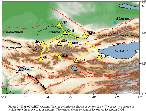
Interactive Google map showing the locations of the 1998 India and Pakistan nuclear tests, the KNET seismic network station locations and the Mw 6.9 Afghanistan earthquake epicenter. Click the red star to see the event parameters for the Mw 6.9 Afghanistan earthquake that occurred around the same time as the nuclear tests. Click the yellow triangles to see the station name in the KNET seismic network. Click the nuclear test icon (mushroom cloud) to see the test event parameters. Double-click the map to zoom in.
India conducted three underground nuclear tests on 11 May, 1998. These tests were recorded by the Kyrgyzstan Seismic Network (KNET) situated approximately 1700 km away with a back azimuth of 190°. The tests conducted on 13 May, 1998 were not recorded by KNET.
Pakistan conducted an as yet undetermined number of underground nuclear tests on 28 May, 1998. Pakistan conducted a second round of tests on 30 May, 1998.
Visit our page on the Pakistan tests (waveform data now available).
This site was awarded a Times Pick by the Los Angeles Times on June 1st 1998.
The following three origins are preliminary and correspond to the largest of the three nuclear blasts:
| Latitude | Longitude | Depth | Origin Time | mb | Author |
|---|---|---|---|---|---|
| 27.1050 | 71.8020 | 0.0 | 5/11/1998 (131) 10:13:41.78 | 5.2 | PDE |
| 26.990 | 71.962 | 0.0 | 5/11/1998 (131) 10:13:41.5 | 5.4 | QED |
| 27.0716 | 71.7612 | 0.0 | 5/11/1998 (131) 10:13:44.2 | 5.0 | REB |
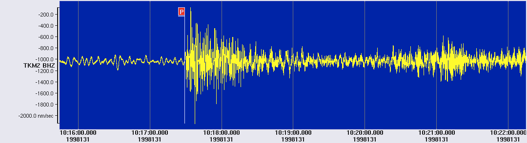
The actual magnitude of the blast is still uncertain. Click the thumbnail image below to see the waveforms recorded by stations in the KNET network.
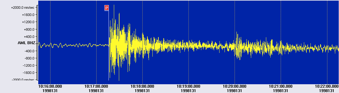
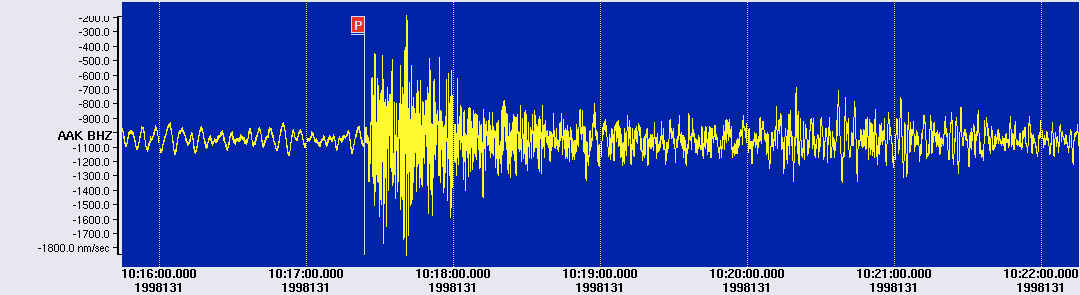
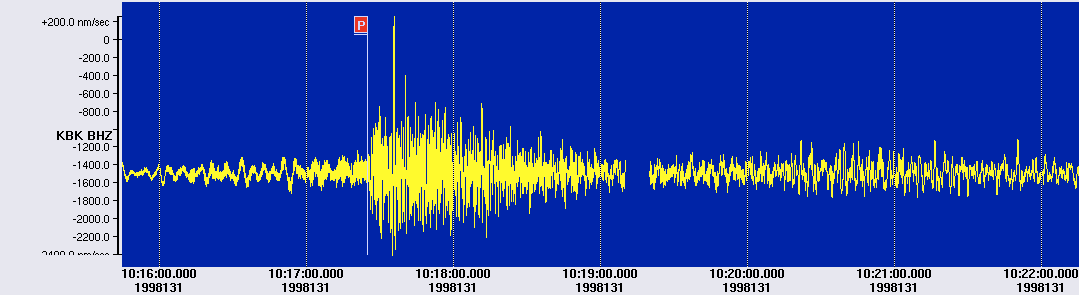
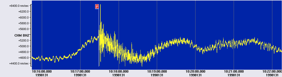
Based on the REB origin we calculated the following information. Click the station code in the table below, or click the station icon in the interactive Google map to the right, to see the waveforms recorded by each KNET station.
| Station | Channel | Arrival Time | Phase | SNR | Delta | Azimuth |
|---|---|---|---|---|---|---|
| AML | BHZ | 5/11/1998 (131) 10:17:16.040 | P | - | 15.142 | 186.602 |
| UCH | BHZ | 5/11/1998 (131) 10:17:18.425 | P | 137.99 | 15.322 | 189.312 |
| AAK | BHZ | 5/11/1998 (131) 10:17:24.023 | P | 61.87 | 15.720 | 189.312 |
| KBK | BHZ | 5/11/1998 (131) 10:17:25.004 | P | 19.50 | 15.799 | 190.474 |
| CHM | BHZ | 5/11/1998 (131) 10:17:28.874 | P | 37.11 | 16.111 | 189.636 |
| TKM2 | BHZ | 5/11/1998 (131) 10:17:29.222 | P | 62.52 | 16.153 | 192.363 |
| USP | BHZ | 5/11/1998 (131) 10:17:31.191 | P | 27.60 | 16.347 | 188.694 |
More information
- Download a GIF image of the blast showing the vertical components from 7 KNET stations.
- Download a map showing the KNET array.
- Download waveforms in CSS3.0 format (includes arrival, origin, event, tables).
Share this page
If you find this page useful, please share it:
![]()